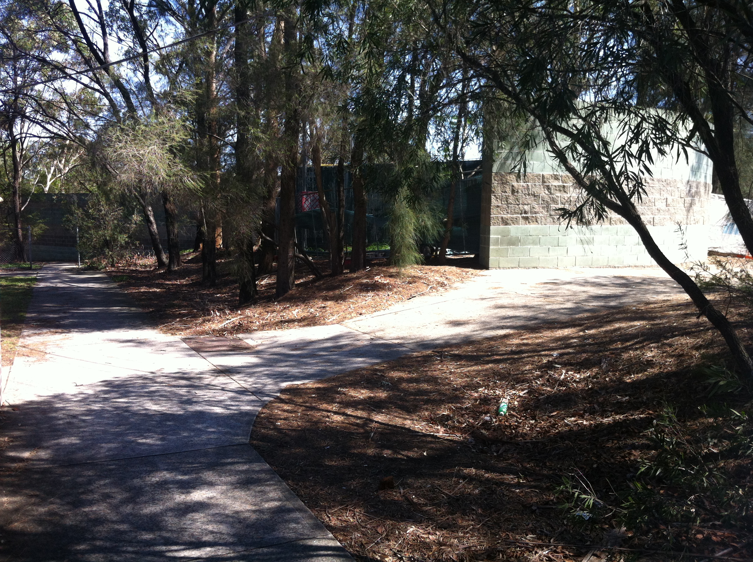
The American Way, Part 1: Happenstance – Monterey, NSW
Goldfinger said, “Mr Bond, they have a saying in Chicago: ‘Once is happenstance, twice is coincidence, the third time it’s enemy action.'”
– Ian Fleming, Goldfinger (1959)
Sydney is a multicultural city. From Bondi in the east to Blacktown in the west, from Narrabeen in the north to Cronulla in the south (well, maybe not Cronulla), it’s not hard to argue that the city has come a long, colourful way since the White Australia of the 1950s.
But long before even that decade, influences of another culture were finding their way into what was a very British way of life at the time, influences that have come to be embraced as the preferred way over time.
Prior to 1788, the British used its North American colonies as a penal dumping ground, auctioning off convicts to plantation owners and other slavery enthusiasts. But when the American Revolution brought that to a halt, the former colony quickly established its own identity as the Empire scrambled to find another outlet for their unwanted lawbreakers.
By the early 20th Century, the American style as we know it today was pretty firmly established, particularly through the film industry blossoming in Hollywood. The extent of the influence of American films around the world is so massive as to be unknowable, but we’re certainly going to know a little part of it today.
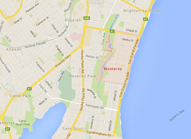
Monterey, 2016. Image courtesy Google Maps
Smack-bang in the middle of the Grand Parade that marches through Ramsgate and Brighton-Le-Sands along the shores of Botany Bay is the broad cleft that is President Avenue.

Along the aptly named President Avenue, everything is presidential. From this palatial block of units reminiscent of Goldfinger‘s Miami…

…to this capital lodge…

I think I can see the president up the top there.
…everything on the avenue fits the bill.
Clearly the ‘P’ has become the victim of vandals.
It’s the suburban equivalent of the kind of aged, staid, rich white guy we generally associate with the US presidency, so perhaps it’s no surprise that it borders today’s subject: Monterey, a young, small suburb that’s essentially comprised of four major streets.

Monterey’s insecure, slightly murky, and largely unofficial history finds its origins in 1877, when it was a piece of Scarborough Park. Jacob Marks, a prominent Jewish property developer, bought a parcel of land in the area, which was beginning to boom thanks to the popularity of the nearby Lady Robinsons Beach and Sandringham Baths. Marks had 13 kids (!), one of whom lived (and died) in California, so when it came time to name the streets in his property, things got red, white and blue pretty quickly.
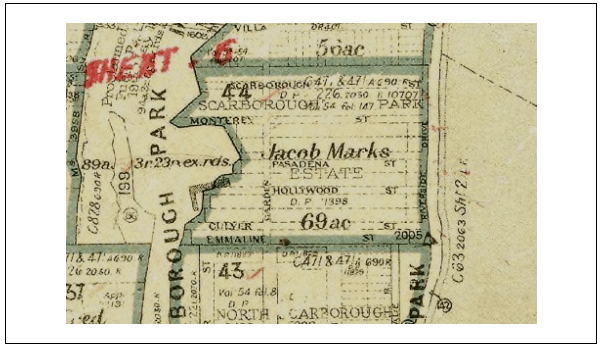
The Marks lot, 1903. Image courtesy Rockdale Library
Here’s where things get a bit cloudy – the street names were carved into stone by 1903, but it’s unclear who named them, and then it wasn’t until the early 1920s when the subdivision went up for sale.
Up for grabs. From the Lance Giddings pitch, 1921. Image courtesy Rockdale Library
The sale was orchestrated by a WWI veteran/motor racing enthusiast/socialite named Lance Giddings, who injected a healthy dose of American panache into the sale. Unfortunately, things didn’t quite take off.
“The enthusiastic advertising copy and promotion produced considerable sales over the next six years but these sales did not result in building. While Council records list and identify considerable lot ownership after 1921, the Sands Directory of 1924 could only find a single Monterey resident, Mr Hugh Macan in Pasadena Street, for its listing.” – Fibro Moderne: Mid-20th Century Fibro Housing in Monterey NSW (Bogle, Pickett 2013)
Even by 1930, the suburb only had five residents. Imagine the parties! Fat bass gramophones uninhibitedly pumping out block-rocking beats of Whispering Jack Smith with the nearest neighbour at least 15 minutes walk away!
Inevitably, the post-WWII housing boom took hold in Monterey, and by the 1950s it was a bustling suburb; although not so bustling that it wasn’t partially gazetted in 1951 for a potential Southern Freeway extension from Waterfall to St Peters. Interestingly, it remains gazetted so today, so if you’re a resident, don’t get too comfortable.
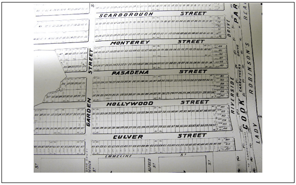
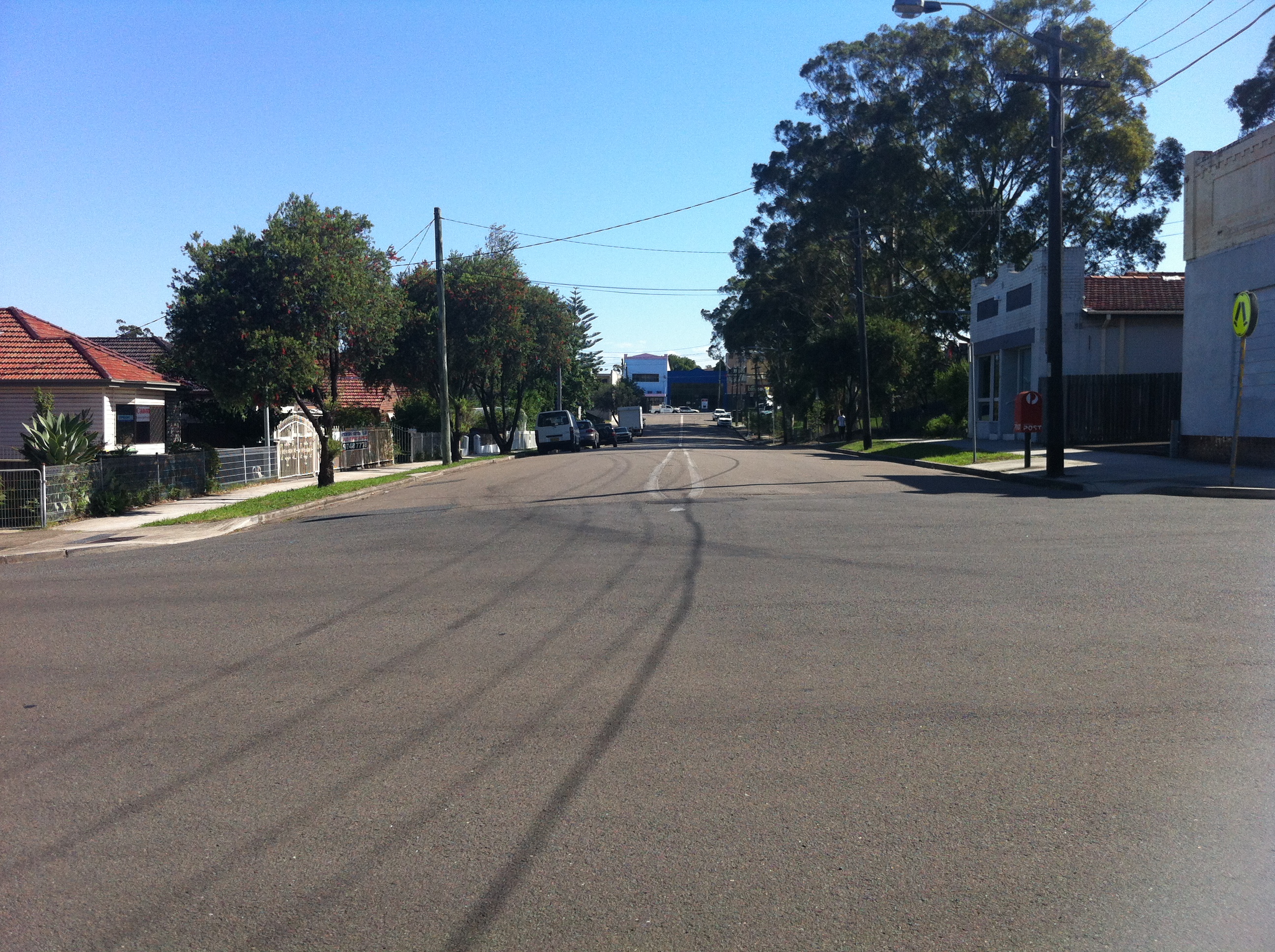
Now, let’s take a look at those street names. When you’re heading south from President Avenue, the first one you come to is Banks Street.

And that’s American! Because banks are…American and…uh, evil, and…how does the rest of that go? Big banks? Big oil…
No, the real Monterey gets started further down, with Monterey Street.

The name Monterey has its origins in Monterrei, Spain. So revered was Gaspar de Zuniga Acevedo y Fonseca, 5th Count of Monterrey (as Monterrei had become known by the 1590s), that Monterrey, Mexico was named in his honour by the conquistadors. Subsequently, in 1602, when it came time to name a newly discovered bay in what is now California, the Spaniards went with Bahia de Monterrey, which eventually evolved into Monterey Bay, which itself lends its name to the nearby city of Monterey, which then became the capital of Alta California. When the United States won the Mexican-American War of 1846-47, California was annexed by the USA right there in Monterey. The city went on to be the site of the first theatre in California (a state now synonymous with show business), and is famous for its cheese. Whew!

Not that kind of cheese…
Now look at Monterey Street, Monterey, with all the trappings of Australian suburbia. Does it bear the weight of all that history? Hell no.
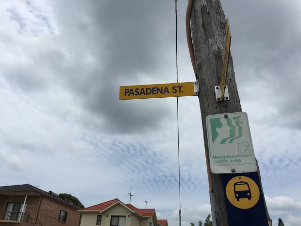
Next up is Pasadena Street, and you’d better believe it’s full of little old ladies. Pasadena gets its name from the city in Los Angeles County, a city that dates back to 1886 and is named for a Chippewa Native American term meaning ‘of the valley’. I’m starting to feel that not a lot of thought went into these street names…

In fact, the most interesting thing I can say about Pasadena Street is that it comes out directly across from Botany Bay. Look at that picture above. That gap in the land is the mouth that flows out to the Tasman Sea, from whence the Endeavour, for better or worse, arrived in 1770.

Again, too much history comes down, crushing the street’s thin veneer of banality, exposing nothing beneath.

Inevitably, there’s Hollywood Street. At the time of its christening, 1903, Hollywood, California had only just been incorporated as a municipality. It wouldn’t get its first movie studio until 1912, so whomever named was showing some astonishing foresight.

Also astonishing is this house on the corner of O’Connell and Hollywood. Just look at it.

Look at it!

Finally, we have Culver Street. Culver City, back in Cali, is another one that didn’t really come to prominence until the years after this street was named. In Culver City’s case, it wasn’t incorporated until late 1917. Weirder still is that Harry H. Culver, after whom Culver City is named, didn’t even arrive in California until 1910! Who named this street?!

Sadly, the psychic who gave Culver Street its name didn’t foresee just how pedestrian it would become in later years.
Mystery still surrounds the naming of these streets. There’s no definitive record of anyone in particular having bestowed the names, and sources have varied throughout histories both official and unofficial over the decades. Even Rockdale Council has no idea, and it’s, like, their ‘hood. What gives?
In 1941, an attempt was made by council to name the suburb ‘Werribah’ for postal reasons. Rolls right off the tongue, don’t it? It didn’t take, and ‘Monterey Park’ was also rejected before settling on plain old Monterey. I mentioned postal reasons…that appears to be its own story, and we’ll come back to that another day. It’ll be worth the wait, I swear!
All the bickering over the name meant that the suburb’s designation Monterey remained unofficial until 1972, when the Geographic Names Board stepped in and shit got real. A local poll of residents of the four American-flavoured streets showed that Monterey was the preferred name for the area, and so it’s remained ever since. Now that was all quite interesting, wasn’t it?
Again, for better or worse, this isn’t the only instance of major American influence in the early days of Sydney. The origins of Monterey are an inauspicious start, but nevertheless interesting given how the whole Brighton area embraced the very Goldfingerian image of the USA from the 1960s onwards.
Shifting tastes, a tipping of the global power balance, and a propensity to bend over for Uncle Sam meant that quite a few changes – from the minor to the irreparable – were on their way.

That means you, Chelsea.
For more reading on Monterey and the fibro houses within, check out Fibro Moderne. Early to Mid-20th century vernacular housing in Monterey NSW, without which I could not have completed this article. So blame them.
Then & Now – King Georges Road, Beverly Hills
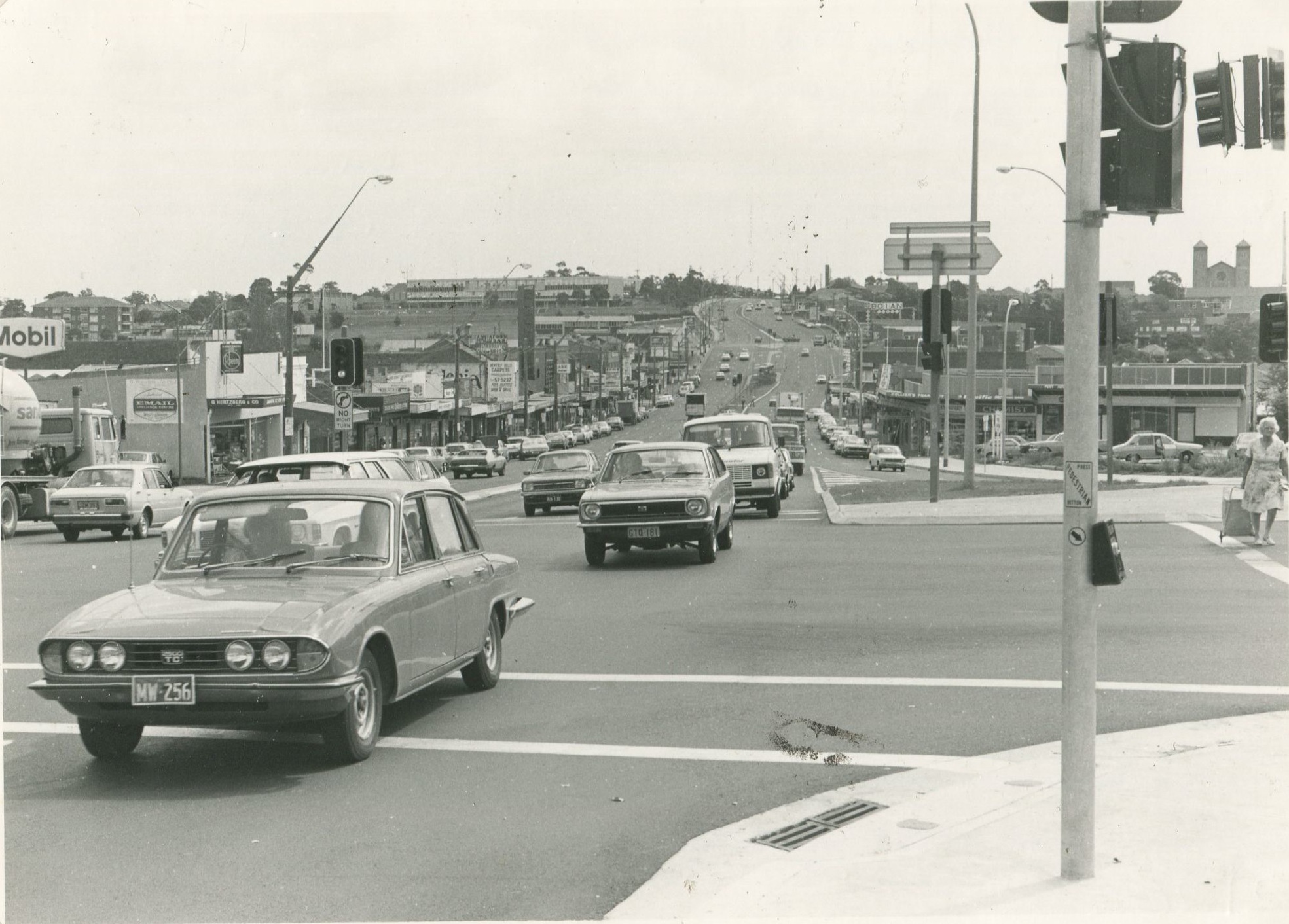
Intersection of King Georges Road and Stoney Creek Road, Beverly Hills, 1981. Image courtesy Hurstville Library
Lots to see in this bold shot from 1981 – check out the Mobil on the corner; Granny crossing the street on the right (on her way back from shopping, by the look of it. Remember when you could do that?); the No Right Turn onto Stoney Creek Road (heaven forbid!); the wide, spacious King Georges Road trailing off into the M5-less distance; the boxy pedestrian buttons; that eerie church just above Granny. But does it really look all that different today?

Not really, 2015.
These days, we can turn right from one busy road onto another; the ancient (although obviously post-1981) Chinese restaurant blocks the view of the eerie church; the Mobil has been replaced by Pancakes on the Rocks; the roads seem narrower and there are a hell of a lot more cars, and yet the air is allegedly cleaner. Must be all those extra trees. Oh, and NO PIZZA HUT.
Parramatta Road, 1982
Further to the recent F4 update (to the article, not to the actual road, what were you thinking? that’s just laughable), here’s another snippet from the same pamphlet giving us a rundown of the history of “the oldest road in Australia”, Parramatta Road, as seen from the vantage point of 1982.
For me, the highlights (emphasis mine) include:
“By 1806 the road was in such poor condition it was declared to be a danger to horses.”
Right, and by 2015, those horses still aren’t getting anywhere near it.
“For those evading the tolls penalties were severe, up to 3 years hard labour and public whipping!”
Any chance we could bring that back?
“The first Judge of the Supreme Court, Jeffrey Bent, was fined 40 shillings and recalled to England after repeatedly refusing to pay the toll and threatening to jail the tollkeeper.”
He was a judge, so no hard labour there of course, but where was his public whipping?
“In 1925…the section from Ashfield to Parramatta was noted as being far too narrow for the traffic using it.”
No need to update those notes, then.
“With the road physically incapable of being widened without enormous cost and commercial upheaval…”
Exactly what commercial upheaval are you worried about?
There’s plenty more good stuff in here, so have a gander, perhaps when you’re sitting around for long stretches of time, not going anywhere, maybe in the late afternoon. You know, one of those times.


Thanks to Burwood Library for the pamphlet.
Hurstfield – Act III: Nemesis (1988-2013)
I began to lose control…

What, you mean it didn’t before?
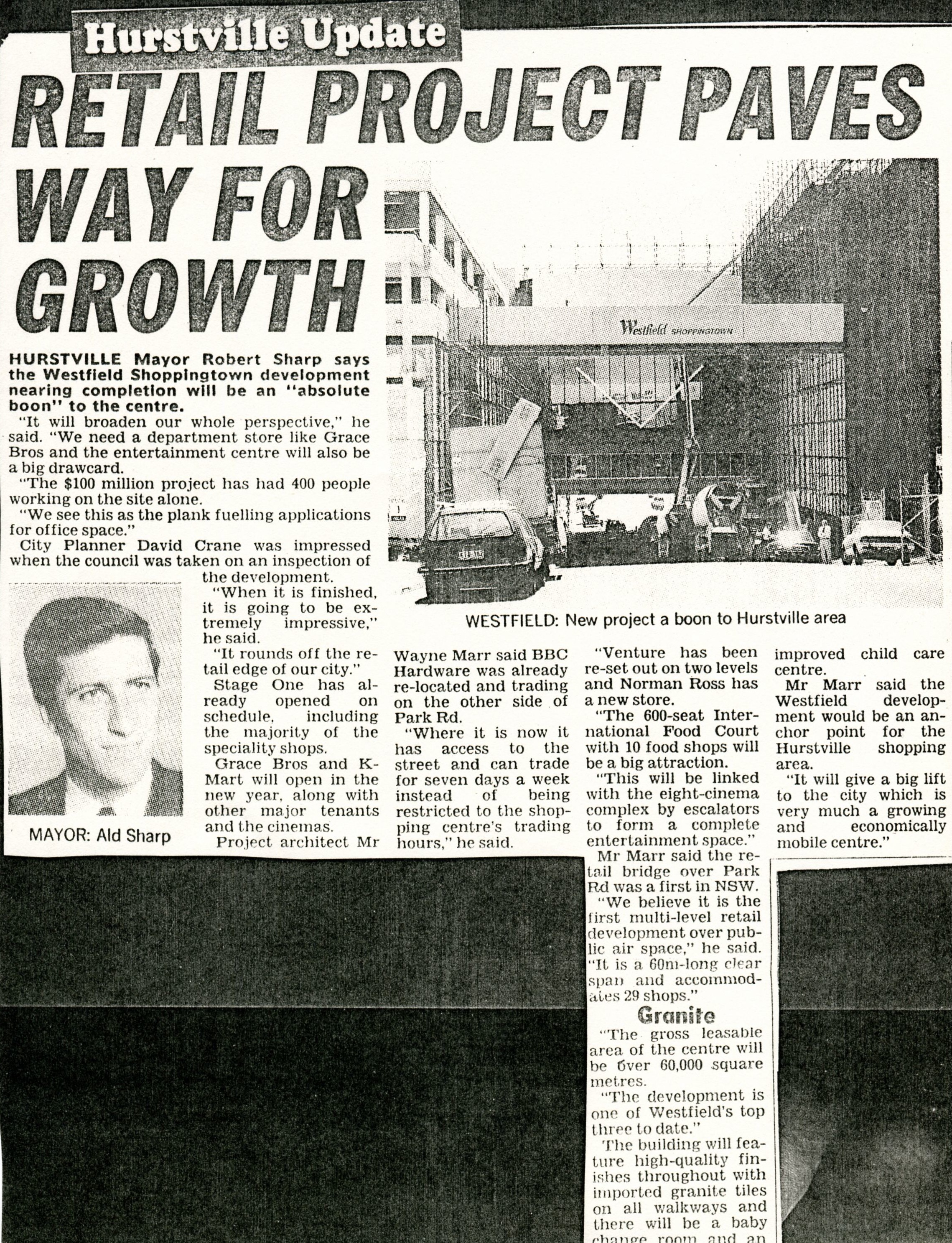
By 1988, the decade-old Westfield Shoppingtown at Hurstville was outgrowing its baby clothes. The centre had been crafted as the perfect milkshake to bring the boys to Hurstville’s yard, but it had worked too well. The public’s insatiable hunger for more shops, more variety, more ways to waste their money had grown, while the centre itself had remained essentially the same.
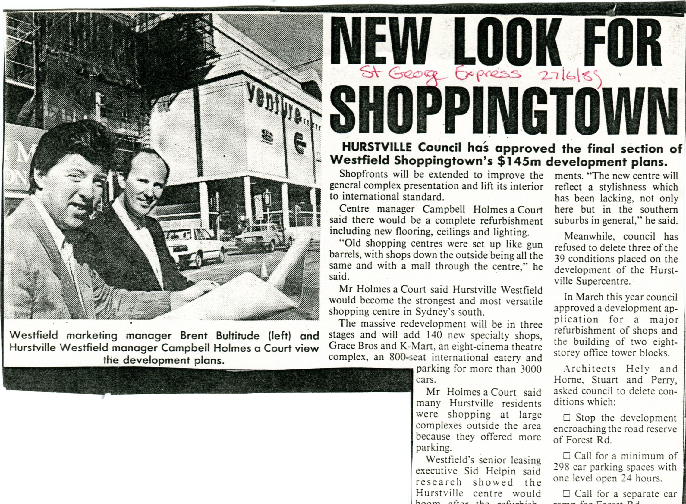
St George Express, June 27 1989
What had met the “international standard” just ten years earlier no longer cut the mustard in the decade of decadence. Of course, this standard was set by Westfield itself, which had opened six centres in the USA since 1980 in its quest to become an international presence. Oh but don’t worry all you xenophobes, they’re still as dinky-di true-blue fair-dinkum mate as a dead dingo’s donger:

Like a weed.
Despite suffering heavy losses in the 1987 stock market crash – bad enough to force the sale of star asset Network Ten (!) in 1989 – the Westfield Group was keen to apply what it had learned in the international market to its legacy outlets.
And let’s face facts: they don’t get much more legacy than Hurstville.

I say we nuke the site from orbit.
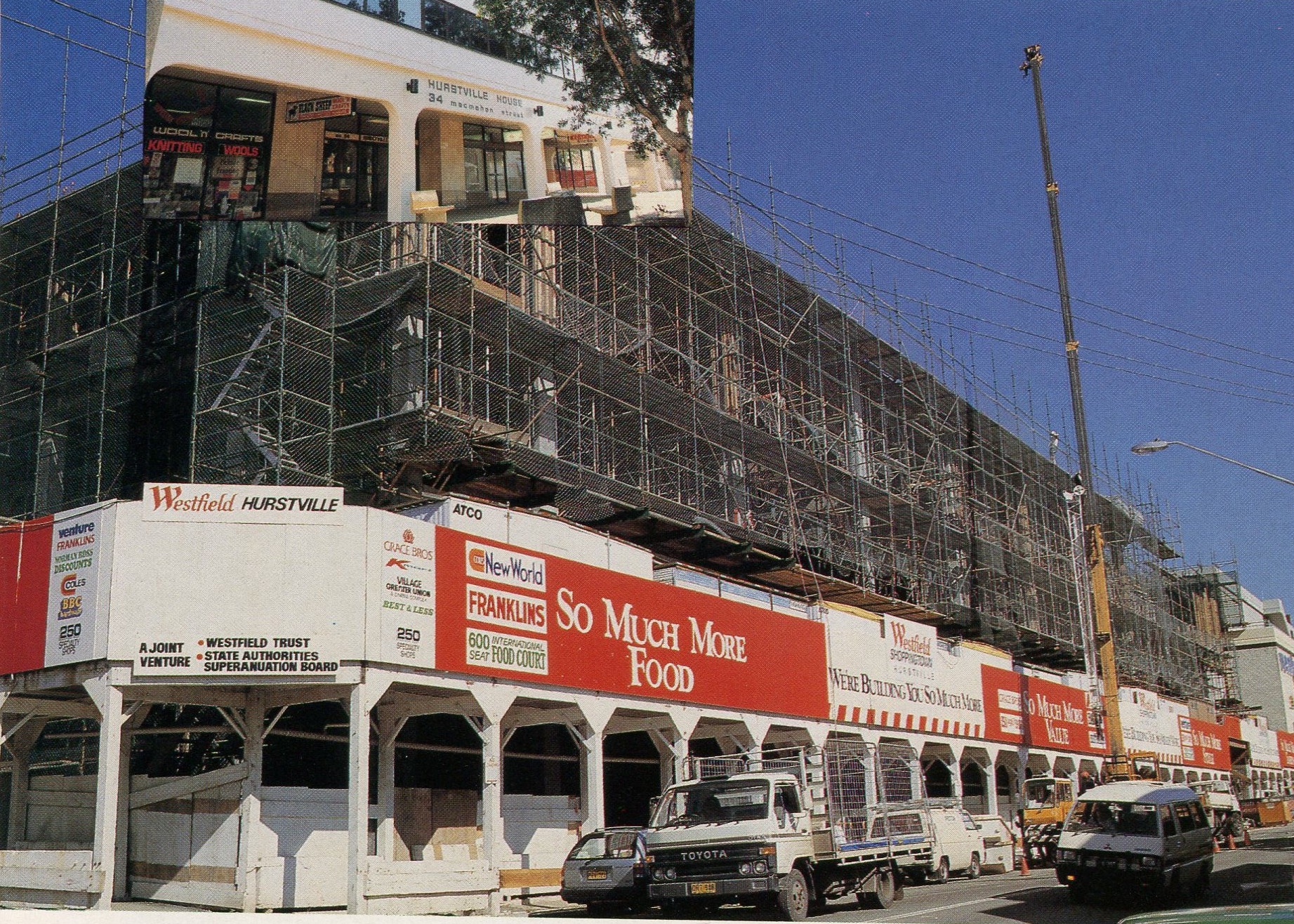
Dated 1987, Westfield’s plan for aggressive expansion looks very bold on paper. The centre’s extension was to take up an entire block neighbouring the existing site, a proposal that no doubt delighted Hurstville Council. I know what you’re saying, “It’s lucky they had a spare block of land bereft of residents on hand in order to allow Westfield to expand!”
Well, about that…

When we thought we were moving closer to the shops, this wasn’t what we had in mind.
Just left of the complex in that picture are houses, trees, all that good stuff. But as the caption says, FULL STEAM AHEAD.

Come on, those houses had parking for three cars at best.
For so fewer people.
Back in their original 1975 proposal, Westfield had been very careful to minimise the impact the centre would have on the community, all in the service of buttering up the Hurstville Council. The pinnacle of this effort was the Snowy Hill Park atop the centre, a nature reserve where people could come and relax away from the hustle and bustle of the retail juggernaut below. In 1988, it was the first to go, razed to make way for a carpark. It says a lot about how the balance of power in the suburb had changed in ten years that this was able to happen. As it stands, this blog entry is now the most public memorial to Snowy. Ouch.
Leader, December 5 1989
All this talk of growth was all well and good, but what exactly was growing? Sure, Westfield’s profits were hulking out, and Hurstville Council’s take-home wouldn’t have been anything to sneeze at, but was Hurstville itself doing much growing? Let’s see…

Leader, March 12 1991

Leader, 1989
Leader, January 15 1991
So, no.
1990. It was time. The grand opening everyone had been foaming at the mouth for, that people had sacrificed their homes for – that Snowy Hill had been swept under the rug for – was at hand. Did Westfield spare any expense bringing out the big guns for such an occasion?

Maggie T wasn’t good enough for you?
Well, okay. Uh…
Isn’t he that guy from The Zone?
Hm. So, no.
The biggest jewel in Westfield’s new crown was the addition of Sydney department store mainstay Grace Bros. With Waltons, Westfield had backed the wrong horse, and were determined to make sure that didn’t happen again. The new Grace Bros. also served to steal even more of the floundering Roselands’ thunder, as GB had been that centre’s pride and joy for years at this point. Also new to Hurstville were K-Mart, 125 new specialty shops, as well as some of the biggest and most resilient names in retail:

BIG

HUGE
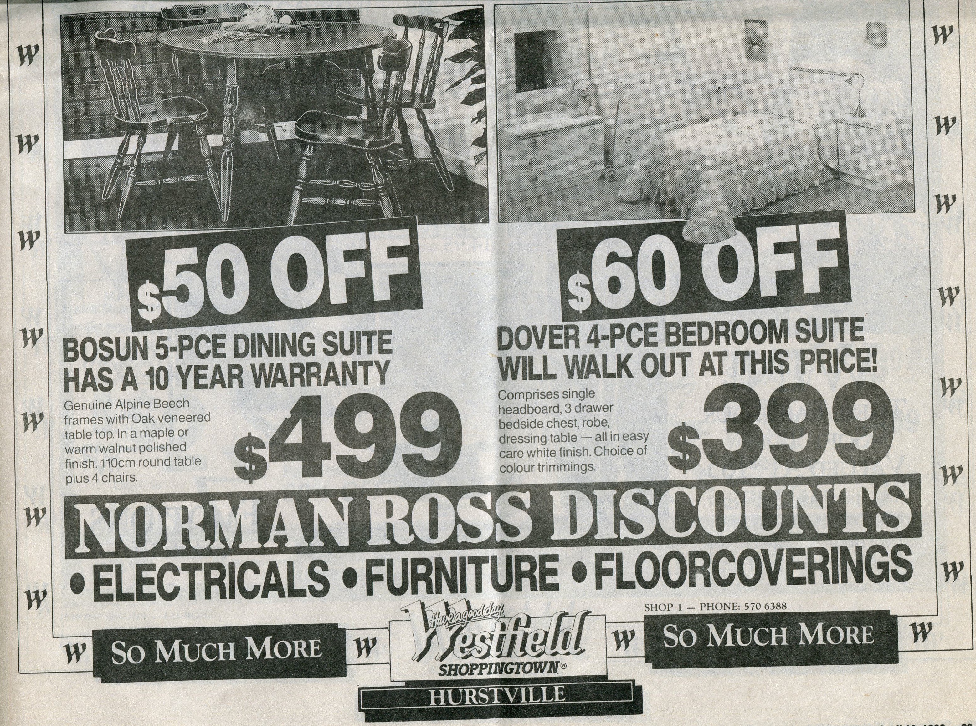
MASSIVE

OOH!

DAMN!
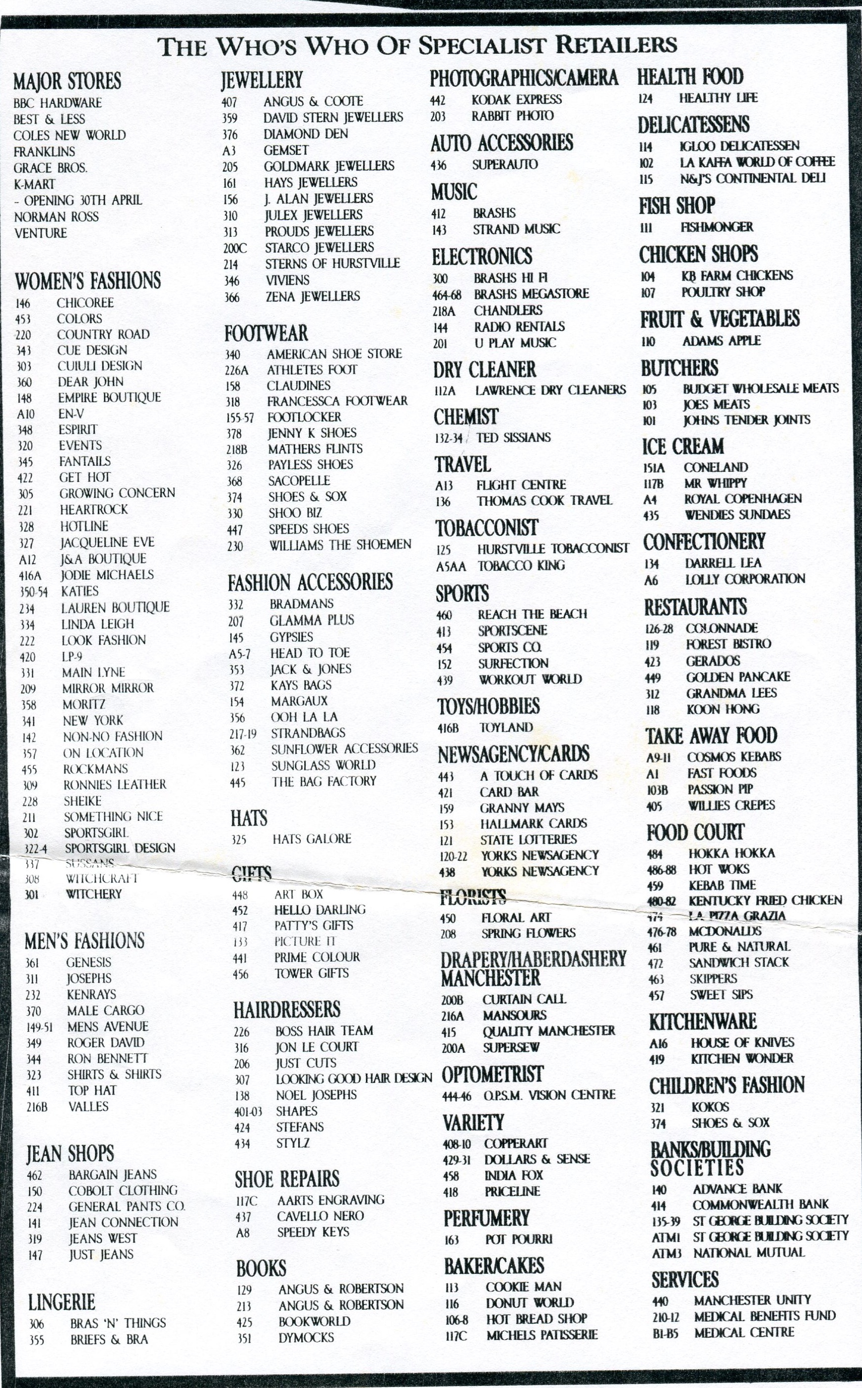
Take a moment to catch your breath and let’s take a look at the whole lineup:
La WHAT’S World of Coffee?! 1990
My award for the best business name ever goes to the hairdresser known as BOSS HAIR TEAM. Untouchable.
Armed with all these new shops and bearing the International Standard ™, Westfield was primed to take the new decade by storm, and for a time it worked. High profile acquisitions and additions peppered the 1990s, but none as exciting as when dying god Venture made way for American toy giant Toys R Us in 1993.
As my contemporaries would concur, the concept of a two storey toy shop was mind-blowing at the time. Compare this to the mere one storey of Bankstown’s World 4 Kids (itself a countermeasure against Toys R Us) and there’s just no competition. Never mind that the bottom level was mainly baby stuff and outdoor junk, that’s not the point. TWO STOREYS.
Whoever rated Another 48HRS as a ‘top’ film should be shot.
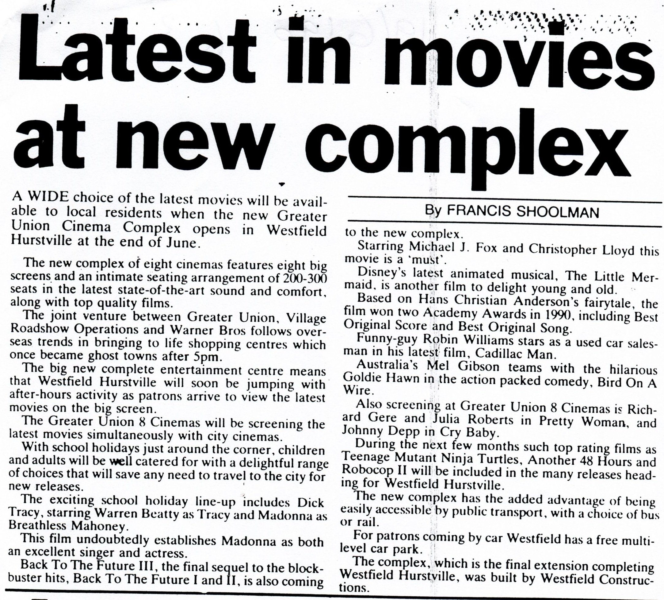
On the entertainment front, Westfield had topped off its retail sundae with the cherry that was Greater Union. An eight-screen cinema (considered huge at the time, believe me), GU blew away local competition like the Hurstville Savoy, the Kogarah Mecca and the Beverly Hills Cinema. How could those small fry hope to compete with eight screens?
For me though, the high point of Westfield’s desire to innovate during the 1990s was Intencity. Pre-empted by a cool, mysterious ad campaign (below), it seemed as if Intencity was the natural evolution of video game arcades of the past such as Spacetacular and Fun & Games….but that’s another story.
By 1995, the future looked very bright indeed:

No more Boss Hair Team. 1995.
But all the glitz and dazzle was blinding Hurstvillians from what was really going on in the area. For every Toys R Us, there was a story like this. For every K-Mart, there was one of these. And for every Grace Bros., there was a Barter’s.

Rhyming years with years is pretty lazy, Barter’s.
Remember Barter’s (see part one if you don’t)? Living proof that bigger isn’t always better, the three-storey Barter’s had begun its slow decline with the advent of the Westfield itself back in the late ’70s. In January 1985, Barter’s held its last ever sale, and everything had to go:

Barter’s Fire Sale, January 1985. Image courtesy Hurstville Council

Just take it. Barter’s Fire Sale, January 1985. Image courtesy Hurstville Council
Scabs from all over Hurstville picked the place clean. What had once been the example of retail elegance in Hurstville was now…well:

Should have had such a sale every day. Barter’s Fire Sale, January 1985. Image courtesy Hurstville Council

They were even giving the Norms away. Barter’s on the slab, July 1985. Image courtesy Hurstville Council
The oft-ignored side effect of the Westfield was the damage it caused to the Forest Road shopping strip. Although it had originally been intended to complement those shops, Westfield had done everything so much bigger and better that the little guys outside didn’t stand a chance. Throughout the ’90s and ’00s, stories like this were common:

Leader, November 14 1996
Leader, July 20 1995
Leader, November 8 2004

Leader, October 5 2000
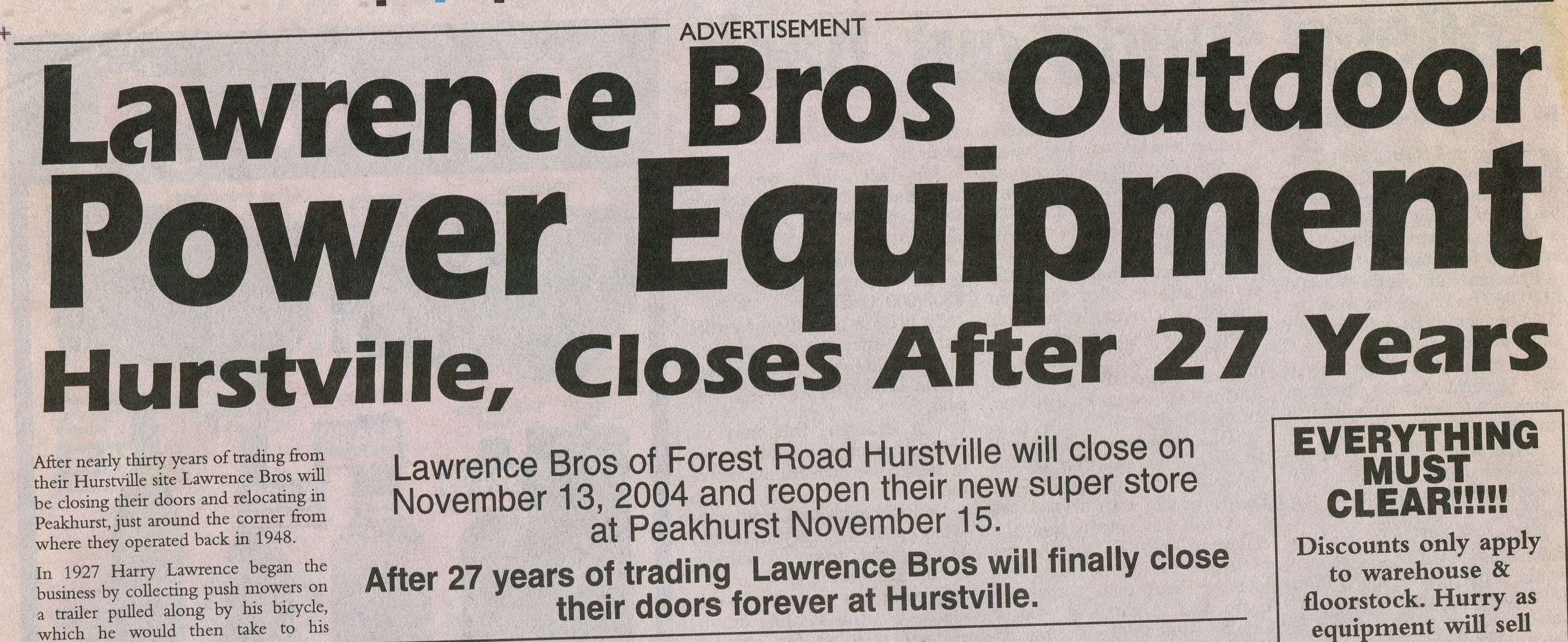
Not helping matters for local retailers was the debacle that was Forest Road Mall. Proposed in 1988 by council and intended to celebrate Hurstville becoming a city that year, the plan would have seen the two-way Forest Road closed off to private traffic and transformed into a pedestrian mall, ‘Hurstville Boulevard’. It was believed that this mall would combat Westfield’s dominance of the area, although how council thought they could do this and not appear two-faced is beyond me. Needless to say, it wasn’t very popular with retailers:

Leader, January 18 1989

Leader, November 3 1992

Leader, November 10 1992
It may shock you to learn that Hurstville Council went ahead with this plan in 1991, going so far as to hold an opening celebration…
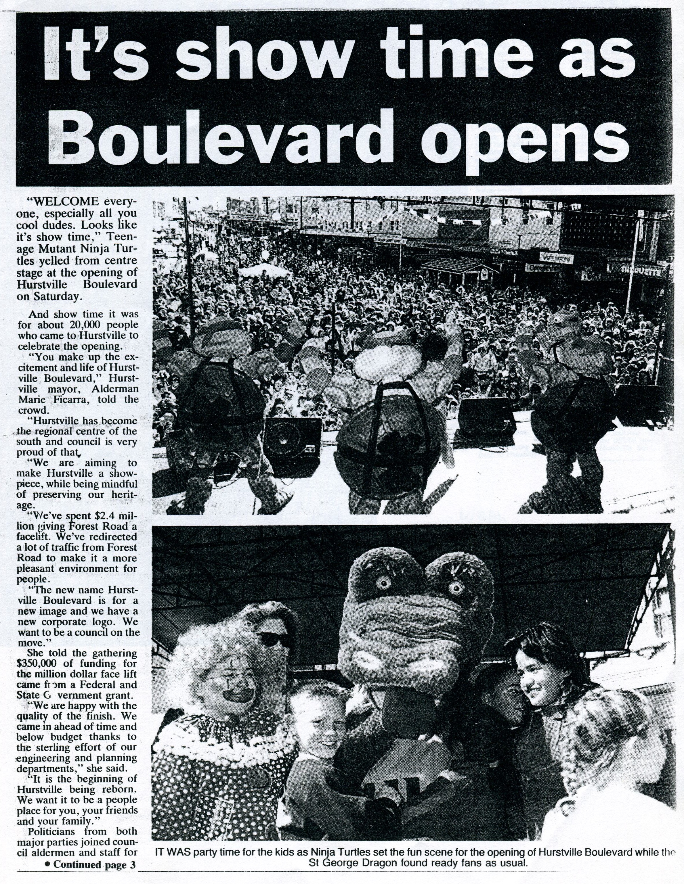
Leader, August 6 1991
…that featured perhaps one of the least appropriate double-billings in entertainment history:
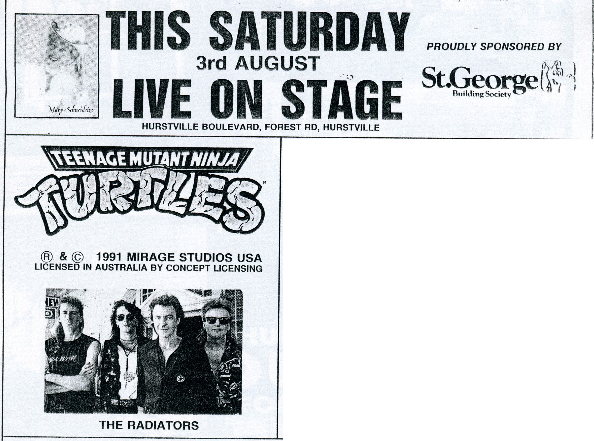
Gimme shred, baby. Leader, August 1 1991
The madness ended in late 1991, as the recession, coupled with increasingly fierce opposition, caused council to rethink their plans. As so much of the construction work to turn Forest Road into the car-free Hurstville Boulevard had been completed, a compromise was met: Forest Road became a one-way street.
Leader, April 3 1991
You can imagine the big cheeses at Westfield sitting around laughing at this mayhem, which only served to strengthen their position in Hurstville.
But by 1998, Westfield’s gloss was starting to wear off. Another ten years had passed, and in that time international standards had increased again, Westfield Miranda had expanded to become even bigger again, Westfield Burwood was slated for demolition to be replaced by a more modern centre, and many of the heavy hitters of the mid ’90s were winding down. The ever-shifting plates of retail had unsettled giants like Brashs, Toys R Us and *sniff* Intencity, which was replaced by Target in 1997.
Even the cinema was starting to lose its sheen, seen by locals as a hangout for thugs and hoodlums, as was the neighbouring food court. Suddenly, it didn’t feel so good to shop at Hurstville.

Leader, April 14 1992

Leader, April 18 1992

Leader, April 7 1992
The social climate of Hurstville was something that neither council nor Westfield stopped to consider at any time, especially when they were bulldozing houses to expand the shopping centre. That Hurstville was becoming increasingly multicultural didn’t seem to occur to either entity also, only becoming apparent when it was too late to repackage and restructure the complex to suit the suburb’s new needs. I wonder if Westfield ever stopped to wonder why it was suddenly filled with cheap $2 junk shops and mobile phone accessory outlets?
Today, it’s a far cry from the glory days. This year marks Westfield Hurstville’s 35th anniversary, and you can’t half tell. Let’s take a quick tour.

Ugh.
‘Shoppingtown’ no more. Yeah, that was the most dated part of the whole thing, Westfield.

The snow has melted…
Here are the steps that once took those of us craving fresh air and nature up to Snowy Hill Park. Now it’s a place to smoke while you’re waiting for your kid to emerge from the daycare centre. See those bushes to the left? That’s all you’re getting.

Snowy Hill Park in better days, 1978.

Mediocrity and unpleasantness all under one roof.
I don’t understand how only some of the floor tiles are stained. How does that happen?

Not really all that jolly, is it?
Jolley’s Arcade lives on today with this dated entrance to a dungeon filled with a pretty dire selection of shops, with the fashionably incongruous Fevercast a notable exception. I wonder if they still pay less rent?

Is that guy in the trackies taking a selfie?
When even Westfield became too depressing, the threatening youth moved outside to hang around. Not quite the pedestrian mall council envisioned, I’m guessing.

Not pictured: Sul Ponte’s clown mascot. Hey, it worked for the last tenant…
What was once a dedicated McDonalds restaurant was cut in half with the 1990 extension, and today it’s Sul Ponte cafe. McDonalds’ original seating arrangements remain inside, but the burgers themselves have moved up to the food court outside K-Mart.

Don’t put a target on the side of your building, it’ll only encourage them.
Park Road was built over in 1990 to create this shopping overpass. On the left is the original Westfield, although the carpark on top was added in 1990.

A rose by any other dead end…
This is all that remains of Rose Street today. That music lessons shop looks ancient enough to remember when it was a full street.
In the scheme of things, Westfield seems to have moved on and forgotten about Hurstville. They don’t even bother to charge for parking. The corporation has realised that the true profits are to be had in places like Bondi Junction and Pitt Street Mall, and it’s safe to say that ‘Hurstfield’ will not be receiving further extensions.
What was once hailed as Hurstville’s saviour undoubtedly proved its greatest nemesis and ultimately, its assassin. The damage is done, the parasite has sucked the city dry, and the glory days are long behind it. Visiting today is a depressing, colourless experience heightened by the assorted mental patients who frequent the centre. It hasn’t just become a part of the Hurstville experience, it has become Hurstville. Without the centre, the suburb would become nothing.
And given the state of the centre, I’m not so sure that hasn’t already come to pass.
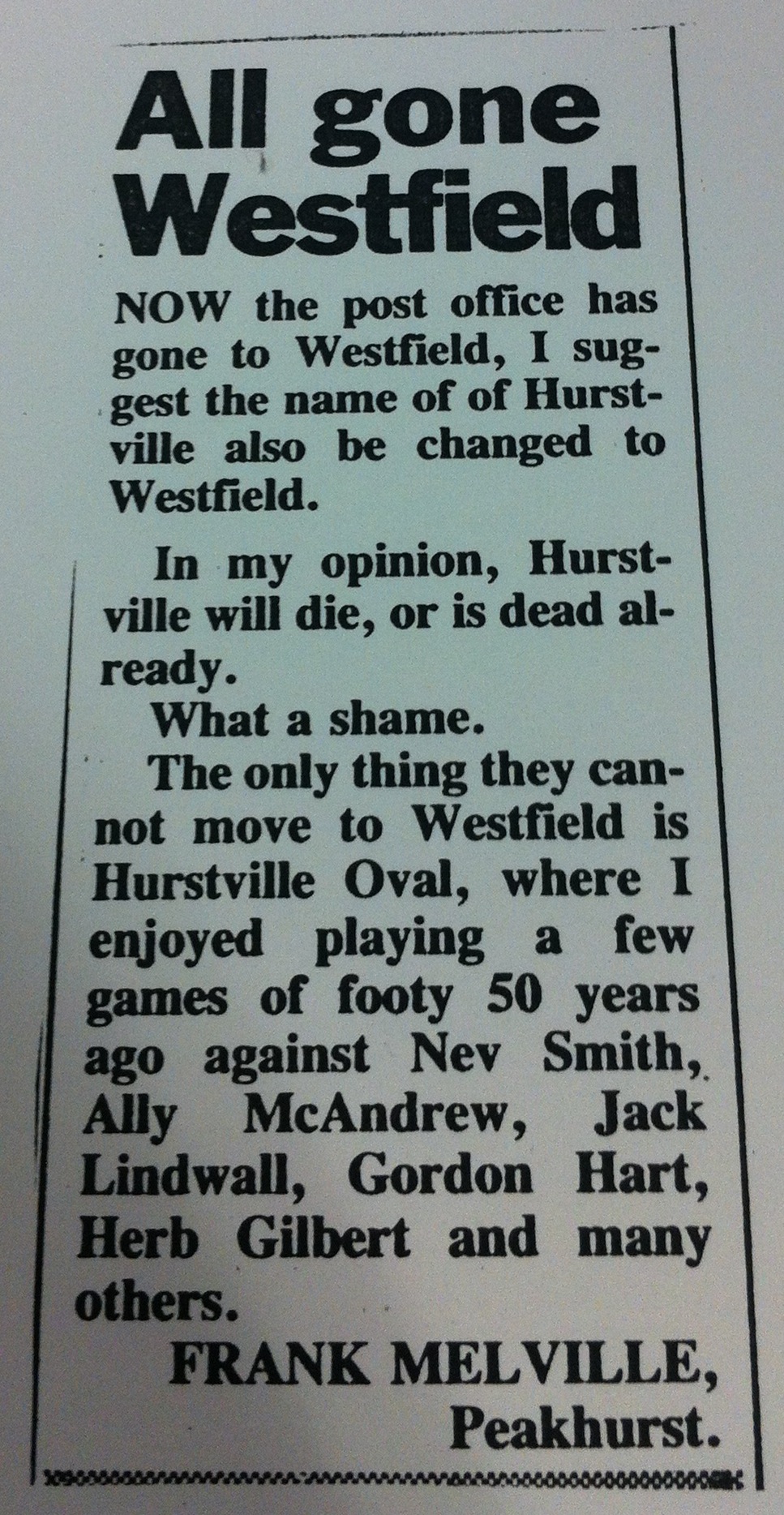
I’d like to wrap this saga up by sharing a letter that I feel is wonderfully succinct, poignant and devastating all at once. This was published in the Leader, November 1 1990, and shows astounding foresight/cynicism. The writer must be dead by now, so RIP Frank, and RIP Hurstville.
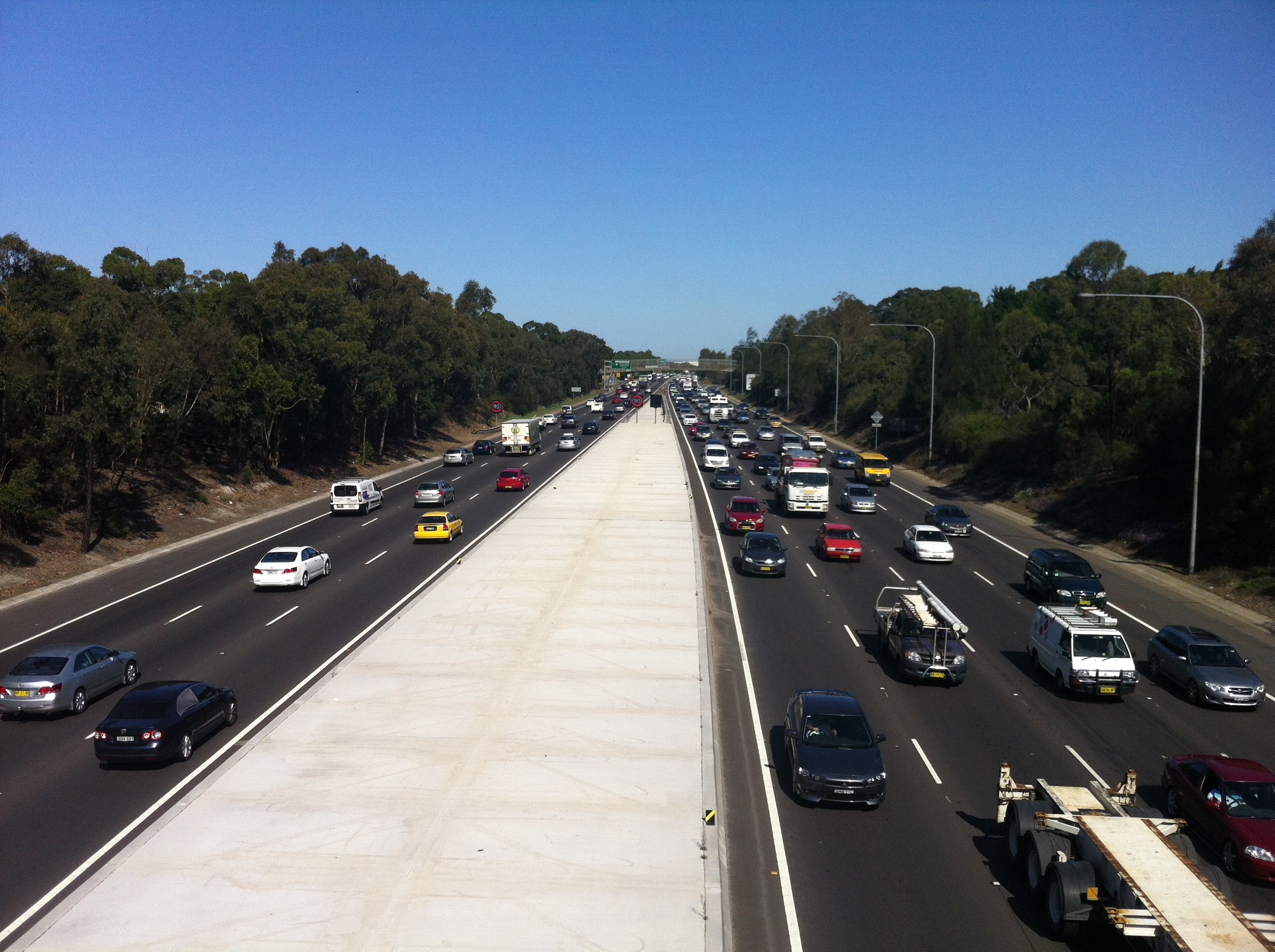
F4 Expressway/SWR Western Motorway/M4 Freeway – Concord, NSW

Image courtesy RTA Magazine/OzRoads
As promised, we’re now going to plunge into the half-assed history of the M4 freeway’s eastern terminus. I’m imagining you’re already as joyful and excited as those people on the bridge above, but don’t peak early – we’ll dig up some good stuff. If I do a half-assed job, consider it an homage.
After World War II it became clear that Parramatta Road wasn’t going to cut it anymore as a way of getting people to and from the western suburbs of Sydney, which had exploded in terms of population. Of course, in those days, Leichhardt was a western suburb, but you get the idea. In 1947, the newly created County of Cumberland Planning Scheme identified a possible route for an expressway which would connect Glebe to the Great Western Highway at Lapstone (of the treacherous Lapstone Incline fame). In reliably speedy NSW Government fashion, the corridor of land was reserved in 1951.
As an aside, I’d just like to shine the spotlight on my ignorance: I had no idea what Cumberland County was, and I was surprised to learn that not only was it created by Governor Arthur Phillip in 1789 and encompasses most of the Sydney metro area, but that there are 141 counties in New South Wales. A shadowy cabal of local government councillors would elect the Cumberland County Council, which then had a powerful influence over town planning in metro Sydney. Spooky stuff.
Anyway, the M4’s construction started backwards, with the first stage completed at Emu Plains in the late 60s. The late 60s. After the plan was formed in 1947. Yeah.
As the freeway crept closer and closer to Sydney, the pocket of land set aside to relieve the ever-building traffic pressure in the city waited patiently for its turn.
It’s still waiting.

This is the start and end of the M4, and as close as the freeway gets to the city. Every day, traffic from the western suburbs and beyond is ripped from the (theoretically) 90km+ flow into the waiting 60km arms of Parramatta Road, Concord. Citybound motorists must then contend with the stop/start rhythm of Sydney’s oldest road and a new nightmare: traffic lights. If this sounds awkward, it’s because it is. And it looks even more awkward:

Image courtesy Google Maps
In 1976, the F4 freeway (as it was then known) was all set to drill right through the inner west and end up at its intended starting point in the city, Glebe. But Glebians (?) had had over 20 years to prepare their outrage and protests, so the Department of Main Roads found itself staring down a pissed off neighbourhood that feared the freeway would shatter its layout and atmosphere. In what would be the first of many such moves for the NSW Government, it backed down. The Concord to Glebe section of the freeway was abandoned, and a backup plan was hastily slapped together.
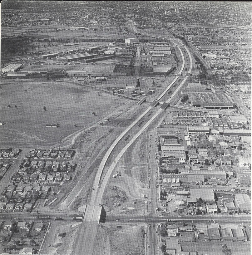
The F4 prepares to cross Silverwater Road, 1979. Courtesy Main Roads Journal/OzRoads
Also hastily slapped together were the physical components of the eventual fix, which was to spill the M4 onto Parramatta Road and hope that it all worked fine. In 1982, more than 30 years after planning had commenced, the section of the M4 between Concord and Auburn was opened to traffic, despite the next section between Auburn and Granville not being complete.

Concord reforged: the F4 ends, 1985. Courtesy Main Roads Journal/OzRoads
What a shemozzle! Although the rest of the freeway west of Concord was eventually completed (pretty much), it’s the section between Concord and Auburn that remains the most interesting and telling of the struggles that went into constructing it. With the O’Farrell Government now gearing up to deliver on its promise to complete the M4 (via a tunnel system, natch), it’s as good a time as any to see what kind of stopgap measures we can look forward to.

Where the M4 itself joins Parramatta Road, it LITERALLY joins Parramatta Road in a series of glued on slabs of cement. It’s easy to see the difference in road material here..

…here…

…and here. This is because the entrance to the M4 as it is today was originally part of Concord Road, which was relocated a block to the west. Why? Bear with me…
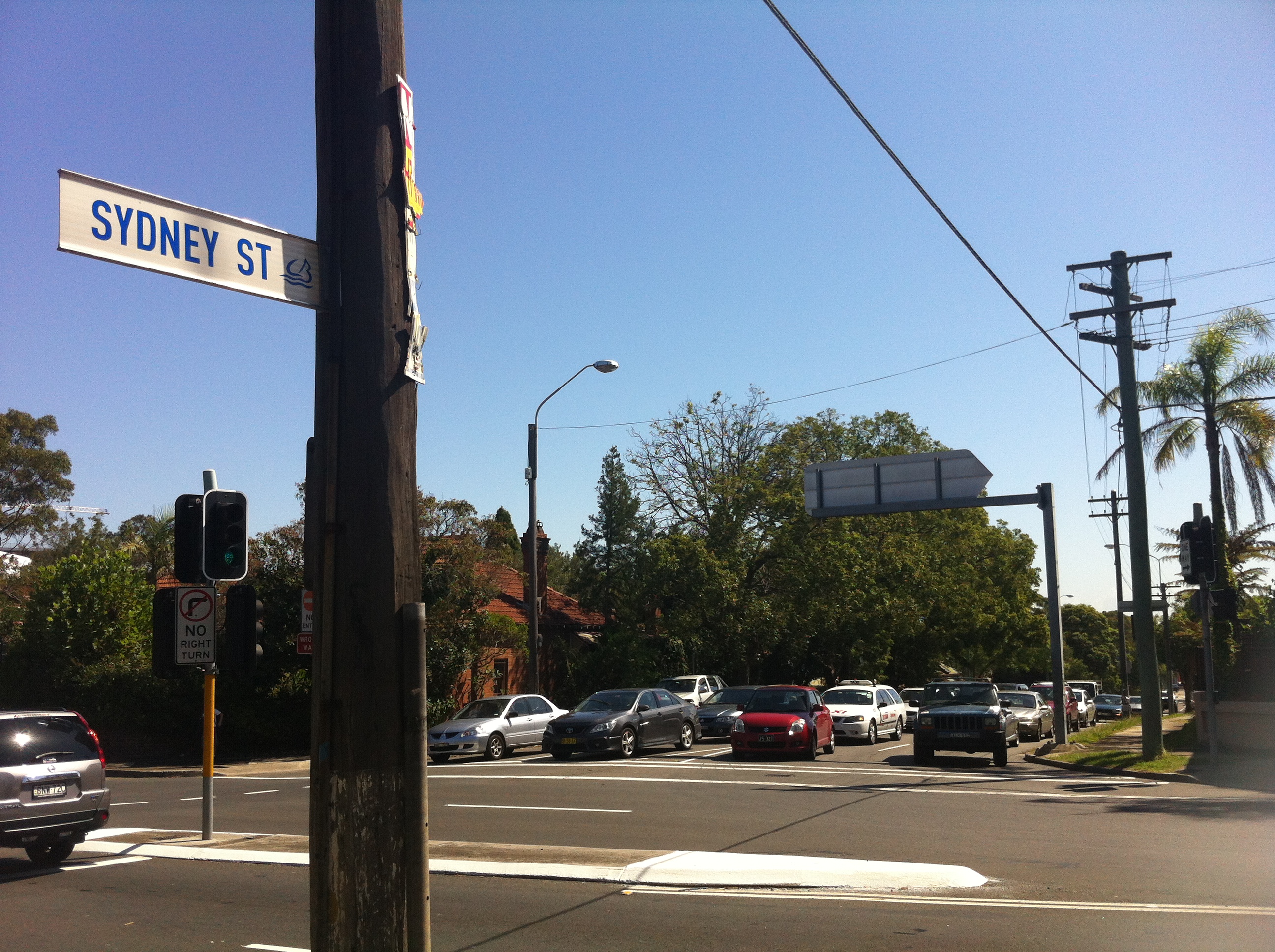
When this section was completed in 1982, the one-way Sydney Street was the only way off the M4. Traffic would then spill into Concord Road, which at the time followed a different alignment…

…being this, the current end of the M4. To accommodate more traffic, Concord Road was realigned to cross Parramatta Road instead of joining it.
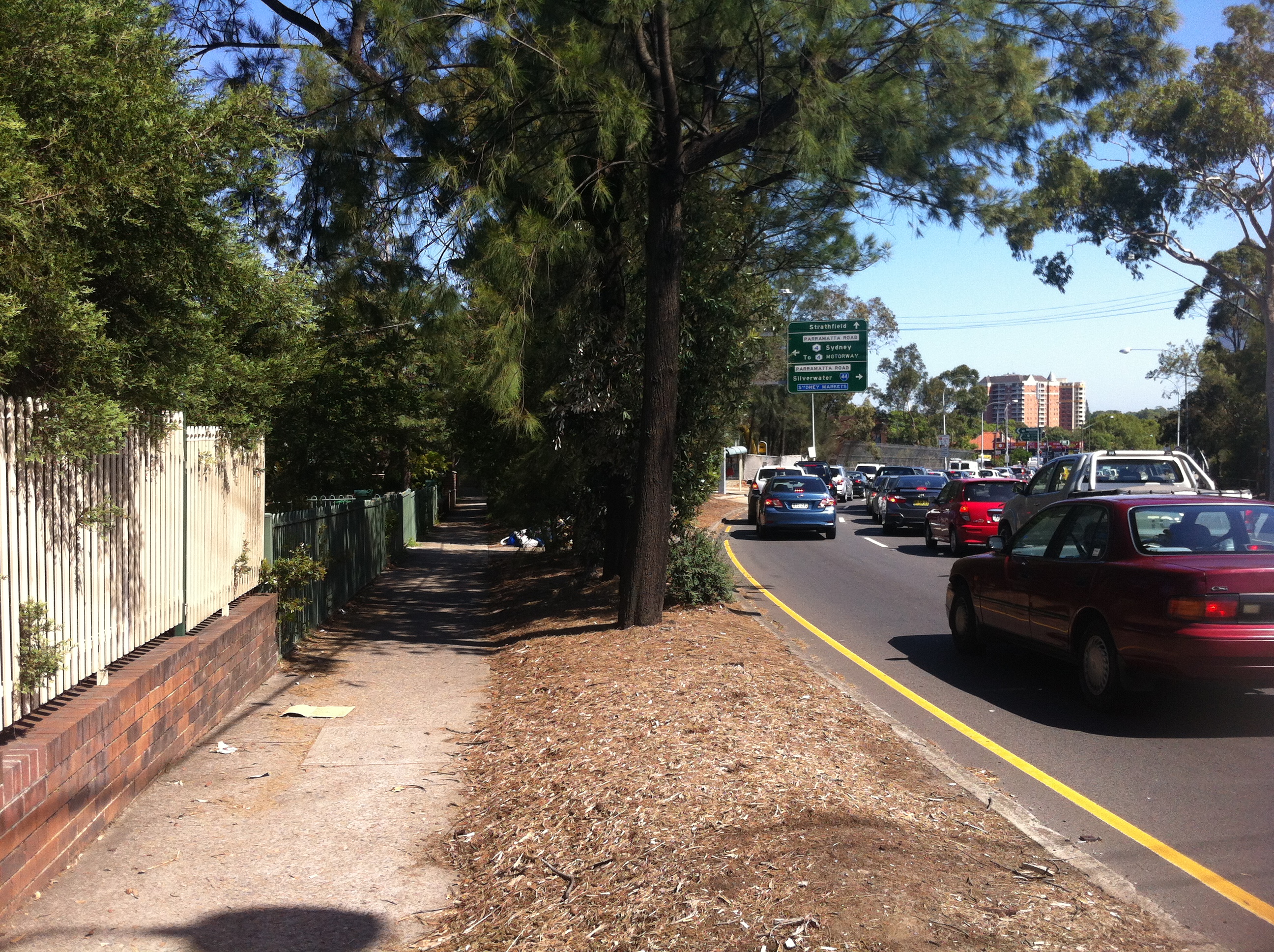
Concord Road was extended towards Leicester Street on the other side of Parramatta Road, and the former curve was filled in by parkland and a bus stop:
So if you’ve ever wondered what this big bit of nothing was all about, that’s the story, although it could be argued that providing more access for buses adds to Parramatta Road’s problems, but that’s another story.

A tunnel was dug here between the M4 and Concord Road to form the overpass that exists there today, and to direct the traffic flow onto Parramatta Road. What was the fruit of all of this effort? One set of traffic lights is bypassed by eastbound traffic.

This restructure meant that Young Street, which in 1982 acted as the eastmost on-ramp for the M4, was cut in half by the new end of Concord Road. What was once one of the most important streets in Sydney now ends with a whimper:

…where once it would have joined the M4 it now provides access to a unit block’s carpark.
As mentioned, the other problem the M4 faced in 1982 was that it stopped at Silverwater. You could get on at Young Street, belt down the freeway at 90km/h in your Holden Monaro for about five minutes before being dumped back onto Parramatta Road, the defacto western expressway, at our old friend Melton Street.
Yes, this is the sight you would have faced exiting the M4 between 1982 and 1984, when the next segment was completed. You would have zoomed up past the school and the Melton Hotel, and then back onto Parramatta Road for the next million years if you were trying to get to Springwood. If we look a bit closer, we can see where the exit ramp used to be:

In the bushes between Adderley Street and the M4 you can see a clear path the motorists would have taken to rejoin Sydney traffic. I’m assuming the RTA has set this land aside for future widening of the freeway, as if that will ever happen, but in the meantime it gives us that vital link to the past. Once again, a seemingly insignificant little road like Melton Street actually did have a grander place in the scheme of things. Parramatta Road: where anything can happen.
Further up from Melton Street is the Silverwater mainstay Stubbs Street, as seen in the very first picture in this article. The M4 proceeds under the Stubbs Street overpass…
…which was completed in 1981 to mark the end of this section of the freeway.

Once the next section between here and Granville was completed in 1984, Melton Street was once again exclusive to pub patrons and parents dropping off their kids, while motorists were free to drive on to the west.
Or were they?

By 1989 only a small section of the M4 as we know it today was missing, and a private consortium, StateWideRoads, was contracted by an exhausted NSW Government to finish the job. As we all know, a grand don’t come for free, so by the time this missing link (and some hastily approved widening) was completed in 1992, someone had to pay.
That someone was you.

SWR tollbooths, 2007. Image courtesy someone who isn’t me.
It was determined that the section between James Ruse Drive at Granville and Stubbs Street, Silverwater was the section through which the majority of cars would pass, thus ensuring the shortest possible time for a toll to be in place. In May 1992, $1.50 was required to continue out to the western suburbs. By the time the toll was removed in February 2010, over $970 million had been paid to pass these booths.

Today, there’s little apart from the alignment of the lanes to suggest that the toll booths were ever there, but other remnants of the M4 project have left a more lasting mark all over Sydney. The freeway is back in the hands of the NSW Government, which is akin to returning an abused child to their abusive parent. As the battle to complete the M4’s route into the city rages on in state parliament, Federal Opposition Leader Tony Abbott has even expressed support for the completion should he win government at the next election. Thousands of motorists a day are still inconvenienced by the half-finished freeway. One accident on the M4 causes traffic chaos all over the city. The Eastern Suburbs are still effectively isolated from the rest of Sydney due to a lack of motorways….so I guess there are always upsides. There’s been talk of reinstating the toll to pay for what would by now be a very expensive couple of kilometres. In 1977, the projected cost of completing the M4 from Concord to Glebe as intended would have been $287m.
The M4 is only 46km long.
Maybe if it ever gets finished, it’ll be linked up to the Western Distributor so that it can actually start distributing people to the west instead of, you know, nowhere.
TRAFFIC STOPPING UPDATE: Thanks to Burwood Library’s archive of interesting old stuff, you can now enjoy this old pamphlet detailing the opening of TWO new segments of the F4 back in 1982. Even better is that this article’s diagrams illustrate the progress of the F4 almost as well as the above article. You all thought I was mad when I wrote this one, but who’s mad now?


