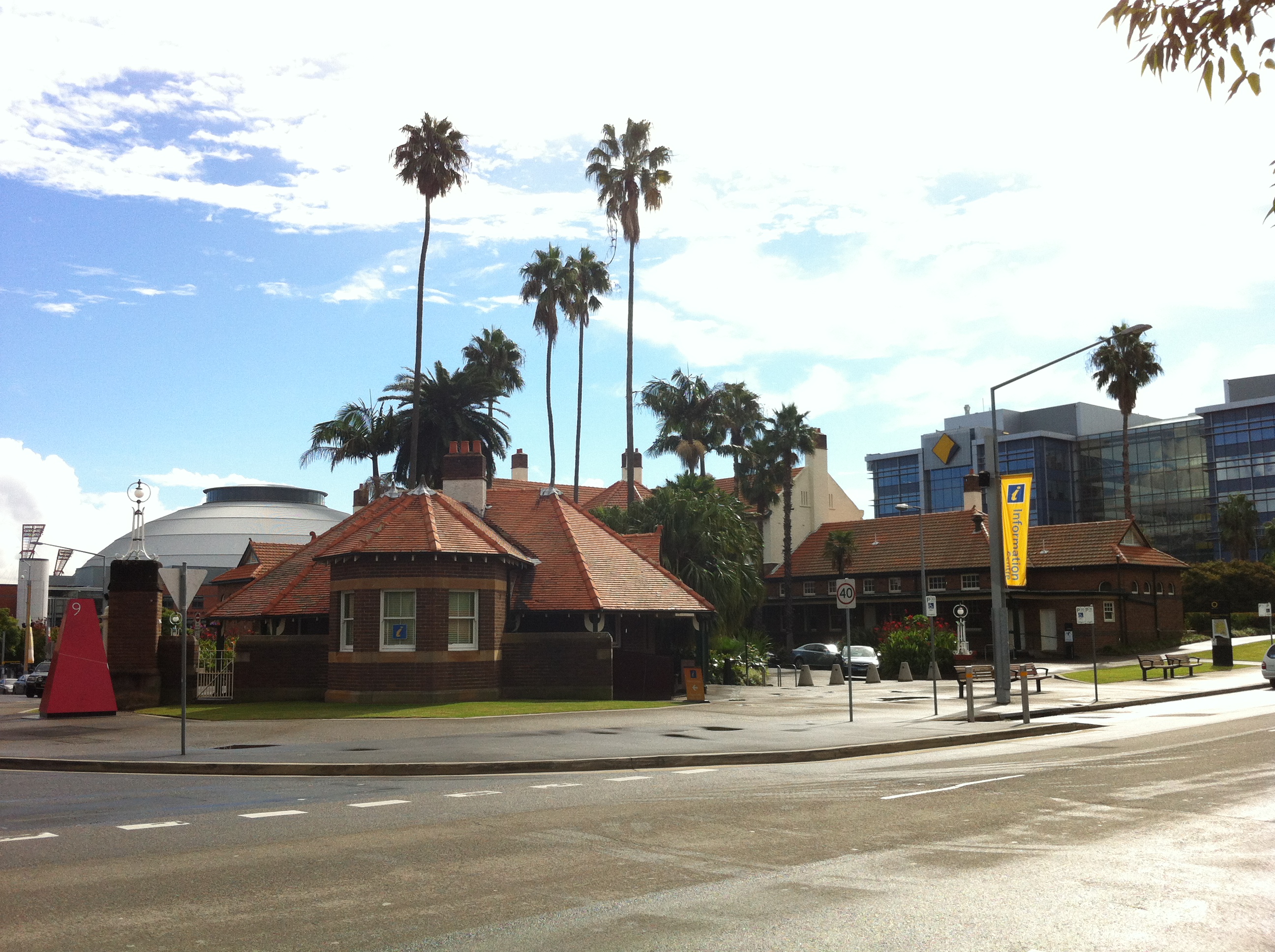
Hurstfield – Act I: Genesis (1875-1975)
Yes, we’ve been on a bit of a Hurstville bender recently, but it’s all been leading up to this. This is arguably the defining story of a suburb intrinsically linked to its biggest resident. The story of Hurstville cannot be told without Westfield, and vice versa. It’s a long story spanning 150 years and a lot of parking spaces. Get comfy – it’s one of those ones. And away we go…
I was dreaming of the past…

The view from above, 1986. Image courtesy Hurstville Council
Our story begins in the 1870s, at which time the St George area was home to a grand total of 2038 happy people. Suburbs such as Lugarno, Oatley, Bexley and Kingsgrove had been growing steadily for a few decades. In the midst of all this action was a large, heavily timbered area scandalously known as Lord’s Bush (after its longtime owner, Simeon Lord).

Michael Gannon, artist’s impression.
Purchased by a Michael Gannon in 1850, the area was renamed Gannon’s Forest, and the road running through the forest from Lugarno to Tempe was renamed Gannon’s Forest Road. See where this is going? The area got its first frothy taste of the commercial life in the early 1850s when – wait for this – a PUB was built. Turns out pubs and the seedy goings-on within attract people, and soon the people came. By 1864 a post office had arisen beside the Blue Post Inn, and was later joined by another pub (the Currency Lass, later the Free and Easy), a bakery (but not that bakery), and some other exciting retail outlets. A growing population means breeding, and that means kids, and kids means education (most of the time), so in 1876 a decision was made to erect a school for dem kidz wat cudnt spel ore reed no gud. A forward thinking inspector suggested the school be named Hurstville, and because it’s undeniably catchy, it stuck. Soon the post office was renamed thusly, and the population continued to grow.
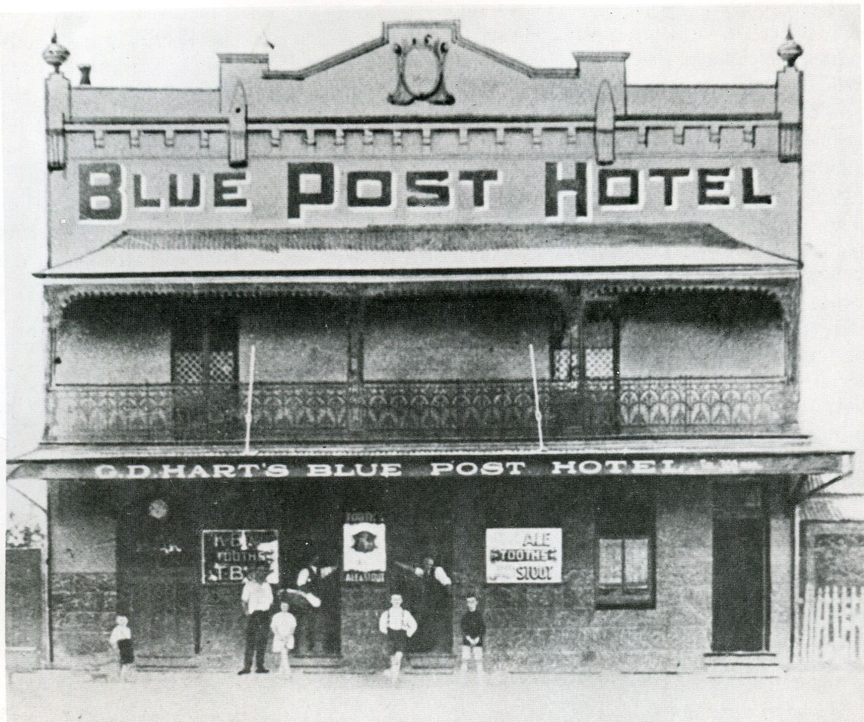
Blue Post Hotel, 1880s. Image courtesy Hurstville Council
Until the mid-1880s, the development of the town had centred around that original pub, the Blue Post Inn, which had become an unofficial meeting place for town development discussions and the like. It was during one of those meetings that a railway station was proposed, and if those walls could talk, I feel certain they would have uttered “Well, shit.”

Hurstville Station, 1910. Image courtesy Hurstville Council
Hurstville Station was built in 1884, one kilometre away from the pub. Businesses changed tack accordingly, and suddenly no one cared about the Blue Post. Perhaps it would have preferred being instantly euthanised like the Free and Easy, which was resumed to make way for the train station. Instead, the Blue Post had its licence transferred to the nearby White Horse Hotel – the greatest dishonour a pub can experience. More like the White Flag Inn, right?
The advent of the public transport hub was like the shot from a starting gun. Hurstville just couldn’t, wouldn’t, be stopped. It became a municipality in 1887, a local newspaper started up (the St George Observer, NOT The Leader, although you could be forgiven for thinking it had been around that long), those big expensive looking mansions were being built all over the place. Even a bank crash/mini depression in 1893 was made less severe by the commercial area that had prospered in the area surrounding the train station.
The land opposite Hurstville Station was swampy marsh named ‘Frog Hollow’. Originally one of the sources of Bardwell Creek, it had been further softened by runoff from both the station and the increasingly busy Forest Road. But Hurstville’s insatiable need for retail saw the swamps drained in 1907 to make suitable foundations for an all new concept in shopping – Croft’s, a two-storey building with four shops within. Why…that means I could get FOUR times the shopping done AT ONCE!
Smile! Croft’s, 1908. Image courtesy Hurstville Council
One of these shops was occupied by a mercer named Bert Jolley, who would later describe himself as “a young man with more confidence than money”. Success wasn’t instant; three months after opening, Jolley’s ledger recorded this lacklustre return: ‘Total Customers, 1; Total Sales, 1’, despite being open from 7am to 8pm.
Meow?
The story goes that Jolley, despondent and faced with bankruptcy, found himself moping around the city looking for a cup of coffee. He ended up at the Black Cat Cafe beneath Her Majesty’s Theatre, and as he drank his black coffee he was transfixed by the walls of the cafe, which were plastered in pictures of black cats. In his crazed desperation, Jolley became convinced the black cat was his spirit animal and good luck charm, and immediately devised a ‘Lucky Black Cat Sale’ for his store. Amazingly, the gamble paid off: by 1910 he’d bought the whole building, leaving both he and his variety-starved customers very jolly indeed.

Jolley 1.0, 1910. Image courtesy B Jolley’s
Jolley’s success as a suburban department store inspired plenty of copycats (heh); in 1917 local trader Diments, a hardware and produce store, expanded in size to rival Jolley, while 1921 saw the advent of Barter’s, a rival department store.

Cash only, 1962. Image courtesy Barter’s
In a tale so similar to Jolley’s that these days copyright lawyers would be involved, Charles Barter bought a single-storey shop at the approximate location of the former ANZ Bank on Forest Road. Before long it wasn’t enough, so Barter very shrewdly bought a piece of land beside the entrance to the railway station with the intention of building the greatest department store the suburbs had ever known.
Can I just interrupt the narrative for a moment to ask where Hurstvillians were getting all this money to spend with these guys? Like maybe you wouldn’t have had to live on a swamp filled with frogs if you’d invested in making your town nice instead of buying hats and black armbands or whatever it was they bought back in those days.

Oh no, please let me walk up three storeys under my own power.
Anyway, during excavation for his wonderful new three-storey building, Barter unearthed an old horseshoe, which he hung in his office for luck. Yes, Barter was such a plagiarist he even swiped Jolley’s good luck charm concept. But Barter would get a taste of his own medicine in 1922 when the Allen brothers opened their own department store (with an emphasis on menswear) further up Forest Road.
Now, do you think that’s enough department stores? Let’s review – at this point, there’s Barter’s, Diments, Jolley’s and Allen Bros., all on Forest Road, all creepily surrounding the station like vultures. Spoiled for choice much, Hurstville? Wouldn’t it be more convenient if, oh, I dunno, they were able to combine many stores and even department stores into one giant superstore?
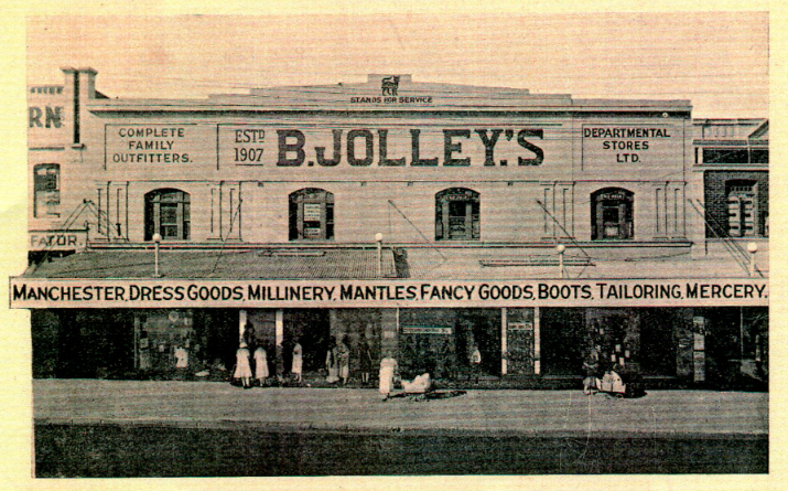
Jolley’s, Mk. II, 1927. Image courtesy B Jolley’s
Jolley was somehow able to stave off these attacks, maintaining a healthy profit throughout. Healthy enough to – you guessed it – expand yet again in 1933. Jolley had grown tired of paying council rates for his ever-expanding shop frontage on Forest Road, so in an ingenious move, he dug out an arcade of shops beneath his existing building, allowing for several new businesses without having to pay any excess rates. The move opened Hurstville’s eyes to the idea of an even greater shopping experience at the expense of cutting into the heart of Hurstville itself. But you can’t make an omelette without breaking some eggs, right?

Suck it, council. Image courtesy Hurstville Council
Jolley’s clever tactic paid off so well that he was able to retire in 1937, selling his 24-shop building and arcade to Woolworths. While at the time it was seen as a ‘local boy done good’ success story, today it’s easier to see the development as the beginning of a pattern; local businesses nurtured by the community being taken over by the big boys and allowed to rot. And oh, how the big boys were beginning to sit up and take notice of Hurstville successes.

Stepping out at Ashleys, 1954. Image courtesy Hurstville Council
Ashleys, a big city clothing store, swallowed its pride and expanded to the sticks of Hurstville in 1940 (the 1926 electrification of the Hurstville train line meant it was easier than ever to get to the retail paradise from the city should Mark Foy not satisfy your desires). When eponymous owner Ashley Buckingham died in 1962, Woolworths were there to buy up his stores. Uh-oh.

C. Diment Store, undated. Image courtesy Hurstville Council
Diments had done its dash by 1961, and the 40-year-old business was liquidated that year. The empty store, on the corner of Forest Road and what is now Diments Way, was bought by Coles. Double uh-oh.
Perhaps the biggest boy to observe what was happening in Hurstville was Grace Bros., which was arguably the biggest department store chain in Sydney at that time. In a show of true spite, and indicative of just how worried they were by this commercial boom they weren’t getting a piece of, Grace Bros. schemed to sap Hurstville’s custom by buying up a disused golf course in a nearby suburb. It was far enough away to appear innocuous, but the intent was clear.

The three Bs. Leader, October 6 1965
When Roselands Shopping Centre opened on the site in October 1965, it was only the biggest shopping centre in the southern hemisphere. To top things off, the beating heart of this beast was – yep – a giant Grace Bros. department store. You hear that, Hurstville? Oh, does Barter’s have a rain-themed water feature? Does Jolley’s Arcade have a cinema? I didn’t think so. Roselands has parking space for 3500 cars, what have you got?

Council Car Park, Crofts Ave & Cross Street, 1976. Image courtesy Hurstville Council.
Ooh, I’m shaking!
Hurstville’s commercial sector was starting to feel the heat. No, Roselands didn’t have a train station nearby, but who cared when it had that much parking space? Could Barter’s three storeys really compare to the 30 acres occupied by Roselands’ 80 stores? No. No, they couldn’t. With Miranda Fair having opened the year before, Hurstville found itself besieged on two fronts, and immediately began taking stock of its assets and liabilities. Coles Variety and Woolworths just weren’t cutting the mustard. The train station was no longer pulling its weight…weight…wait a minute…
In 1956, a cake shop owner at Wynyard Station lodged an unusual application with Hurstville Council. Inspired by the way shops sat above Wynyard’s train line, he proposed an five-storey development above Hurstville Station. Flush with cash from years of financial prosperity, council approved the plan. The Railways Department approved the plan. Kogarah Council, which had jurisdiction over the Ormonde Parade side of the train station, approved the plan. With all this approval, what could go wrong?

More like Blows. Image courtesy Hurstville Council
Construction of the Bowes Supercentre began in 1957 by Bowes Corporation, but was pipped at the post by that year’s opening of the Top Ryde Shopping Centre, the first American-style retail hub to open in Sydney. Plans for the Super Centre, already changed from five storeys to eight storeys during development, were altered again, with final plans blowing up to ten storeys. And parking? You’d better believe it:

Leader, August 26 1959
But Bowes was more adept at making increasingly outlandish promises (‘LUXURY HOTEL TO STRADDLE RAIL LINES’ read one headline) than he was at construction, which ground to a halt in 1959, the same year two former delicatessen owners opened a small shopping centre, ‘Westfield Place’, at Blacktown.

No shit. Express, August 30 1961
In 1961, the project, now known as the Hurstville Super Centre, was taken over by W H Duffy, who projected a completion date of late 1962. The Supercentre became the object of special interest of both Hurstville Mayor G W “Snowy” Hill and the Federal Transport Minister John McMahon, even as setback after setback stalled construction.

Ominous, isn’t it? Image courtesy Hurstville Council.
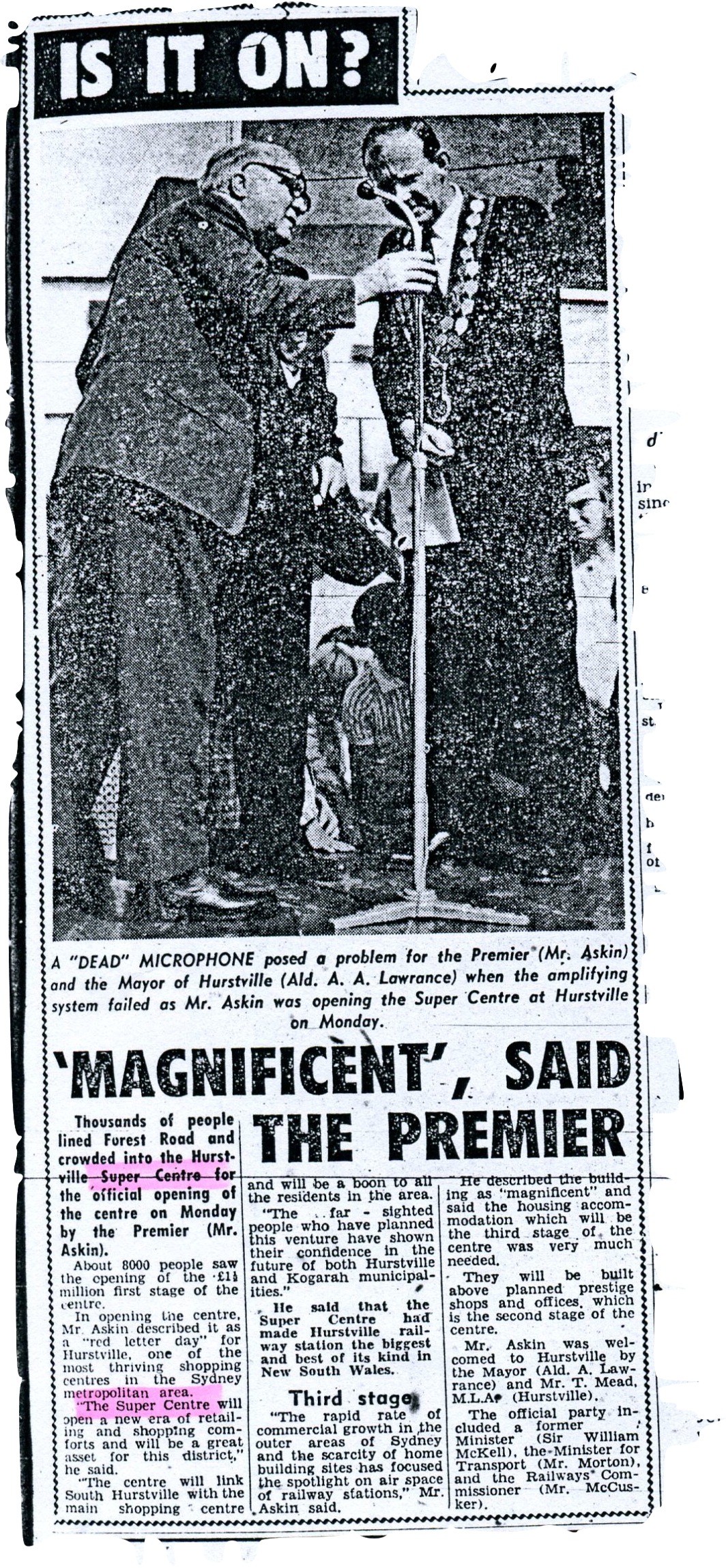
I hope not. Leader, September 15 1963
By the time of the Hurstville Super Centre’s grand opening in September 1965, only the first stage had been completed and Roselands was only a month from opening. Even worse, attendees who could get a park then had to endure an appearance by Premier Robert “Don’t call me Robin” Askin among others:

Oh…goody.
In the same year, Transport Minister McMahon lost his position following election defeat, and was criticised by the Opposition for a “lack of vision in providing transport infrastructure”. Even Snowy Hill was no longer mayor by the time it opened. Am I calling the Super Centre a total failure that stained the character and reputation of all involved? Yes.
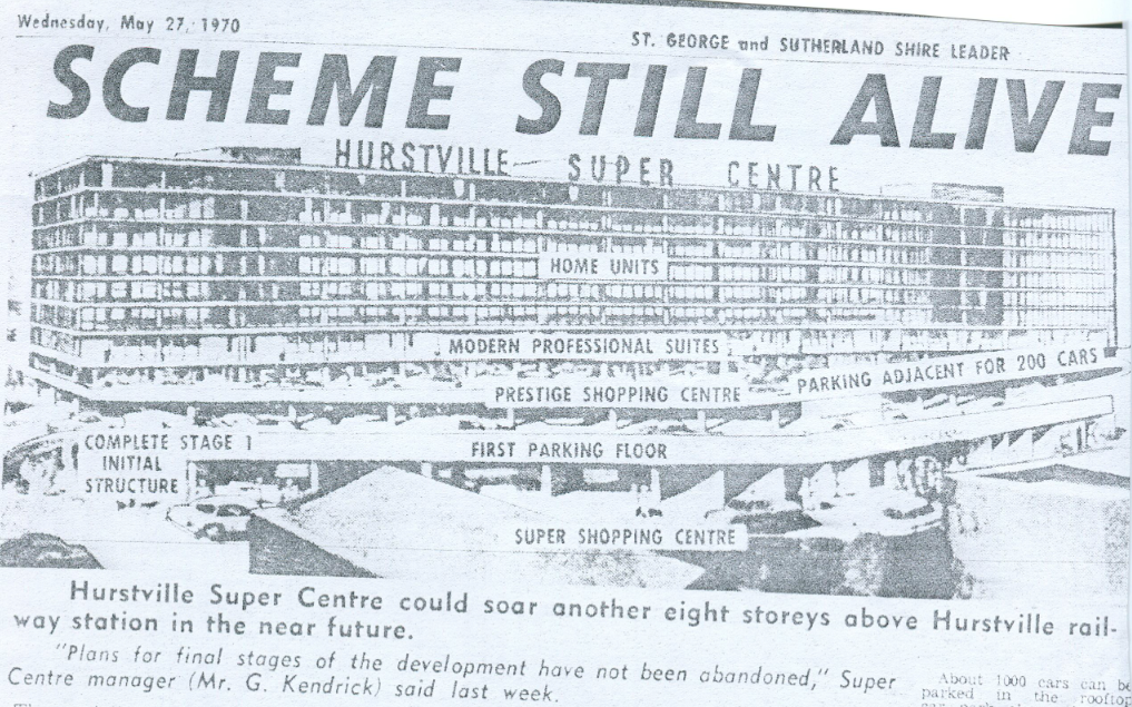
Interest still dead. Leader, May 27 1970
Throughout the late 60s and early 70s, empty promises were made to finish the Centre and bring it up to speed with the original vision, as if anyone was hanging out for that to happen. It was the modern age, no one relied on trains anymore. Department stores and giant shopping centres were a thing of the past in the city, and Roselands and Miranda (purchased by Westfield in 1969) were only quick drives away.
Away…from Hurstville. It seemed that despite that initial promise, no one had the vision to truly exploit Hurstville to the full extent of its commercial potential. Of the giants of the 20s, only Barter’s was still around (I guess that horseshoe worked), and even it had been overshadowed (literally) by the disastrous Super Centre. With no money coming in, council was sweating. Retailers were coasting on fumes. The swamp suddenly seemed thicker than ever.
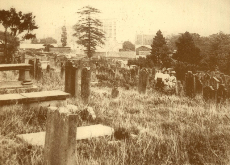
Devonshire Street Cemetery/Central Station – Sydney, NSW
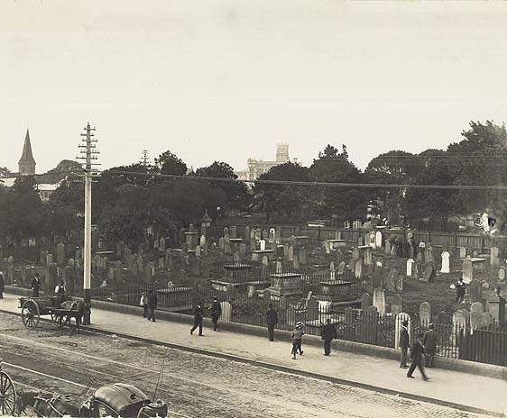
Devonshire Street Cemetery, 1901. Image courtesy State Records NSW
“I once walked through the burial grounds on the Surry Hills, in the commencement of Spring, just as the flowers were beginning to bloom forth in all their beauty…”
Bridget Flood was in the same situation too many of us have found ourselves in all too often: stranded at Sydney’s Central train station, hopelessly late. The big difference is that she was waiting there for over 60 years.
As we’ve previously learned, 1820 was a good year to die in Sydney. Rather than ending up beneath the public piss-pot that was once the colony’s first burial ground, you could find yourself in a brand new plot freshly dug at the just-consecrated Devonshire Street Cemetery.
Yes, that Devonshire Street.

Location, location, location. South Sydney plan, 1842. Image courtesy K Johnson and M Sainty.
Chosen for its abundance of space and central (heh) location, the area bordered by Elizabeth and Devonshire streets was chosen to replace the Old Burial Ground as Sydney’s premier final resting place. Quartermaster Hugh McDonald, 40, was the first lucky stiff to be buried there following his death in 1819. Long waiting lists…so Sydney so chic.
“It was early in the morning when I commenced rambling amongst the tombs, the dew had not yet been dissipated by the genial rays of the invigorating luminary, and the cool fragrance of the atmosphere had not yet given way to the noon-day heat…”
Bridget Flood died in October 1836 at the age of 49 and, like virtually all deaths in Sydney at the time, was interred at the Devonshire Street site. Quoth her headstone:
“Pain was my potion
Physic was my food
Groans were my devotion
Drugs did me no good
Christ was my physician
Knew what way was best
To ease me of my pain
He took my soul to rest.”
They don’t write ’em like that anymore. And rest she did, as did all those buried at Devonshire Street Cemetery well past its 1867 closure.

Go home, we’re full. Devonshire Street Cemetery, 1901. Image courtesy RAHS.
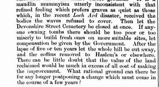
Although steadily employed by the city’s dead between 1820 and 1866, the nail in the coffin (heh heh) for the cemetery was the latter year’s introduction of the Sydney Burial Grounds Act (NSW), which prohibited burials “within the city of Sydney from 1 January 1867, with the exception that persons with exclusive rights of burial at that date could still be buried on application to the Colonial Secretary who needed to be satisfied that ‘the exercise of such right will not be injurious to health’“. Phew. Just tie some rocks to me and throw me in the harbour!

Devonshire Street Cemetery, 1901. Image courtesy Royal Australian Historical Society.
You’d think this act would be in anticipation of some kind of grand plan for the burial ground, but no. With the exception of infrequent additions to family plots as outlined by the overly wordy act (and even these ceased in 1888), Devonshire Street was largely ignored by the growing city while new sites like Waverley Cemetery and the Rookwood Necropolis served the public’s burial needs.

Prince Alfred Park’s Exhibition Building looms large. Devonshire Street Cemetery, 1901. Image courtesy Royal Australian Historical Society.
By 1900, its advanced state of neglect and decay reflected its residents and disturbed the public:

Illustrated Sydney News, 1878.
…although it wasn’t all bad:

SMH, January 26 1878.
“In short, it was exactly such an hour as an imaginative or sensitive being would delight to rove about, and lose himself in the regions of fancy…”
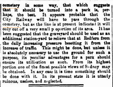
It wasn’t long before some of the more opportunistic voices began to speak out about the the site’s real estate value:
Illustrated Sydney News, 1878.
And as early as 1888 there were rumblings about how best to use the land:
SMH, March 3 1888.
It made sense, given that Central Station’s predecessor, ‘Sydney Station’, lay opposite the cemetery along Devonshire Street.
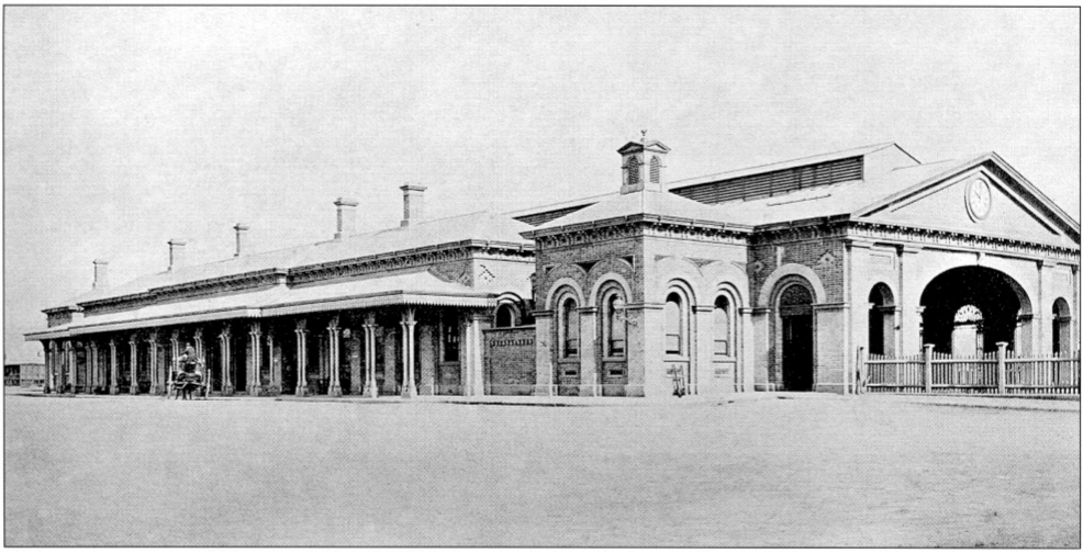
Sydney Station, the forerunner of Central Station, 1874. Image courtesy ARHS Rail Resource Centre.
Since 1884, Sydney’s existing rail network had been under the stress of increasing traffic and a limited reach (sounds familiar, doesn’t it?). Sydney Station was constantly receiving upgrades and additional platforms, culminating in a messy setup of 13 train platforms and numerous tram sheds (sounds familiar, doesn’t it?). The city’s railway commissioners initially struggled to decide upon a plan for the future which would provide Sydney with a central hub expansive enough to extend the rail network to the suburbs (sounds- never mind).

The planned terminus for Hyde Park. Image courtesy RailCorp.
An 1897 royal commission proposed the resumption of Hyde Park for use as the central terminal and, to counter the public outrage over the loss of parkland, the Devonshire Street Cemetery would be converted into a park. For a time this plan seemed to be a go until the unexpected death of Railway Commissioner E M G Eddy (of Eddy Avenue fame) that same year. This forced a literal return to the drawing board, where it was decided that it was probably easier to resume just one giant park instead of two. Nice thinking, guys.

The new plan. Image courtesy Public Works Committee.

The undertakers size up the corpse, December 1900. Image courtesy State Records NSW.
In January 1901, the Department of Public Works served notice that anyone with relatives buried at Devonshire Street were to front up and make known their desire to have the remains reinterred at other cemeteries by train, with the cost to be borne by the NSW Government. These days, they’d just tell you to bring a shovel.

Devonshire Street Cemetery, 1901. Image courtesy RAHS.
Unfortunately, these relatives were given a strict time limit of two months to act, and by the end of that time, only 8,460 bodies had been claimed (not among these was Eddy, who had been buried at Waverley following his death). This left 30,000 remains unclaimed, most of which were transferred to other cemeteries anyway, but due to the rushed nature of construction and given they did such a bang-up job the last time, it’s safe to say there are more than a few commuters at Central waiting for a train that will never come.
With that many bodies to exhume, you can imagine just how many creepy stories must have come out of the venture. Here’s just one:
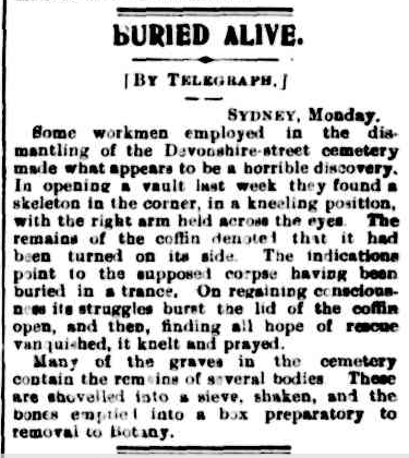
Barrier Miner, July 29 1901.
The reason for the rush was that Melbourne had started work on their Central equivalent, Flinders Street Station, that same year. Sydney was determined to get the drop on Melbourne this time, as Flinders predecessor ‘Melbourne Terminus’ had been Australia’s first city railway station back in 1854, pipping Sydney by a year. The Devonshire Cemetery site had been completely cleared by 1902, and stage one of Central’s construction, which aimed to have the station operational, was completed in 1906. On opening day, the new station featured…13 platforms. Despite being twice the size of its predecessor, this was no improvement, and did nothing to alleviate Sydney’s transport woes (but then again, what ever does?).

Central Station, 1906. Image courtesy State Records NSW.
“I directed my footsteps to a cluster of tombs on an eminence, which was thickly covered with green and blooming geraniums…”
But the unexpected fruit of the Department of Public Works’ labour was the emergence of commercial activity in the areas surrounding the new station. Its proximity to the city made department store shopping for those out in the sticks a treat, with Grace Bros., Marcus Clark, Anthony Hordern, Bon Marche and Mark Foy all within walking distance of Central by 1908. The Tivoli and Capitol theatres became entertainment meccas for those starved of entertainment in the ‘burbs.
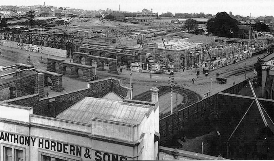
Anthony Hordern awaits new business during Central’s construction, April 1903. Image courtesy ARHS Rail Resource Centre.
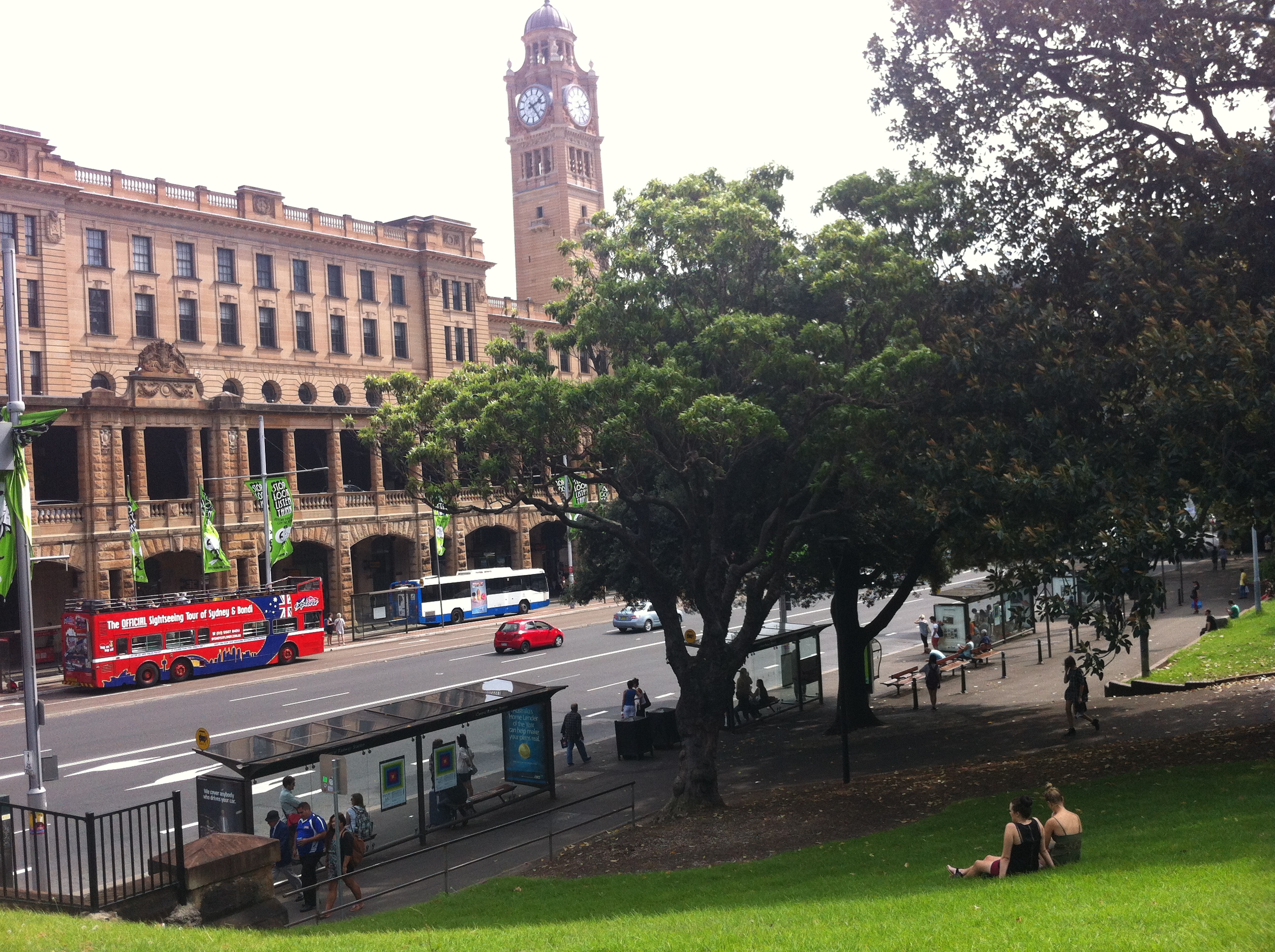
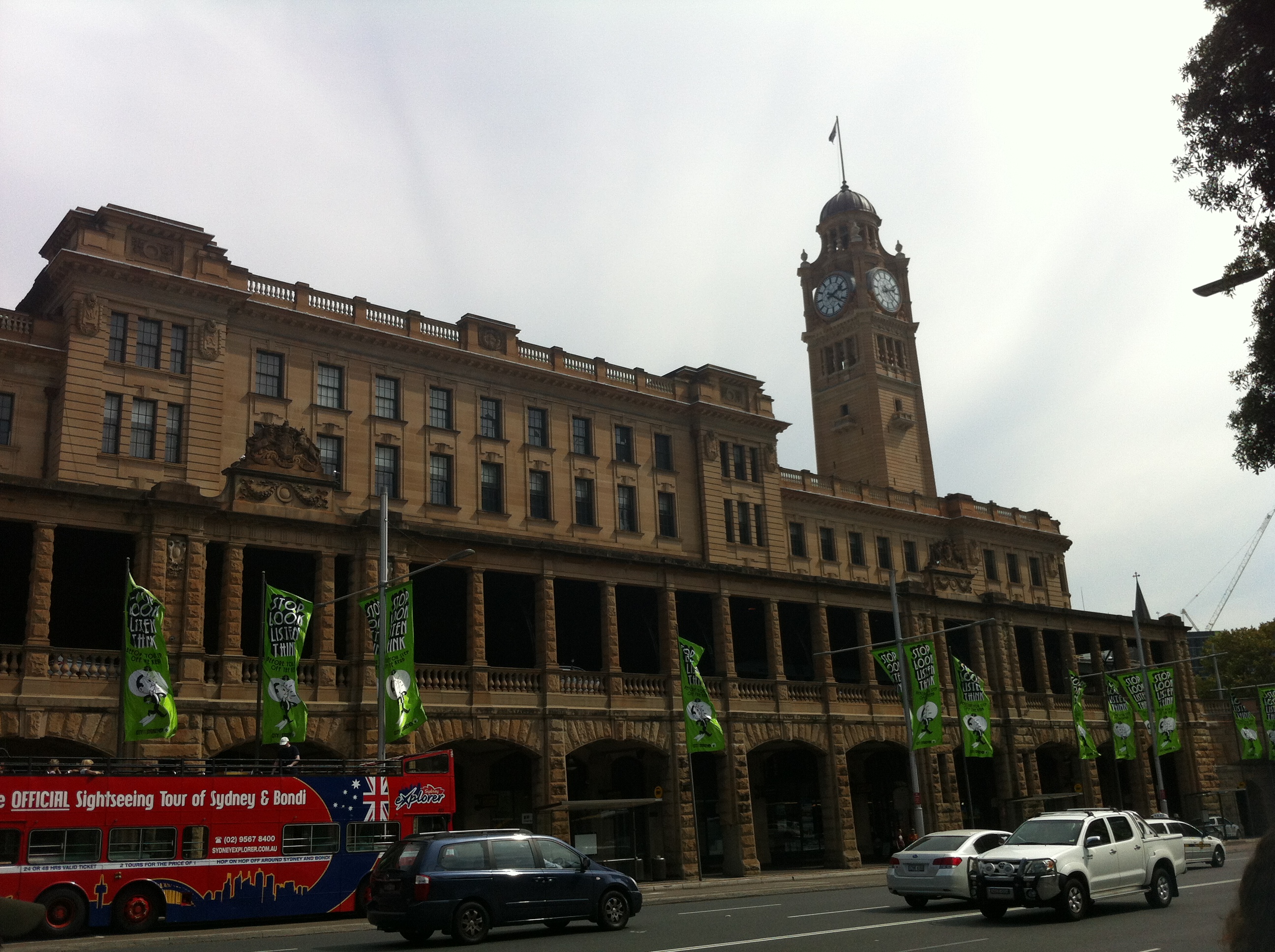
The station itself was hardly the thing of beauty its early designs had suggested, with the rushed development cycle omitting many intended features – least of all Central’s iconic clock tower, which wasn’t completed until 1924.

Always on time: Central Station’s clock tower completed, 1924. Image courtesy State Records NSW.
The construction wasn’t just focused on making sure the station would be operational before Flinders Street, though; there was particular care taken to ensure no trace of the Devonshire Street Cemetery remained, going so far as to completely eradicate Devonshire Street west of its intersection with Elizabeth. Other structures that once stood on the land now occupied by Central and its surrounds – the Belmore Police Barracks, the Benevolent Asylum, the womens refuge – have similarly been lost to time.
“I at first almost forgot the ravages of the grave in contemplating the enchanting appearance of the place.” – James Martin, 1838.
Today, nothing remains to remind commuters of the morbid nature of Central’s past. The cemetery itself was largely situated underneath today’s platforms:

Devonshire Street Tunnel, once Devonshire Street, runs directly underneath the path once carved between the cemetery and Sydney Station, depositing Surry Hills pedestrians into Railway Square amid el-cheapo bargain shops, youth hostels and fast food joints.

Looking east toward Devonshire Street, 2013.

Looking west toward Railway Square, 2013.
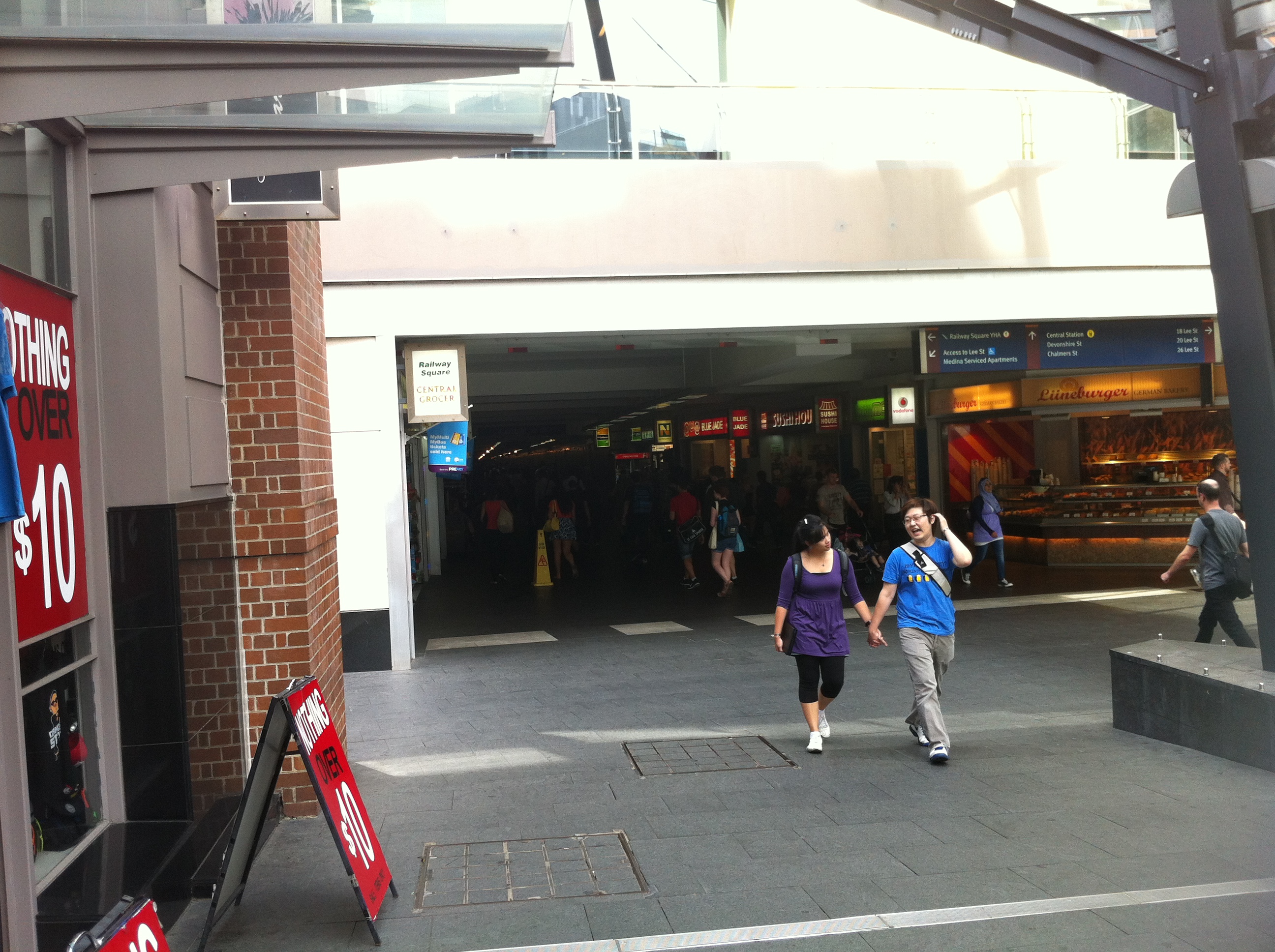
Emerging into Railway Square, 2013.
Also in Railway Square is a series of plaques designed to inform passers-by on the history of Central Station and railway in NSW. The cemetery is mentioned in passing (heh).
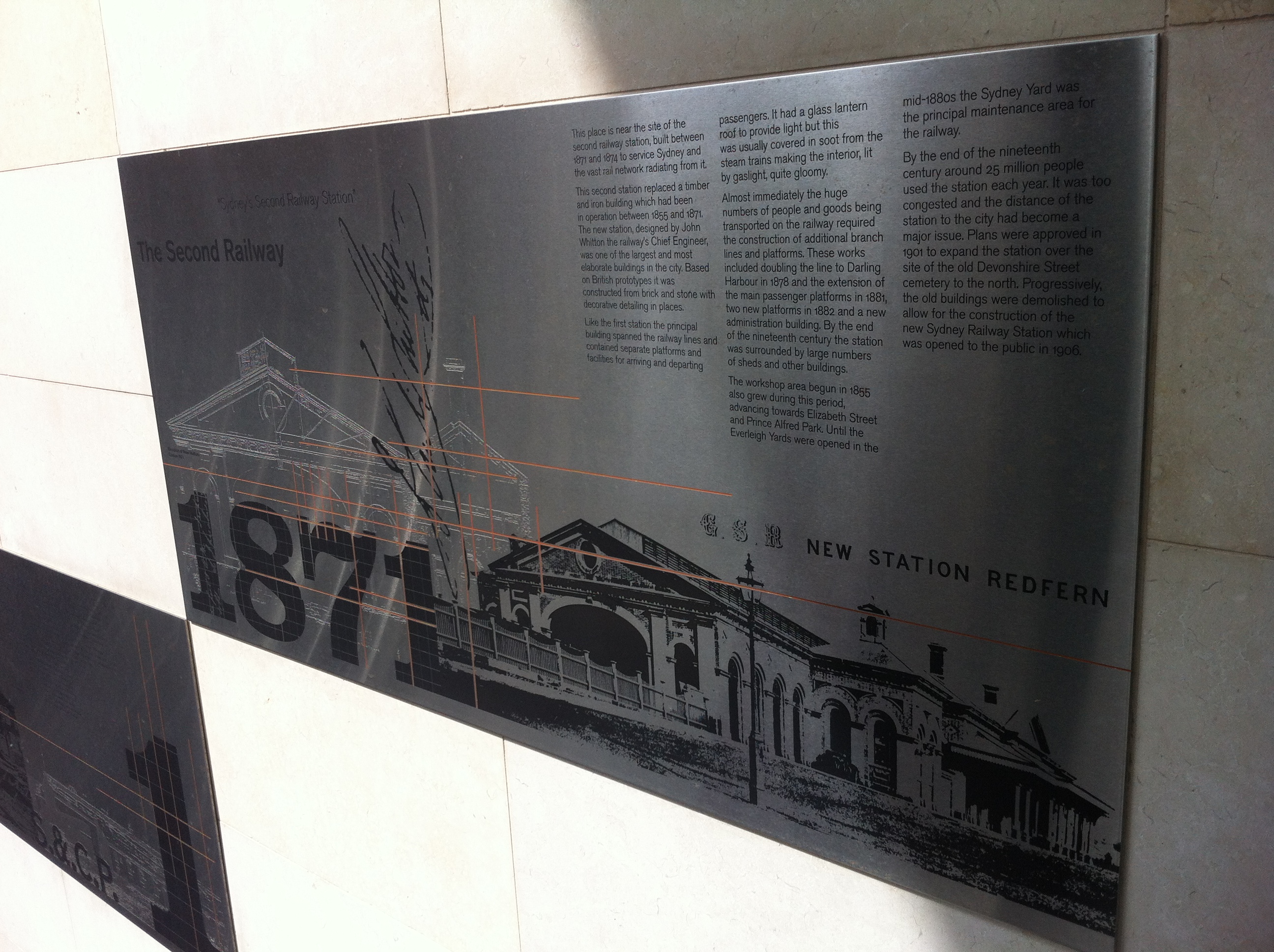
Revisionist history part one, 2013.

Revisionist history part two, 2013.

Revisionist history part three, 2013.
Belmore Park, 2013.
The uneven terrain of Belmore Park perhaps provides us with the nearest idea of what the Devonshire Street Cemetery was like in its natural state as is possible today, although even it has a sordid and ugly past as an open gutter for the refuse of the nearby Belmore Produce Markets and Paddys Markets.

Belmore Park, 2013.

Gateway to limbo. Camperdown Cemetery, 2013.
Rookwood Necropolis, Eastern Suburbs Memorial Park, Woronora Cemetery and many others were the recipients of many of the (not so) permanent residents of Devonshire Street, but none feature as striking and immediate a memorial as the tiny, eerie Camperdown Memorial Rest Park. Here, amongst the sombre atmosphere of tombstones and gloomy, gnarled trees lie what were once the gate posts met by visitors to Devonshire Street. These were removed along with everything else in 1901, and mysteriously disappeared from existence until 1946, when…

SMH, October 9 1946.

It’s kinda graffiti. Camperdown Cemetery, 2012.
It seems almost sacrilegious that thousands of commuters tread all over this once-consecrated ground every day without any kind of marker to signify what was and who mattered, even if it was nearly 200 years ago. C’mon, NSW Government! They’re even in the right electorate! Meanwhile, to the 30,000 Sydneysiders scattered to the four corners by the winds of progress, the term ‘final resting place’ has little meaning.
Finally, here’s a fascinating account of a visit to Devonshire Street Cemetery just as its demolition was beginning. It originally appeared in the Clarence and Richmond Examiner, October 1 1901.


Ghouls, not girls. Devonshire Street Cemetery, 1901. Image courtesy RAHS.
Past/Lives Flashback #6: Regent Street Station – Chippendale, NSW
Original article: Mortuary Station/Regent Street Station – Chippendale, NSW
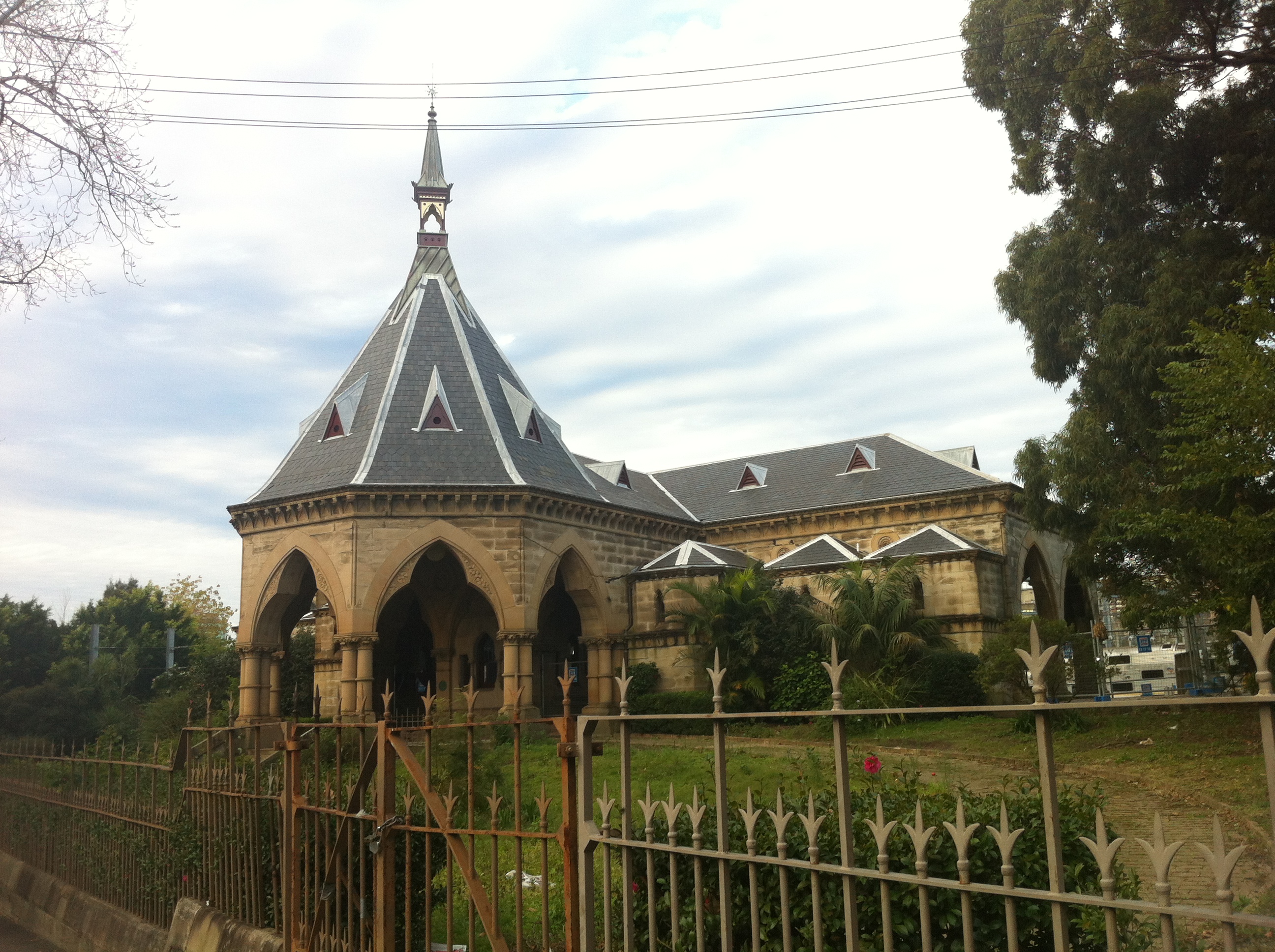
When you’re a 144-year-old building custom built for a purpose long redundant, excitement comes in fits and starts. A renovation here, a graffiti attack there. Occasionally you’ll have a tour group come through, but with today’s concerns, even that’s a rare treat.
And so goes the continued existence of Regent Street’s Mortuary train station.

Continually hogging the city’s rail refurbishment efforts (c’mon, Central needs some attention! It’s a dive), ‘Ol’ Morty’ sits where it’s always sat, a stranger to change and a fully functioning time warp. If you want to go and see it, it’s a safe bet to put it at the bottom of your ‘To Do’ list – this place will likely outlive you.
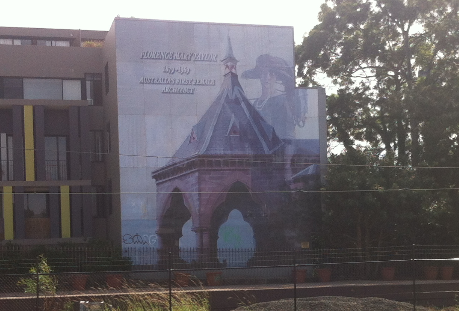
So with that in mind, let’s take a look at the curious mural that stands beside the station facing east. I mentioned this last time, and it continues to baffle me.
Florence Mary Taylor arrived in Sydney in 1884. Her father worked for the sewerage division of the Department of Public Works, and she would assist him in his work. When he died in 1899, Florence studied architecture and became a draftsman, going on to co-found the Town Planning Association of NSW in 1913 and joining the Institute of Architects in 1920. As the mural itself says, she was Australia’s first female architect.
When her husband George Taylor died in 1928, Florence continued to edit and publish three of their eleven engineering journals. She died at Potts Point in 1969, leaving behind a legacy of achievements (including becoming the first Australian woman to fly in 1909) that did much to further the public acceptance of women in industry.
Which is all fine – but I’m still not sure what she has to do with the Mortuary Station, which was completed ten years before her birth. As I’ve mentioned, the Regent Street station and its receiving end were designed by colonial architect James Barnet.
Still, using the ever eye-catching station to highlight Taylor and her achievements isn’t a bad thing at all, even if her ideas are more ingrained in Sydney’s layout than seems obvious. Throughout her career, Taylor was an advocate of, among other things, a harbour tunnel crossing, a distributor freeway in the Eastern Suburbs, and somewhat less popularly, the demolition of Hyde Park Barracks. Maybe that’s why there’s no mural of her there.
Past/Lives Flashback #8: Sydney Olympic Park – Homebush, NSW
Original article: NSW State Abattoirs/Sydney Olympic Park – Homebush, NSW
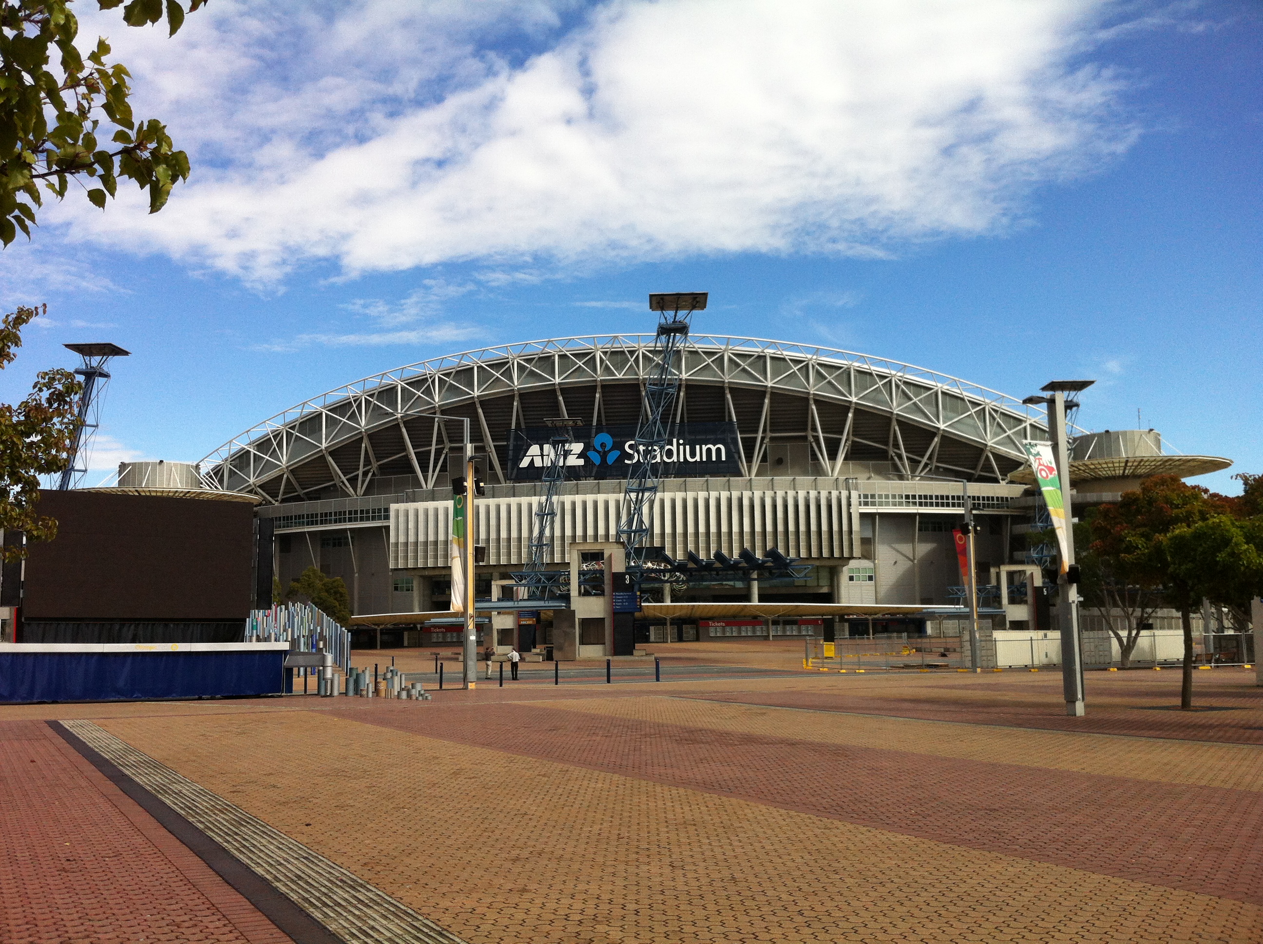 It’s hard to believe it’s been a year since I last visited this place. The blood-soaked history of Sydney Olympic Park is perhaps the most heavily researched article on Past/Lives, yet all that knowledge is quick to fall away when you’re actually standing on site, inhabiting the space where it all went down. The post-Easter Show cleanup only serves to strip back the gaudy decorations designed to distract from the past, leaving today’s visitors with one of two visions: the glorious Olympics, or the violent abattoirs.
Apart from the hubbub surrounding the Easter Show, change visits the Olympic zone about as often as I do (read: not much). The stadium seems to have settled on ANZ as its name for the time being, just as the arena’s heart still belongs to Allphones. During my refresher course on the ins and outs of the Olympic era of the site’s history, I laughed when I learned the arena’s actual name is the ‘Sydney Super Dome’. For the first time ever, Allphones sounds comparatively low-key.
So since change is such a stranger here, it’s going to be more beneficial to take a look at some of the landmarks around the Olympic site that betray its brutal past. We didn’t touch on too many last time, with the Abattoir Heritage Precinct being the natural focus. First up is Olympic Park station, the last stop of the train line which delivers thousands of Easter Show-goers to the park each year…

Abattoir platform, 1982. Image courtesy Graeme Skeet/NSWrail.net
…just as it delivered hundreds of thousands of animals to their deaths each year for decades, some as recently as 25 years ago. Granted, it isn’t the exact same station (although if it was, abattoir workers would have enjoyed the most stylish station in Sydney), but its location is approximate to the original. A complete train line (with stations opening from 1915) served the abattoir and the nearby brickworks, with country trains deviating from the existing rail network at Lidcombe and Flemington to deposit country animals to the abattoir. Employees could catch their own trains from a small platform at the end of Pippita Street, Lidcombe.
As the abattoir declined, the need for employees did so as well, and in 1984 the abattoir line was closed, with the facility itself closing in 1988. The entire Homebush Salesyard Loop, on which the Olympic Park line is based, was closed in 1991. In 1996, the Pippita Street station became the last of the abattoir stations to be demolished, and interestingly, the street itself was absorbed into the huge Dairy Farmers site nearby (now, why do you think that’s there?). The brand-spanking-new Olympic Park loop line opened in 1998, with most of the Homebush Salesyard Loop repurposed to be a part of it.
Now, since that was a little…dry, let’s get wet.

The Sydney Olympic Park Aquatic Centre was the first part of Olympic Park to be constructed following the closure of the abattoir, unless you count Bicentennial Park, which opened in 1988. The Aquatic Centre opened in 1994, with the rest of the park completed by 1996. As such, the Aquatic Centre is the ‘middle child’ of the Olympic Park, with a design sensibility halfway between Bicentennial Park and the stadiums that followed. It’s a strange beast, and one made even stranger by my near-absolute certainty that when it first opened, its entrance was in fact this:
 Sometime in 1995, I attended a birthday party at the exciting new Aquatic Centre, which was rumoured on the playground to have a whirlpool and slides. I don’t remember any slides, but I do have a distinct memory of our posse leaving behind a rubber WWF wrestler toy, tossed high up in those bushes on the left in a fit of excitement…while we were hanging around the entrance. Does the Iron Sheik still reside in those bushes today, subsisting on a diet of ants, rainwater and the occasional small bird? Nearly 20 years later, I still wasn’t game enough to climb up and find out. But I did go in for a closer look…

The appearance of those bolt marks, where the original entry sign was probably attached, seems to validate my memory of this being the main entrance. The doors underneath now serve as an emergency exit. If anyone can shed some light on this mystery, drop a line in the comments below. My theory is that when the Aquatic Centre opened, the entrance was here because it faced away from the abattoir site (and at the time, a huge construction site), but when the rest of the park was completed, the entrance was moved around to the opposite end of the facility, a spot which pretty much faces the Abattoir Heritage Precinct (and everything else, in keeping with the Olympic spirit of inclusion and togetherness). Today’s entrance looks a lot more ‘Olympic’ anyway, so it was probably a change for the best. Still…
 Our last stop is just down the road from the Aquatic Centre. Back in the 70s and 80s, Swire (then Woodmasons Cold Storage) would have been one of the places to store the freshly processed animal carcasses on ice before being shipped to the nearby butcheries and markets. For a cold storage facility (and for Dairy Farmers), this was the perfect location…when the abattoir was there. How it’s still able to do business is a stone cold mystery, but I guess that’s why they’re no longer Woodmasons.
See you next time, when we’ll attempt to go for a drive…
F4 Expressway/SWR Western Motorway/M4 Freeway – Concord, NSW

Image courtesy RTA Magazine/OzRoads
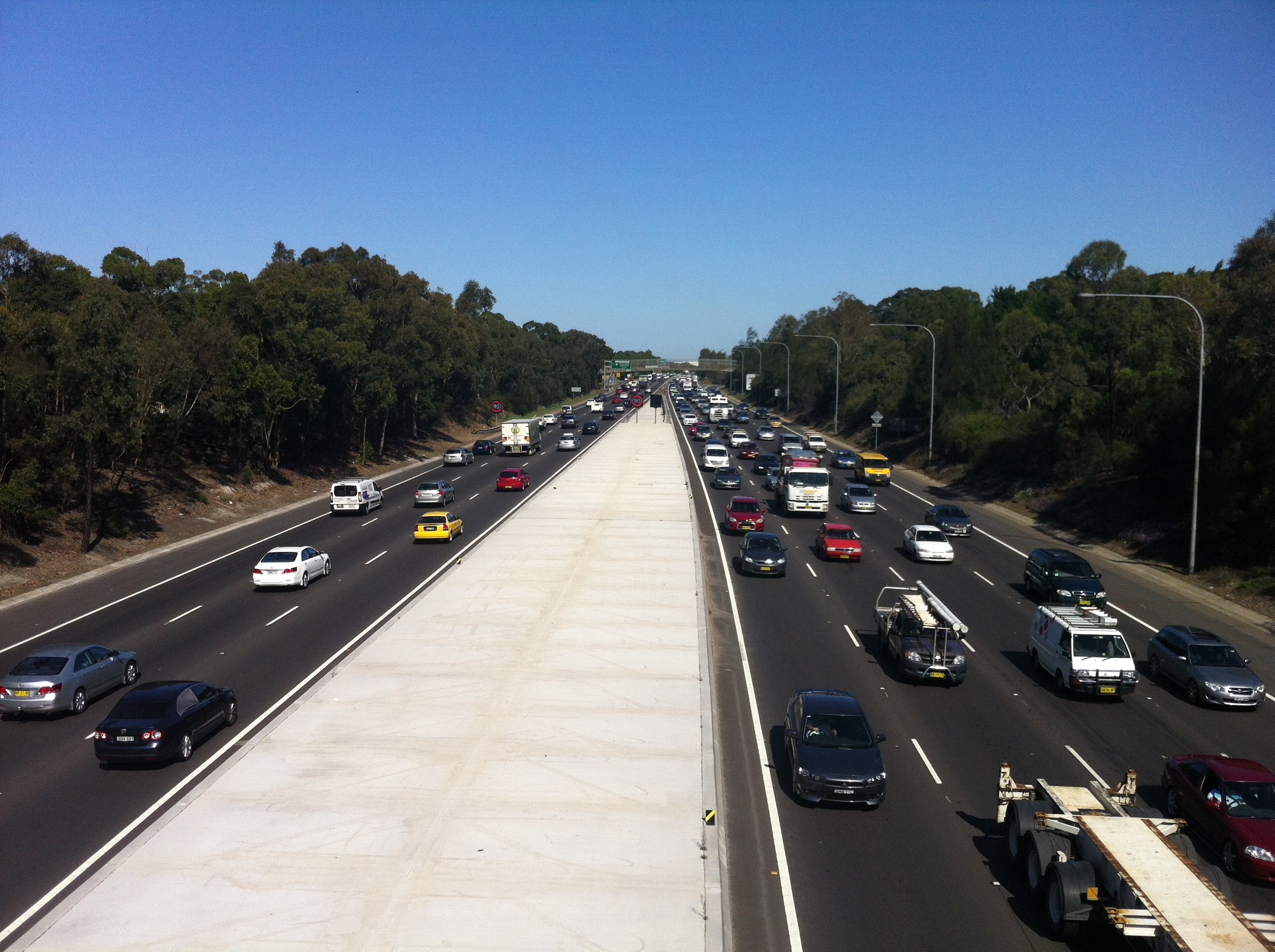
As promised, we’re now going to plunge into the half-assed history of the M4 freeway’s eastern terminus. I’m imagining you’re already as joyful and excited as those people on the bridge above, but don’t peak early – we’ll dig up some good stuff. If I do a half-assed job, consider it an homage.
After World War II it became clear that Parramatta Road wasn’t going to cut it anymore as a way of getting people to and from the western suburbs of Sydney, which had exploded in terms of population. Of course, in those days, Leichhardt was a western suburb, but you get the idea. In 1947, the newly created County of Cumberland Planning Scheme identified a possible route for an expressway which would connect Glebe to the Great Western Highway at Lapstone (of the treacherous Lapstone Incline fame). In reliably speedy NSW Government fashion, the corridor of land was reserved in 1951.
As an aside, I’d just like to shine the spotlight on my ignorance: I had no idea what Cumberland County was, and I was surprised to learn that not only was it created by Governor Arthur Phillip in 1789 and encompasses most of the Sydney metro area, but that there are 141 counties in New South Wales. A shadowy cabal of local government councillors would elect the Cumberland County Council, which then had a powerful influence over town planning in metro Sydney. Spooky stuff.
Anyway, the M4’s construction started backwards, with the first stage completed at Emu Plains in the late 60s. The late 60s. After the plan was formed in 1947. Yeah.
As the freeway crept closer and closer to Sydney, the pocket of land set aside to relieve the ever-building traffic pressure in the city waited patiently for its turn.
It’s still waiting.

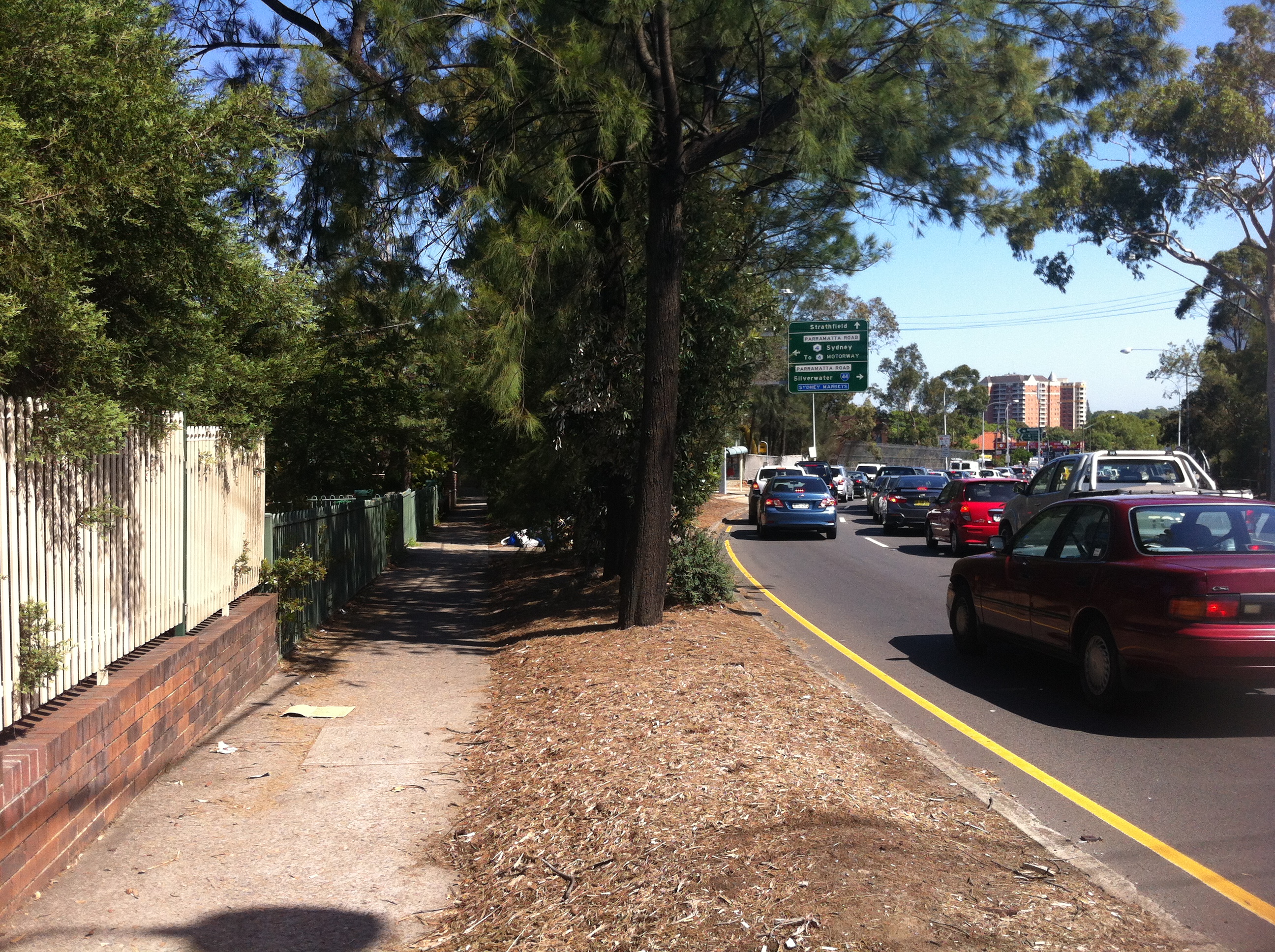
This is the start and end of the M4, and as close as the freeway gets to the city. Every day, traffic from the western suburbs and beyond is ripped from the (theoretically) 90km+ flow into the waiting 60km arms of Parramatta Road, Concord. Citybound motorists must then contend with the stop/start rhythm of Sydney’s oldest road and a new nightmare: traffic lights. If this sounds awkward, it’s because it is. And it looks even more awkward:

Image courtesy Google Maps
In 1976, the F4 freeway (as it was then known) was all set to drill right through the inner west and end up at its intended starting point in the city, Glebe. But Glebians (?) had had over 20 years to prepare their outrage and protests, so the Department of Main Roads found itself staring down a pissed off neighbourhood that feared the freeway would shatter its layout and atmosphere. In what would be the first of many such moves for the NSW Government, it backed down. The Concord to Glebe section of the freeway was abandoned, and a backup plan was hastily slapped together.
The F4 prepares to cross Silverwater Road, 1979. Courtesy Main Roads Journal/OzRoads
Also hastily slapped together were the physical components of the eventual fix, which was to spill the M4 onto Parramatta Road and hope that it all worked fine. In 1982, more than 30 years after planning had commenced, the section of the M4 between Concord and Auburn was opened to traffic, despite the next section between Auburn and Granville not being complete.

Concord reforged: the F4 ends, 1985. Courtesy Main Roads Journal/OzRoads
What a shemozzle! Although the rest of the freeway west of Concord was eventually completed (pretty much), it’s the section between Concord and Auburn that remains the most interesting and telling of the struggles that went into constructing it. With the O’Farrell Government now gearing up to deliver on its promise to complete the M4 (via a tunnel system, natch), it’s as good a time as any to see what kind of stopgap measures we can look forward to.

Where the M4 itself joins Parramatta Road, it LITERALLY joins Parramatta Road in a series of glued on slabs of cement. It’s easy to see the difference in road material here..

…here…

…and here. This is because the entrance to the M4 as it is today was originally part of Concord Road, which was relocated a block to the west. Why? Bear with me…
When this section was completed in 1982, the one-way Sydney Street was the only way off the M4. Traffic would then spill into Concord Road, which at the time followed a different alignment…

…being this, the current end of the M4. To accommodate more traffic, Concord Road was realigned to cross Parramatta Road instead of joining it.
Concord Road was extended towards Leicester Street on the other side of Parramatta Road, and the former curve was filled in by parkland and a bus stop:
So if you’ve ever wondered what this big bit of nothing was all about, that’s the story, although it could be argued that providing more access for buses adds to Parramatta Road’s problems, but that’s another story.

A tunnel was dug here between the M4 and Concord Road to form the overpass that exists there today, and to direct the traffic flow onto Parramatta Road. What was the fruit of all of this effort? One set of traffic lights is bypassed by eastbound traffic.

This restructure meant that Young Street, which in 1982 acted as the eastmost on-ramp for the M4, was cut in half by the new end of Concord Road. What was once one of the most important streets in Sydney now ends with a whimper:

…where once it would have joined the M4 it now provides access to a unit block’s carpark.
As mentioned, the other problem the M4 faced in 1982 was that it stopped at Silverwater. You could get on at Young Street, belt down the freeway at 90km/h in your Holden Monaro for about five minutes before being dumped back onto Parramatta Road, the defacto western expressway, at our old friend Melton Street.
Yes, this is the sight you would have faced exiting the M4 between 1982 and 1984, when the next segment was completed. You would have zoomed up past the school and the Melton Hotel, and then back onto Parramatta Road for the next million years if you were trying to get to Springwood. If we look a bit closer, we can see where the exit ramp used to be:

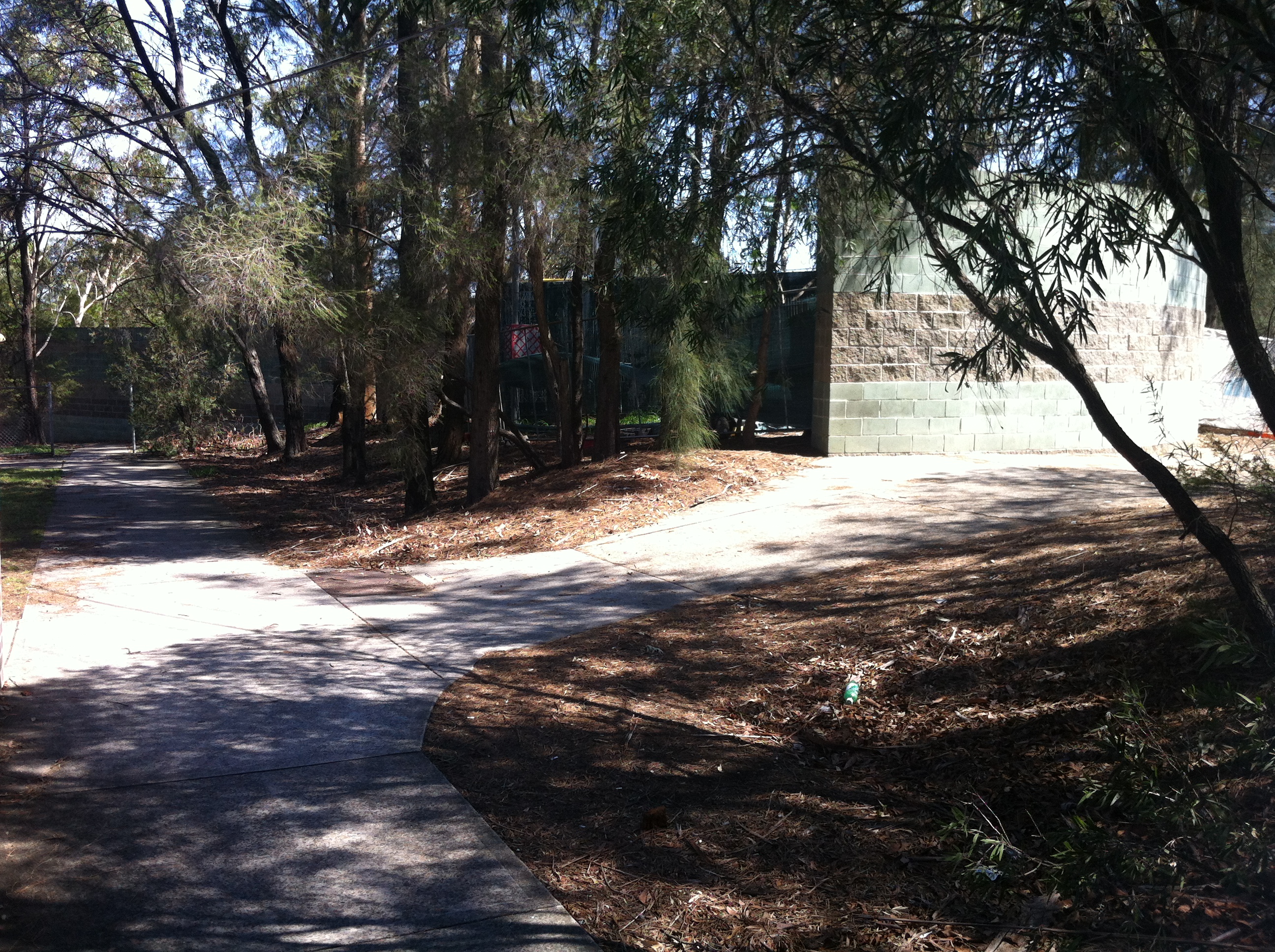
In the bushes between Adderley Street and the M4 you can see a clear path the motorists would have taken to rejoin Sydney traffic. I’m assuming the RTA has set this land aside for future widening of the freeway, as if that will ever happen, but in the meantime it gives us that vital link to the past. Once again, a seemingly insignificant little road like Melton Street actually did have a grander place in the scheme of things. Parramatta Road: where anything can happen.
Further up from Melton Street is the Silverwater mainstay Stubbs Street, as seen in the very first picture in this article. The M4 proceeds under the Stubbs Street overpass…
…which was completed in 1981 to mark the end of this section of the freeway.

Once the next section between here and Granville was completed in 1984, Melton Street was once again exclusive to pub patrons and parents dropping off their kids, while motorists were free to drive on to the west.
Or were they?

By 1989 only a small section of the M4 as we know it today was missing, and a private consortium, StateWideRoads, was contracted by an exhausted NSW Government to finish the job. As we all know, a grand don’t come for free, so by the time this missing link (and some hastily approved widening) was completed in 1992, someone had to pay.
That someone was you.

SWR tollbooths, 2007. Image courtesy someone who isn’t me.
It was determined that the section between James Ruse Drive at Granville and Stubbs Street, Silverwater was the section through which the majority of cars would pass, thus ensuring the shortest possible time for a toll to be in place. In May 1992, $1.50 was required to continue out to the western suburbs. By the time the toll was removed in February 2010, over $970 million had been paid to pass these booths.

Today, there’s little apart from the alignment of the lanes to suggest that the toll booths were ever there, but other remnants of the M4 project have left a more lasting mark all over Sydney. The freeway is back in the hands of the NSW Government, which is akin to returning an abused child to their abusive parent. As the battle to complete the M4’s route into the city rages on in state parliament, Federal Opposition Leader Tony Abbott has even expressed support for the completion should he win government at the next election. Thousands of motorists a day are still inconvenienced by the half-finished freeway. One accident on the M4 causes traffic chaos all over the city. The Eastern Suburbs are still effectively isolated from the rest of Sydney due to a lack of motorways….so I guess there are always upsides. There’s been talk of reinstating the toll to pay for what would by now be a very expensive couple of kilometres. In 1977, the projected cost of completing the M4 from Concord to Glebe as intended would have been $287m.
The M4 is only 46km long.
Maybe if it ever gets finished, it’ll be linked up to the Western Distributor so that it can actually start distributing people to the west instead of, you know, nowhere.
TRAFFIC STOPPING UPDATE: Thanks to Burwood Library’s archive of interesting old stuff, you can now enjoy this old pamphlet detailing the opening of TWO new segments of the F4 back in 1982. Even better is that this article’s diagrams illustrate the progress of the F4 almost as well as the above article. You all thought I was mad when I wrote this one, but who’s mad now?


