Where Are They Now? 2015 Edition
As the sun sets on another wonderful year of staring longingly back into the past and more often than not wondering “why?”, it’s time to turn our attention to some of the places previously featured on PLOTNF. In the twilight of 2015, this terrible trio (or terrific trio, if you work there :D) are of interest entirely because they’ve all lost reason for being interesting.
Yes, if they’d have made these changes from day one, we might never have known the surprisingly philanthropic tale of Australian Plastic Fabricators…
THEN
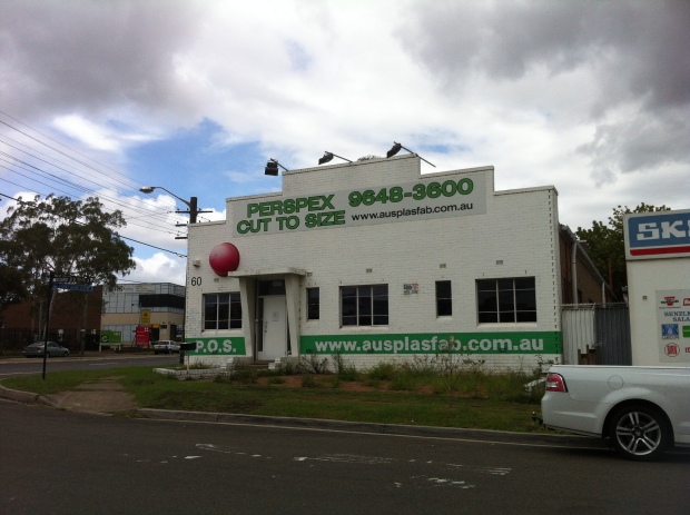
We were attracted by its charitable red nose, and certainly not by its colour scheme. Perhaps sensing this, the APF crew sent around a collection jar of their own and coughed up for a new coat of paint.
NOW
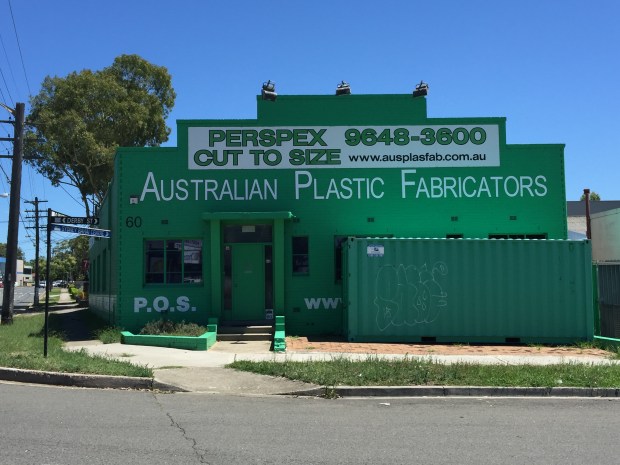
They’re really married to that colour pairing, aren’t they? I wonder how it went down as they rediscovered the red nose during the painting. Did someone recognise it? Was there anyone left from 1995’s management team to say “Oh, that bloody thing’s still up there”? Did anyone make a joke about the boss having a redder nose than the building? Only the building knows for sure, and walls can’t talk – especially when they’re covered in a new coat of paint.
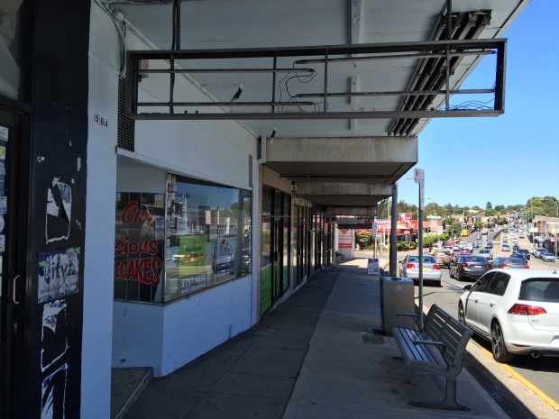
We might never have gone from A to…A with A Helen and her Pavalova Palalice…
THEN

Helen bought too many vowels.
NOW
For reasons we may never know, although perhaps tied to some kind of customer service trouble, Helen has decided to call it a day. Well, actually, if Helen was calling it, it’d be A A Day, wouldn’t it? Or A Aday. Or Daay. Hee hee, I could milk this all daay.
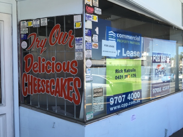
Props to you for finally showing some restraint, Helen, but alas, it’s too little too laate.
And perhaps saddest of all, we may never have known the story of the suburban movie house that became a…suburban movie house.
THEN
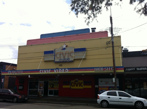
Formerly the Padstow Star, a cinema dating back to the early 1950s, Civic Padstow and its team of minimum wage teens serviced the entertainment needs of the area for over 30 years before finally shutting its doors last month.
NOW
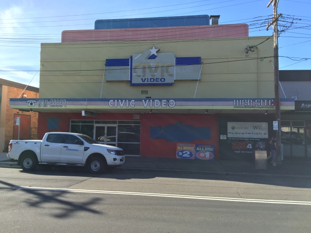
The closing down sale was so drastic that even the shelves were cleared out.
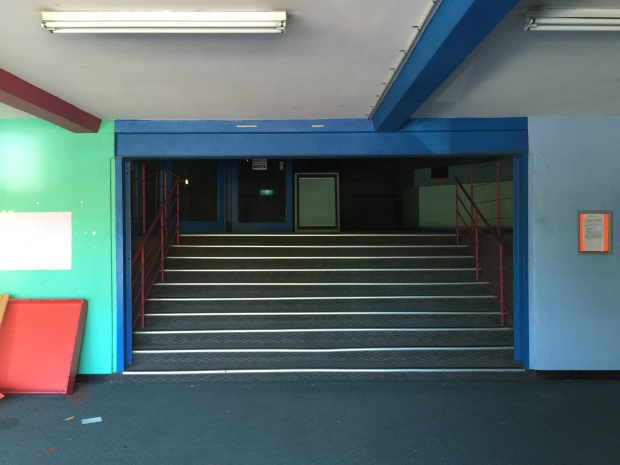
Seeing this sad, empty lobby makes you wonder about the thousands of people who would have made their way up those steps over the decades, eagerly anticipating a few hours lost in a celluloid world of fun and excitement. And now that feeling will never exist there again.

Put your hand up if you’re the reason they had to add those disclaimers down the bottom. C’mon, you know who you are. Oh yes? You? Congratulations, you’re an idiot.
The light’s off, the plug’s been pulled, the register’s empty and overdue fees will be waived.
Goodbye 2015, hello 2016 and all the wondrous stories of past livin’ ahead of us. Happy new year, folks.
Parramatta Road, 1982
Further to the recent F4 update (to the article, not to the actual road, what were you thinking? that’s just laughable), here’s another snippet from the same pamphlet giving us a rundown of the history of “the oldest road in Australia”, Parramatta Road, as seen from the vantage point of 1982.
For me, the highlights (emphasis mine) include:
“By 1806 the road was in such poor condition it was declared to be a danger to horses.”
Right, and by 2015, those horses still aren’t getting anywhere near it.
“For those evading the tolls penalties were severe, up to 3 years hard labour and public whipping!”
Any chance we could bring that back?
“The first Judge of the Supreme Court, Jeffrey Bent, was fined 40 shillings and recalled to England after repeatedly refusing to pay the toll and threatening to jail the tollkeeper.”
He was a judge, so no hard labour there of course, but where was his public whipping?
“In 1925…the section from Ashfield to Parramatta was noted as being far too narrow for the traffic using it.”
No need to update those notes, then.
“With the road physically incapable of being widened without enormous cost and commercial upheaval…”
Exactly what commercial upheaval are you worried about?
There’s plenty more good stuff in here, so have a gander, perhaps when you’re sitting around for long stretches of time, not going anywhere, maybe in the late afternoon. You know, one of those times.


Thanks to Burwood Library for the pamphlet.
Australian Plastic Fabricators – Silverwater, NSW
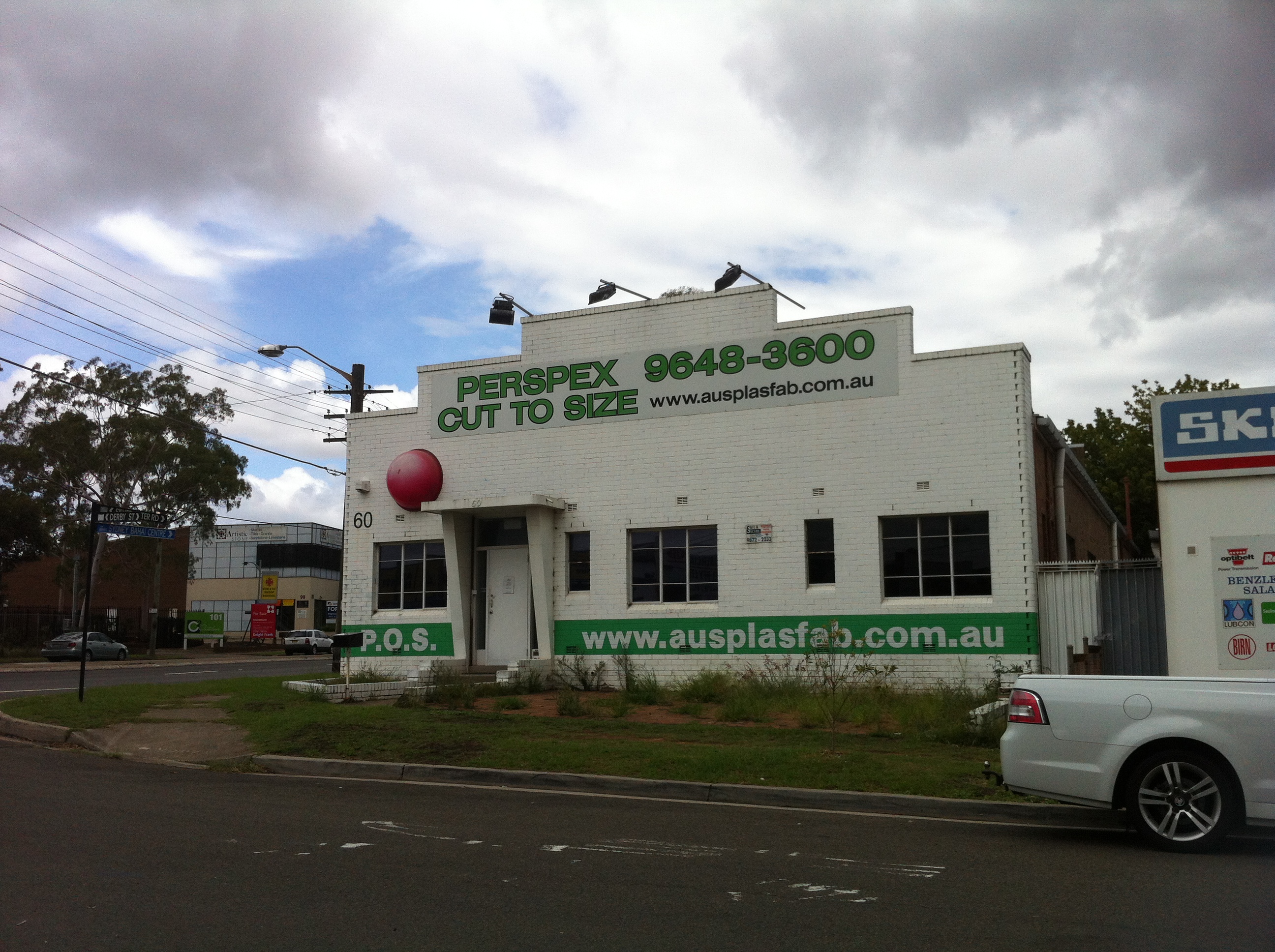
Now, before any employees of Australian Plastic Fabricators read this and panic – this place is still in business. But for once we’re not interested in the business itself.
For those of you no longer in primary school, it may surprise you to learn that the SIDS and Kids organisation’s Red Nose Day event is still going. A major fundraising initiative to help the fight against sudden infant death syndrome (SIDS), Red Nose Day involves (at least, it did when I was in primary school) buying a plastic red clown-like nose to wear all day, with the money going to SIDS and Kids. Even as a kid, I had a hard time marrying up the concepts of SIDS research and wearing a red nose. I get the idea of being “silly for a serious cause”, but why a red nose? Wouldn’t a rainbow or comically oversized nose be even sillier? Personally, I was always disappointed that the noses didn’t honk. Maybe that was the deluxe model.
During my school years it became a phenomenon akin to the Starlight Christmas ornament scramble. On the last Friday of every June kids went wild for these red noses, and anyone who missed out was for the rest of the day shunned nearly as badly as the kids who dared to wear their red nose the following Monday. I don’t know that many of us actually understood that there was a charity behind the clowning – I suspect had they known they might not have been as enthusiastic.
But for the first ten years or so of its existence, Red Nose Day exploded into the national psyche. You’d see newsreaders, politicians, shopkeepers, anyone who wanted to be seen to be doing some good (or anyone who’d be laughed at anyway) would don the red nose…and always, always Red Symons.

These REALLY should have honked.
It took off to the extent that SIDS and Kids started producing red noses for cars. For that one wacky day you could surrender your car’s dignity for a good cause, and many, many people did. So ubiquitous was Red Nose Day in my youth, yet so sudden was its disappearance once I reached high school that I was kind of amazed to learn it was still going. Certainly at this Silverwater factory, it’s been Red Nose Day every day for years.
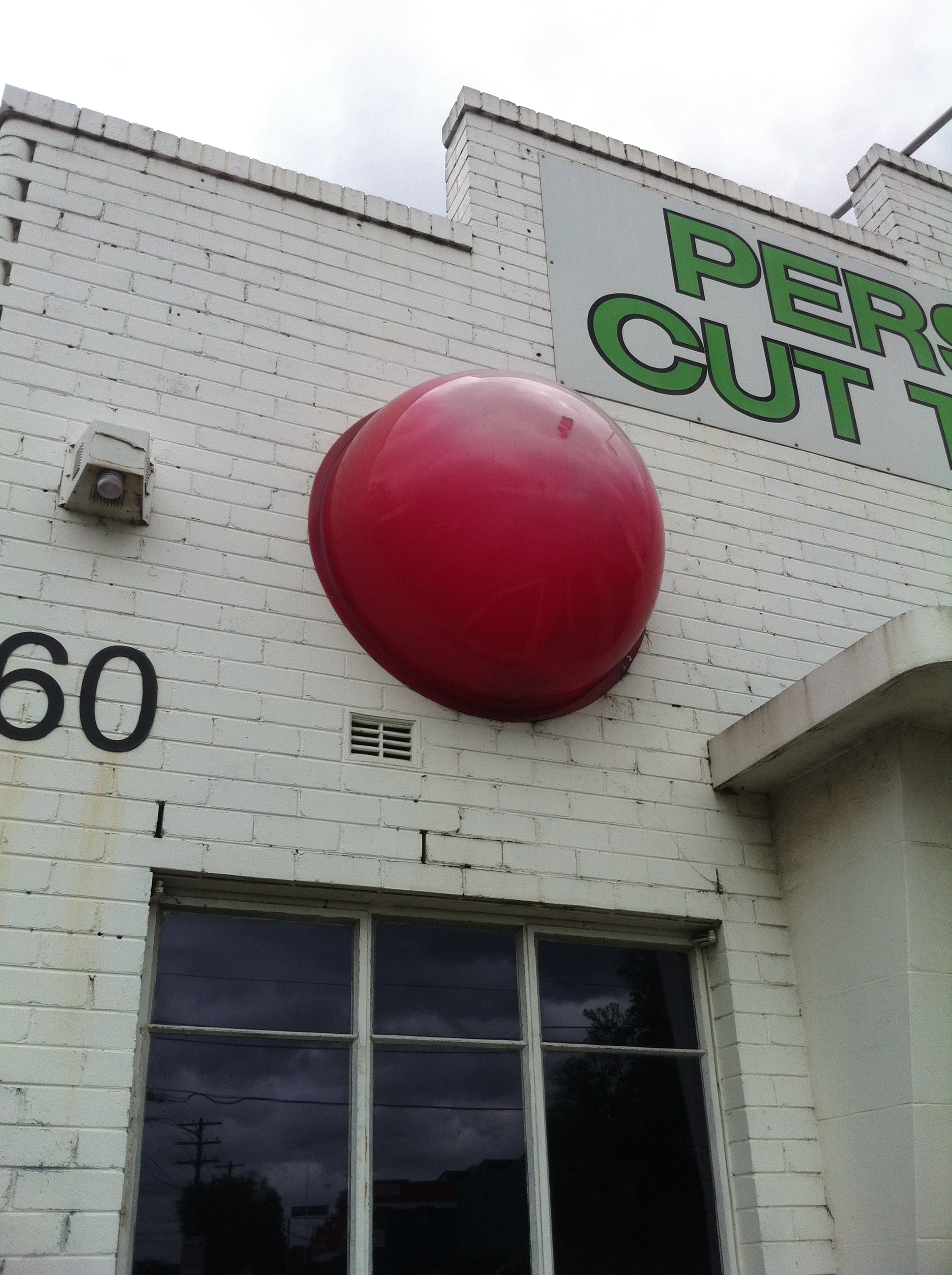
At the height of Red Nose Day mania, SIDS and Kids took the bold step of producing red noses for buildings. This was a risky move: SIDS and Kids had to be sure that the recognition factor of the event was so high that people would know what the hell they were looking at when they saw a giant red dome on the side of any building zany enough to go with it. Maybe this was the case in 1996, but these days, the fading red growth attached to Australian Plastic Fabricators of Silverwater (a suburb no stranger to red noses) doesn’t even give cause for a double take.
That said, I’m sure there are some babies out there who owe their lives to AusPlasFab’s brave choice years ago to look the fool amongst the hardened plastic fabrication industry. By the aged look of this nose, those kids are probably old enough to work here now.
SIDS and Kids’ Red Nose Day will be held again this year (its 25th anniversary) on the last Friday in June. Do your bit and make sure that the only red noses attached to cars this year aren’t those obnoxious Rudolph the Red Nosed Reindeer ones.
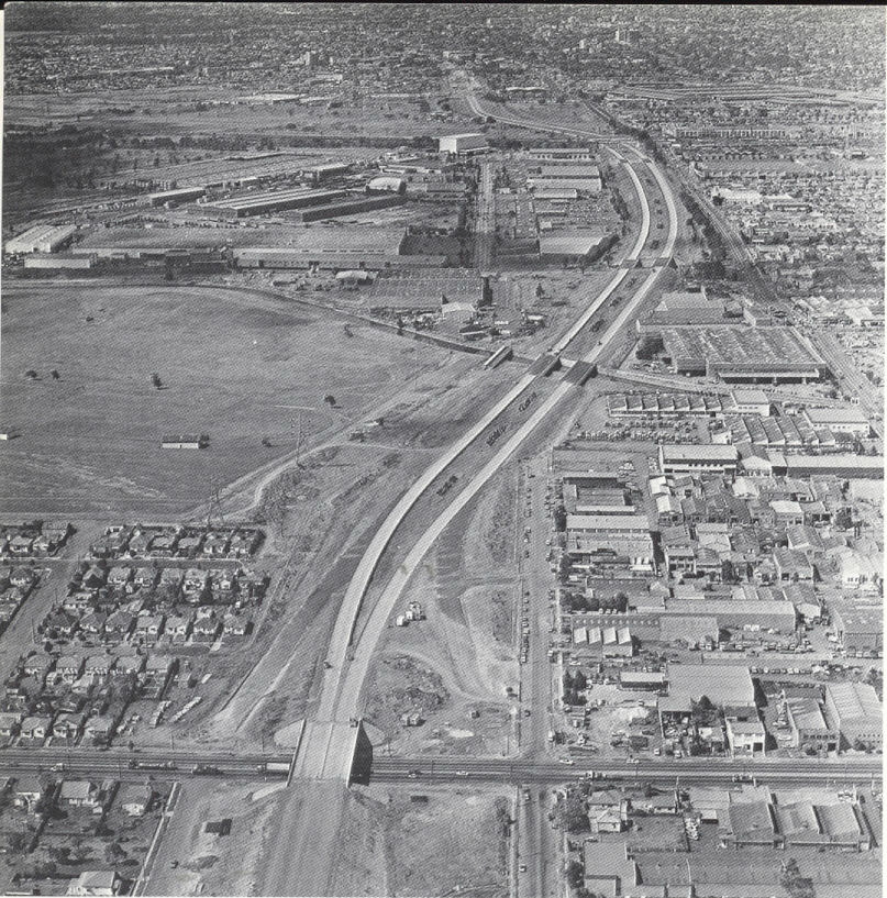
F4 Expressway/SWR Western Motorway/M4 Freeway – Concord, NSW

Image courtesy RTA Magazine/OzRoads
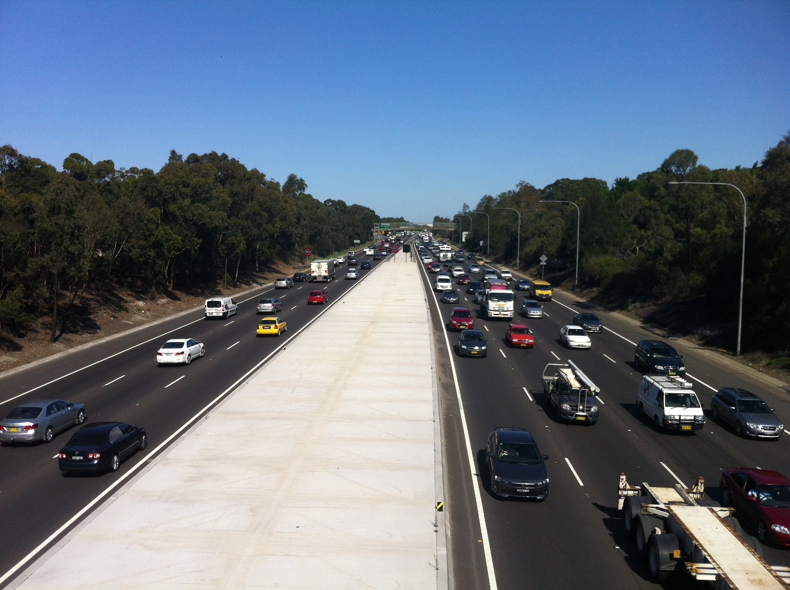
As promised, we’re now going to plunge into the half-assed history of the M4 freeway’s eastern terminus. I’m imagining you’re already as joyful and excited as those people on the bridge above, but don’t peak early – we’ll dig up some good stuff. If I do a half-assed job, consider it an homage.
After World War II it became clear that Parramatta Road wasn’t going to cut it anymore as a way of getting people to and from the western suburbs of Sydney, which had exploded in terms of population. Of course, in those days, Leichhardt was a western suburb, but you get the idea. In 1947, the newly created County of Cumberland Planning Scheme identified a possible route for an expressway which would connect Glebe to the Great Western Highway at Lapstone (of the treacherous Lapstone Incline fame). In reliably speedy NSW Government fashion, the corridor of land was reserved in 1951.
As an aside, I’d just like to shine the spotlight on my ignorance: I had no idea what Cumberland County was, and I was surprised to learn that not only was it created by Governor Arthur Phillip in 1789 and encompasses most of the Sydney metro area, but that there are 141 counties in New South Wales. A shadowy cabal of local government councillors would elect the Cumberland County Council, which then had a powerful influence over town planning in metro Sydney. Spooky stuff.
Anyway, the M4’s construction started backwards, with the first stage completed at Emu Plains in the late 60s. The late 60s. After the plan was formed in 1947. Yeah.
As the freeway crept closer and closer to Sydney, the pocket of land set aside to relieve the ever-building traffic pressure in the city waited patiently for its turn.
It’s still waiting.

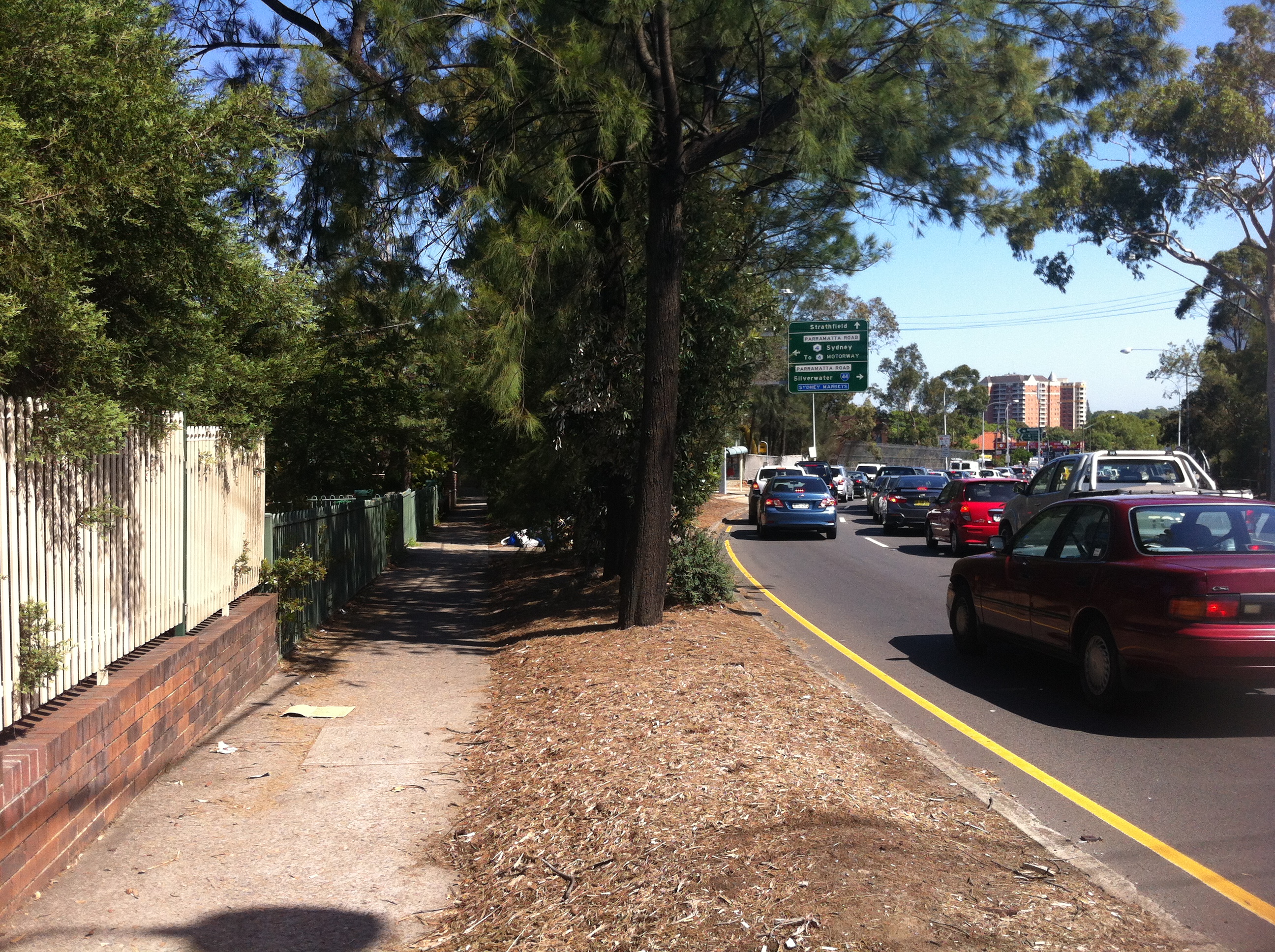
This is the start and end of the M4, and as close as the freeway gets to the city. Every day, traffic from the western suburbs and beyond is ripped from the (theoretically) 90km+ flow into the waiting 60km arms of Parramatta Road, Concord. Citybound motorists must then contend with the stop/start rhythm of Sydney’s oldest road and a new nightmare: traffic lights. If this sounds awkward, it’s because it is. And it looks even more awkward:

Image courtesy Google Maps
In 1976, the F4 freeway (as it was then known) was all set to drill right through the inner west and end up at its intended starting point in the city, Glebe. But Glebians (?) had had over 20 years to prepare their outrage and protests, so the Department of Main Roads found itself staring down a pissed off neighbourhood that feared the freeway would shatter its layout and atmosphere. In what would be the first of many such moves for the NSW Government, it backed down. The Concord to Glebe section of the freeway was abandoned, and a backup plan was hastily slapped together.
The F4 prepares to cross Silverwater Road, 1979. Courtesy Main Roads Journal/OzRoads
Also hastily slapped together were the physical components of the eventual fix, which was to spill the M4 onto Parramatta Road and hope that it all worked fine. In 1982, more than 30 years after planning had commenced, the section of the M4 between Concord and Auburn was opened to traffic, despite the next section between Auburn and Granville not being complete.

Concord reforged: the F4 ends, 1985. Courtesy Main Roads Journal/OzRoads
What a shemozzle! Although the rest of the freeway west of Concord was eventually completed (pretty much), it’s the section between Concord and Auburn that remains the most interesting and telling of the struggles that went into constructing it. With the O’Farrell Government now gearing up to deliver on its promise to complete the M4 (via a tunnel system, natch), it’s as good a time as any to see what kind of stopgap measures we can look forward to.

Where the M4 itself joins Parramatta Road, it LITERALLY joins Parramatta Road in a series of glued on slabs of cement. It’s easy to see the difference in road material here..

…here…

…and here. This is because the entrance to the M4 as it is today was originally part of Concord Road, which was relocated a block to the west. Why? Bear with me…
When this section was completed in 1982, the one-way Sydney Street was the only way off the M4. Traffic would then spill into Concord Road, which at the time followed a different alignment…

…being this, the current end of the M4. To accommodate more traffic, Concord Road was realigned to cross Parramatta Road instead of joining it.
Concord Road was extended towards Leicester Street on the other side of Parramatta Road, and the former curve was filled in by parkland and a bus stop:
So if you’ve ever wondered what this big bit of nothing was all about, that’s the story, although it could be argued that providing more access for buses adds to Parramatta Road’s problems, but that’s another story.

A tunnel was dug here between the M4 and Concord Road to form the overpass that exists there today, and to direct the traffic flow onto Parramatta Road. What was the fruit of all of this effort? One set of traffic lights is bypassed by eastbound traffic.

This restructure meant that Young Street, which in 1982 acted as the eastmost on-ramp for the M4, was cut in half by the new end of Concord Road. What was once one of the most important streets in Sydney now ends with a whimper:

…where once it would have joined the M4 it now provides access to a unit block’s carpark.
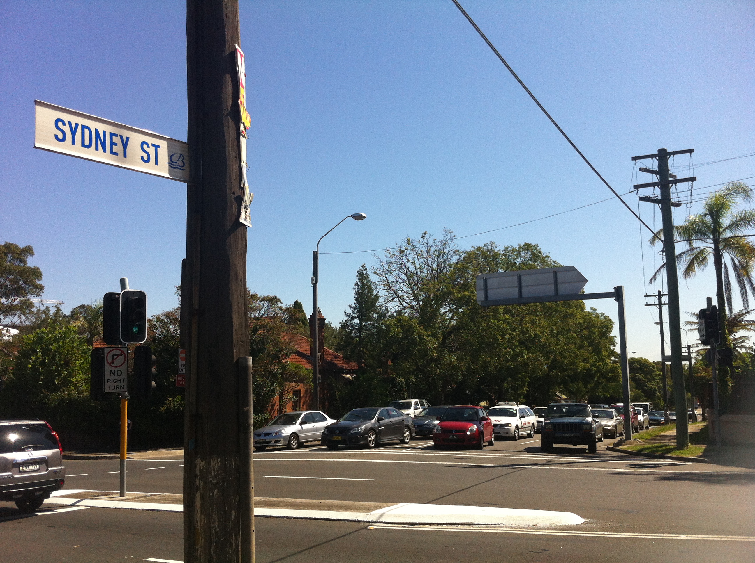
As mentioned, the other problem the M4 faced in 1982 was that it stopped at Silverwater. You could get on at Young Street, belt down the freeway at 90km/h in your Holden Monaro for about five minutes before being dumped back onto Parramatta Road, the defacto western expressway, at our old friend Melton Street.
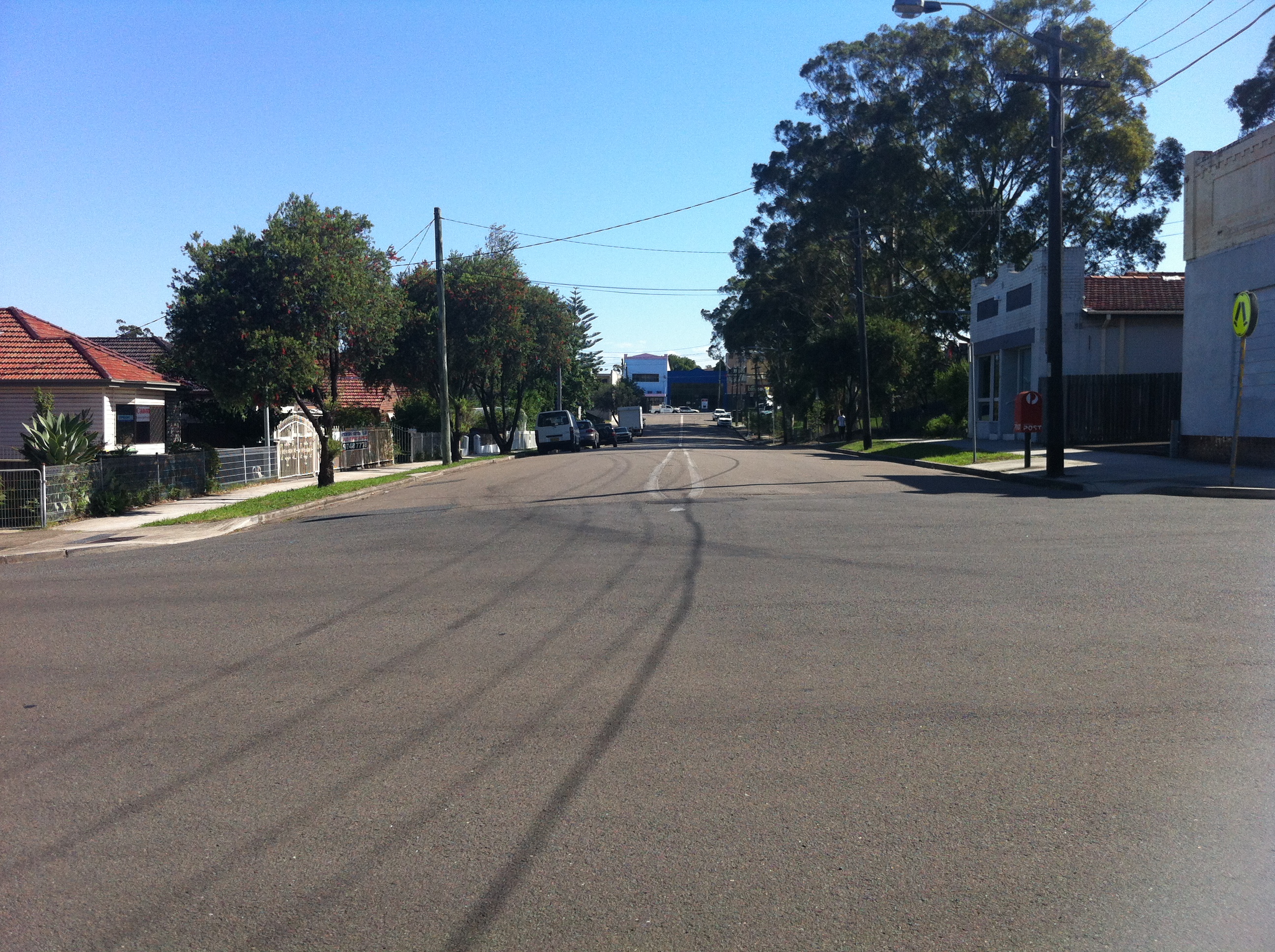
Yes, this is the sight you would have faced exiting the M4 between 1982 and 1984, when the next segment was completed. You would have zoomed up past the school and the Melton Hotel, and then back onto Parramatta Road for the next million years if you were trying to get to Springwood. If we look a bit closer, we can see where the exit ramp used to be:

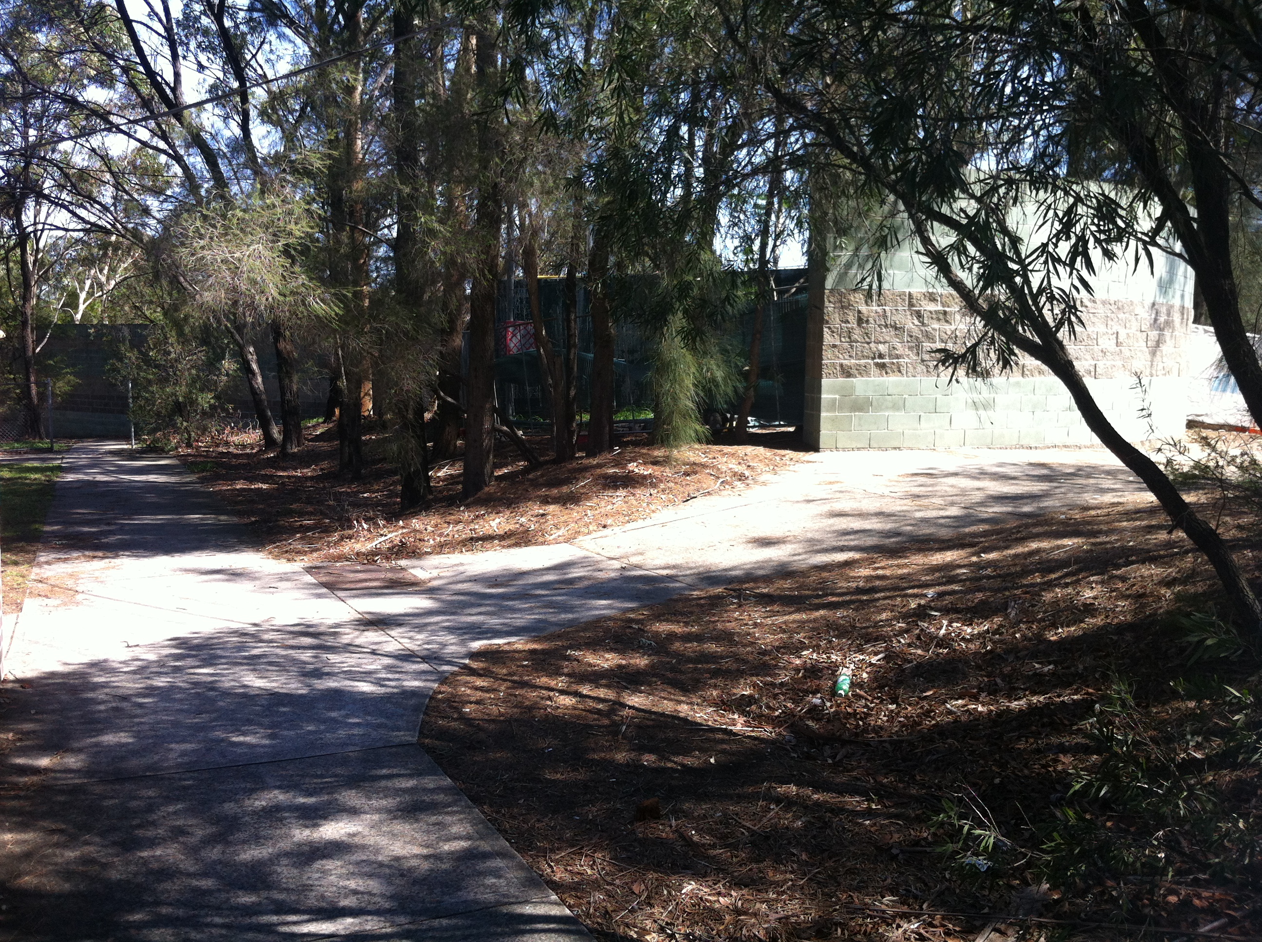
In the bushes between Adderley Street and the M4 you can see a clear path the motorists would have taken to rejoin Sydney traffic. I’m assuming the RTA has set this land aside for future widening of the freeway, as if that will ever happen, but in the meantime it gives us that vital link to the past. Once again, a seemingly insignificant little road like Melton Street actually did have a grander place in the scheme of things. Parramatta Road: where anything can happen.
Further up from Melton Street is the Silverwater mainstay Stubbs Street, as seen in the very first picture in this article. The M4 proceeds under the Stubbs Street overpass…
…which was completed in 1981 to mark the end of this section of the freeway.

Once the next section between here and Granville was completed in 1984, Melton Street was once again exclusive to pub patrons and parents dropping off their kids, while motorists were free to drive on to the west.
Or were they?

By 1989 only a small section of the M4 as we know it today was missing, and a private consortium, StateWideRoads, was contracted by an exhausted NSW Government to finish the job. As we all know, a grand don’t come for free, so by the time this missing link (and some hastily approved widening) was completed in 1992, someone had to pay.
That someone was you.

SWR tollbooths, 2007. Image courtesy someone who isn’t me.
It was determined that the section between James Ruse Drive at Granville and Stubbs Street, Silverwater was the section through which the majority of cars would pass, thus ensuring the shortest possible time for a toll to be in place. In May 1992, $1.50 was required to continue out to the western suburbs. By the time the toll was removed in February 2010, over $970 million had been paid to pass these booths.

Today, there’s little apart from the alignment of the lanes to suggest that the toll booths were ever there, but other remnants of the M4 project have left a more lasting mark all over Sydney. The freeway is back in the hands of the NSW Government, which is akin to returning an abused child to their abusive parent. As the battle to complete the M4’s route into the city rages on in state parliament, Federal Opposition Leader Tony Abbott has even expressed support for the completion should he win government at the next election. Thousands of motorists a day are still inconvenienced by the half-finished freeway. One accident on the M4 causes traffic chaos all over the city. The Eastern Suburbs are still effectively isolated from the rest of Sydney due to a lack of motorways….so I guess there are always upsides. There’s been talk of reinstating the toll to pay for what would by now be a very expensive couple of kilometres. In 1977, the projected cost of completing the M4 from Concord to Glebe as intended would have been $287m.
The M4 is only 46km long.
Maybe if it ever gets finished, it’ll be linked up to the Western Distributor so that it can actually start distributing people to the west instead of, you know, nowhere.
TRAFFIC STOPPING UPDATE: Thanks to Burwood Library’s archive of interesting old stuff, you can now enjoy this old pamphlet detailing the opening of TWO new segments of the F4 back in 1982. Even better is that this article’s diagrams illustrate the progress of the F4 almost as well as the above article. You all thought I was mad when I wrote this one, but who’s mad now?


The Melton Hotel – Auburn, NSW
Get comfy, this’ll be a long one.
 Sometimes, it’s not so much about what a place has become as it is about how it got that way. This is certainly true in the case of Auburn’s Melton Hotel. Ordinarily I, like any passer-by, would take one look at the Melton and think ‘I value my life too much to go in there,’ subsequent to the instinctual thought of ‘Just another pub.’ Situated along Parramatta Road at the corner of Station Street, there’s just nothing that sticks out about the hotel in any way; not even the jovially named ‘Hey Hey Kebab’ adjoining gives cause for anything more than a mild double-take.
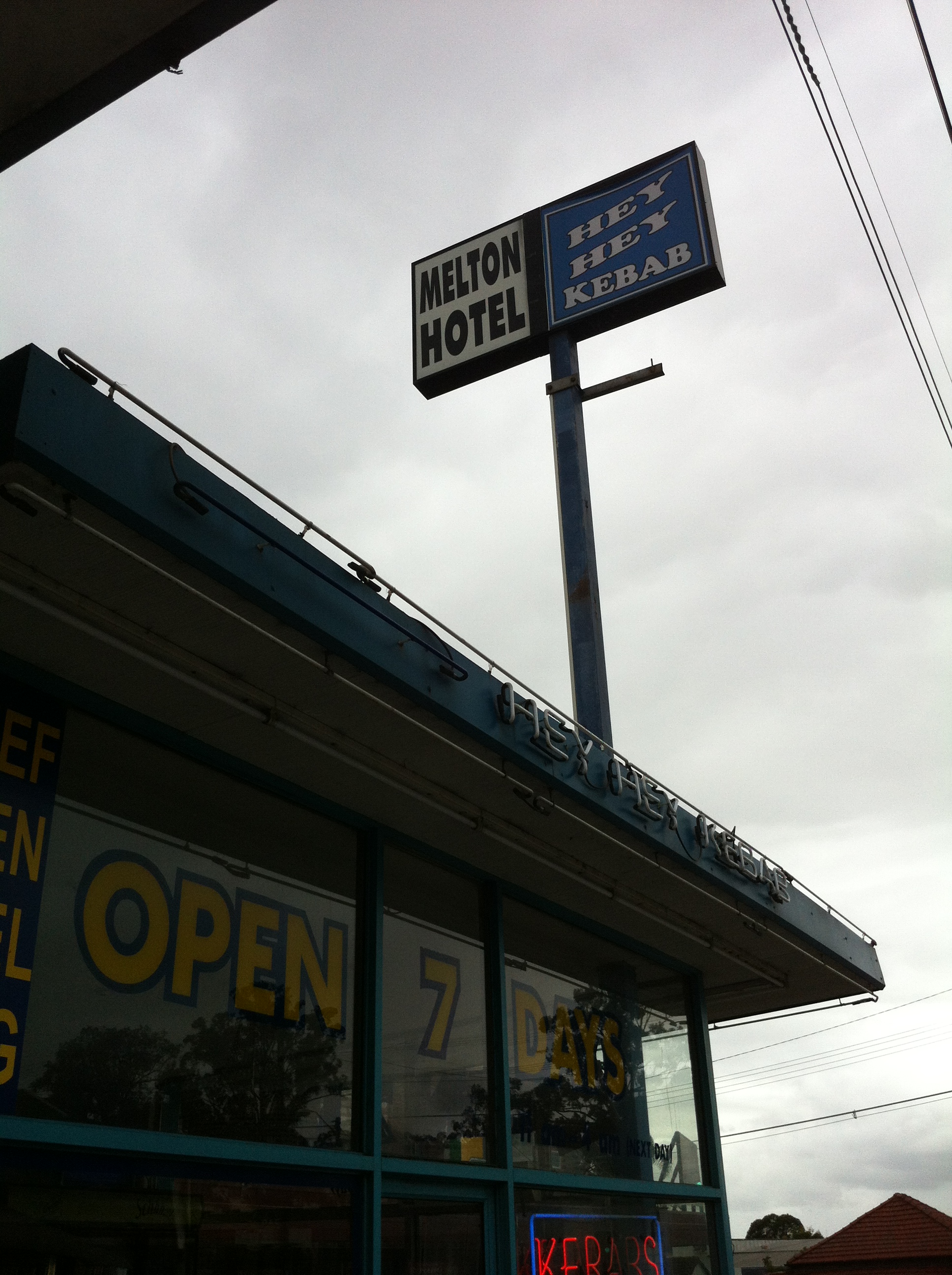 So why, dear reader, am I subjecting you to this dry account of a seemingly humdrum pub? Well, what piqued my interest (as I’m sure it will yours) was the simple fact that the street running parallel to the hotel’s side of the block is called Melton Street South.

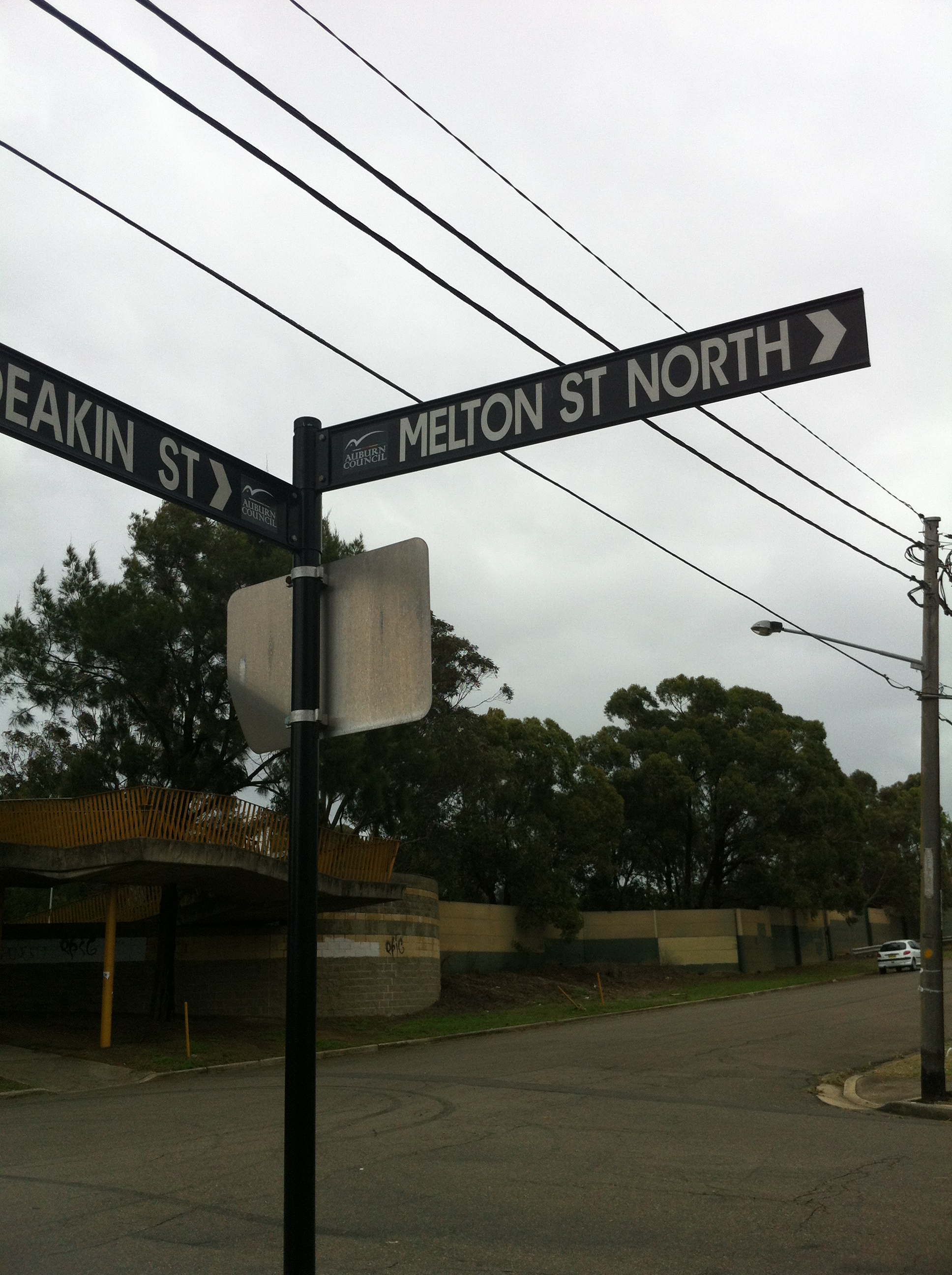
Not pictured: Melton Street North
This got me thinking: why was the pub named the Melton Hotel if it wasn’t actually on Melton Street? Clearly it was time for some field detective work, because I knew if I didn’t solve the mystery it would bother me all day. I couldn’t find anything about anyone named Melton in the area’s history (it’s not even clear to historians why the area itself is named Silverwater), but I had a feeling if they were honouring some local hero, they wouldn’t just name a pub and a street after them. First port of call: the Atlas of the Suburbs of Sydney, ca 1885-1890.

Courtesy the Atlas of the Suburbs of Sydney, ca. 1885-1890
This map of Auburn shows that neither Station Street nor Melton Street South existed at the time. Today, they’re located between the map’s Stubbs Street and Sutherland Street (now Silverwater Road).
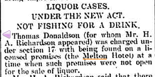
Next: time to research the pub itself. Thankfully, the pub in question has an illustrious history; according to the hoteliers, its license dates back to 1811 (when it was owned by Samuel Haslem, of Haslem’s Creek fame), attached to an inn located not too far from the current site. In 1877 a former jockey, Fred Martineer, became the licensee of the Melton Hotel and held that position for over 30 years, firmly establishing the pub as a favourite of the area’s myriad meat workers.
Tragedy struck in 1914 when, after too many cases like this…
The Cumberland Argus and Fruitgrowers Advocate, 21 February 1906
…the public was swept up by a need to reinstill a sense of public decency via a series of local option acts. The acts enforced a six o’clock closing time for pubs and resulted in 293 hoteliers losing their licenses, including Martineer. Despite the pub’s closure and with flagrant disregard to the after hours prohibition, he continued to live in what became known as the ‘old Melton Hotel’ until his death in 1918:
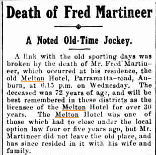
The Cumberland Argus and Fruitgrowers Advocate, 16 March 1918
The Old Melton had been named sometime prior to 1895, when it appeared on that year’s list of Hotel Licensees. It’s this hotel that sat on the corner of Melton Street South (then Melton Road), so from this we can assume the street was named after the pub. But, like me, the Martineers couldn’t let it go. In 1929, the Martineers built the NEW Melton Hotel at its current location, which at the time seemed to take up the entire section of Parramatta Road between Melton Street and Station Street.
That’s all well and good, but today it’s a very different story. Nothing remains of the Old Melton, the New Melton is nowhere near the corner of Melton Street, and there’s a string of dingy shops between it and its namesake street. What happened?
 Discounting the obvious greed associated with subletting the Melton Street side of the block to said dingy shops, the true answer seems to lie in the Melton Hotel’s parking lot. The hyperbolic claim of “stacks & stacks of parking” is betrayed by the truncated nature of the car park itself. Here it is, seen from Station Street:
 Further encroachment into the lot reveals a flimsily constructed wall on the Melton Street side. Hmm…
 And a gap in the northern end of that wall. HMM…
 The gap leads out to Melton Street, whereupon you’re immediately facing a school. This sign:
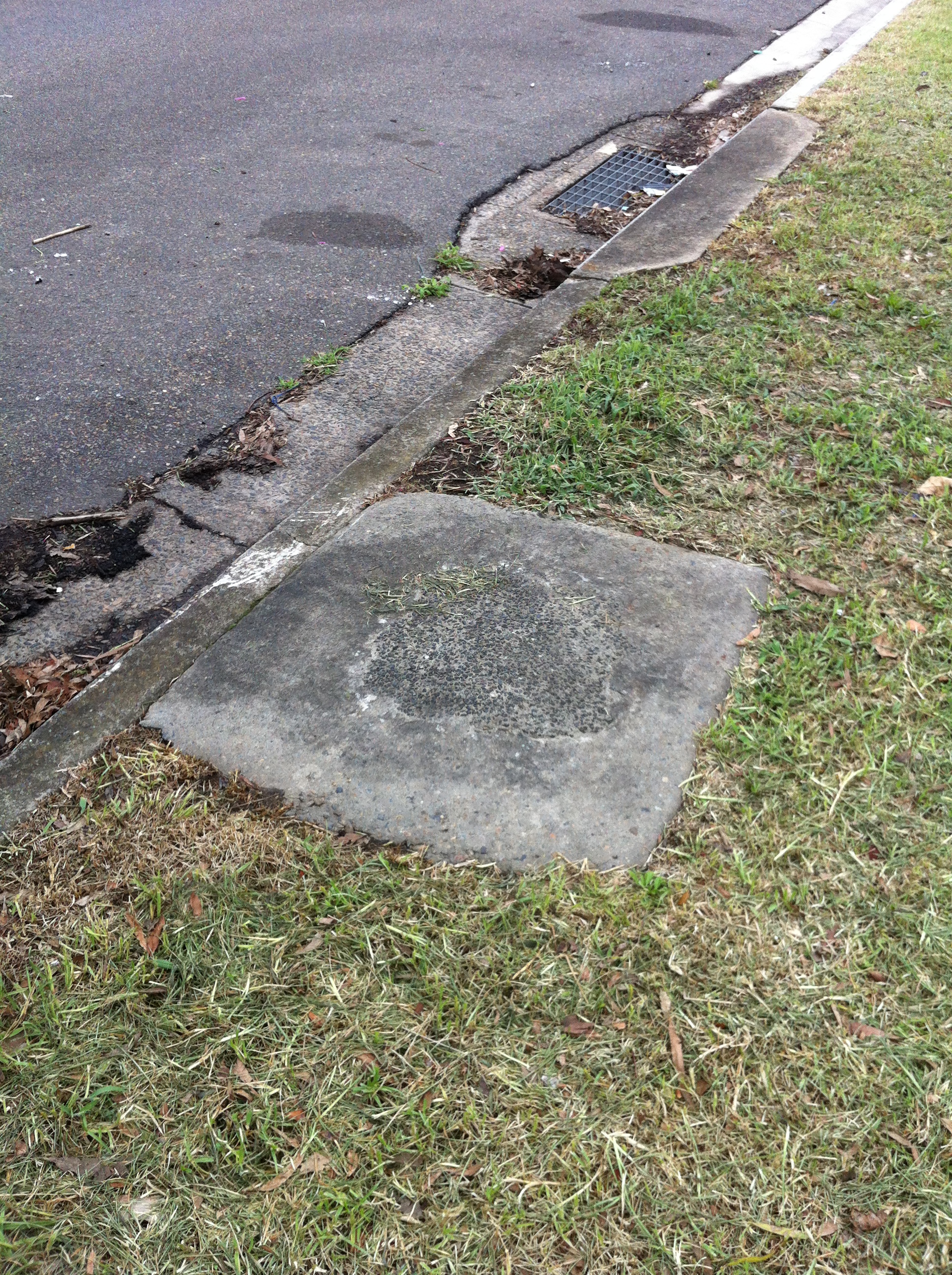
 …is all that remains of this side’s former life as an entrance/exit to the Melton’s car park, and indeed of the Melton’s connection to the street it inspired. A closer look at the other side of the fence backs this deep bit of insight up.
 The kerb is clearly a lighter shade of cement, indicating the spot where the driveway used to be. The two bushes are doing a laughable job of hiding the wooden fencing that blocks off those driveways.
 Even stranger is the choice to keep these former barriers, and simply cut them where the new fence intersects.
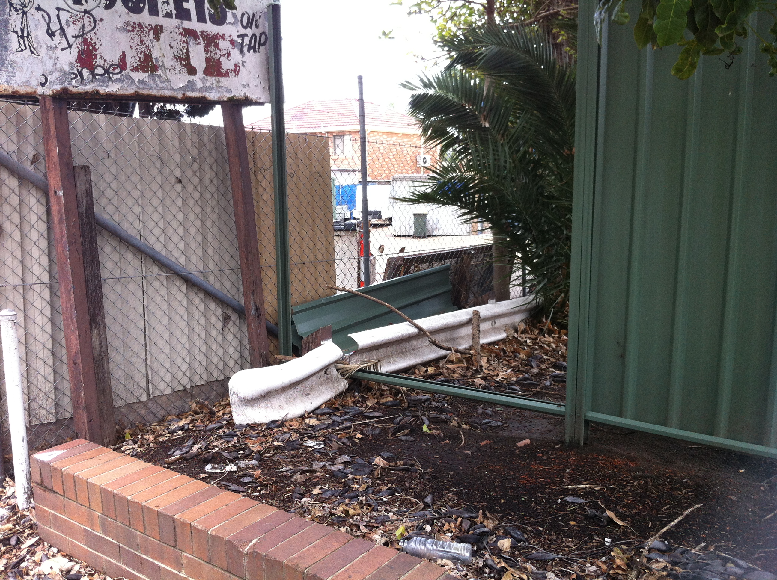
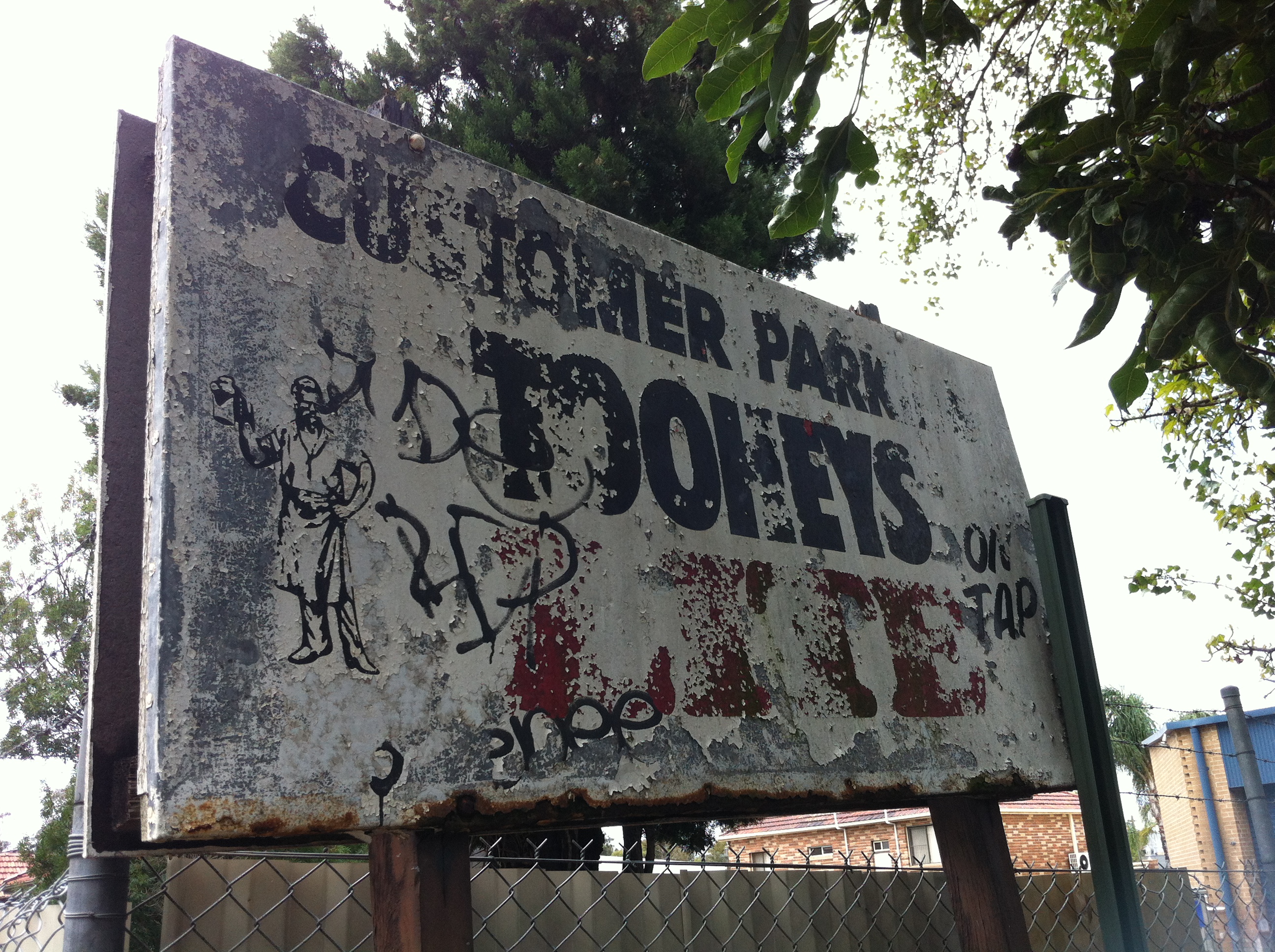 One of the more interesting aspects of all of this is the sign that once guided thirsty drivers into the parking lot. Hidden by overgrown branches and worn away by years of neglect, there’s no real reason for the hoteliers to have left it there – least of all what it’s advertising. After all, if it hadn’t been for the sign, I never would have stumbled upon this madness in the first place. No, for me, the real gold is the sign’s reverse side:
 Remarkably well-preserved, the sign advertises Tooheys 2.2, which was an attempt by Tooheys to introduce a light beer to their otherwise heavy range in the late 1980s.
While it would be nice to think that this was Tooheys doing its part to avoid another 1914 Local Option fiasco, the way the ad puts a jokey spin on drunken violence and employs a disturbing tagline clearly aimed at the breathalyser crowd suggests a more cynical set of motives. For better or worse, this didn’t take, and by 1995, 40 years after the Local Option acts were repealed, 2.2 was 6.0 feet under. It’s worth pointing out that 2.2 was supplanted in 1998 by Hahn Premium Light, which is now Australia’s top selling light beer…and owned by Tooheys. A fascinating trail of the significant episodes of 2.2’s short life can be found here (WORTH READING). I think the lesson here is don’t give your beer a name that invites terrible Richie Benaud impressions.
But back to the Melton. Also of note are the apparent remains of either a garbage can or a phone box (remember those?) located between the two driveways.
 Let’s stop for just a second to process this. Regardless of whether this was in fact a garbage can which spent countless nights being chundered into by melting Meltonians, or a phone booth which spent its Friday and Saturday nights listening to endless pleas by hopelessly pissed pub patrons for their wives, girlfriends, parents or less drunk mates to come and pick them up, and then being chundered into, the fact remains that it was located BETWEEN the two driveways. How is this a spot for either of those objects which both appear as bright flames to drunken moths? The line for the phone alone would have been both long and drunkenly ignorant enough to queue across the nearest driveway. You can’t tell me this didn’t cause at least one clipped wing.
Even worse is the pub’s proximity to Auburn North Public School. Anyone foolish and drunk enough to ‘breathe easy’ and attempt to drive home via the Melton Street exit (or entrance, depending on the level of drunkenness) on a weekday afternoon ran the risk of knocking over a kid on their way home. If it didn’t happen or nearly happen, I’d be surprised.
With these reasons in mind, it’s easy to imagine just how and why the Melton would have had these driveways sealed up, thereby severing its ties to its own history. It’s also easy (and funny) to imagine particularly OCD and DUI pub patrons attempting to drive out of their usual exit and smashing the fence, otherwise why the need for the bushes and the potplants? Sure, the Melton could have chosen to seal up the Station Road driveways, which face the old Joyce Mayne complex, but it turns out that a child’s life is worth more than that of a shopper looking for bargain whitegoods. Who knew?
And all because some public spirited men didn’t know their limits and couldn’t hold their beer.
Of course, I could be wrong about everything, and I might owe both the Melton and overdrinkers everywhere an apology, but have a look at this:

The Cumberland Argus and Fruitgrowers Advocate, 10 July 1915
EPILOGUE
Not pictured: Melton Street South
You may have just read all that and be wondering ‘what was the point?’ or ‘where’s the remove bookmark button?’, but more inquisitive (or less demanding) readers may be wondering ‘What was so drastic that happened to Melton Road to cause it to be split into Melton Road South and Melton Road North?’
Next time, baby.
