F4 Expressway/SWR Western Motorway/M4 Freeway – Concord, NSW

Image courtesy RTA Magazine/OzRoads
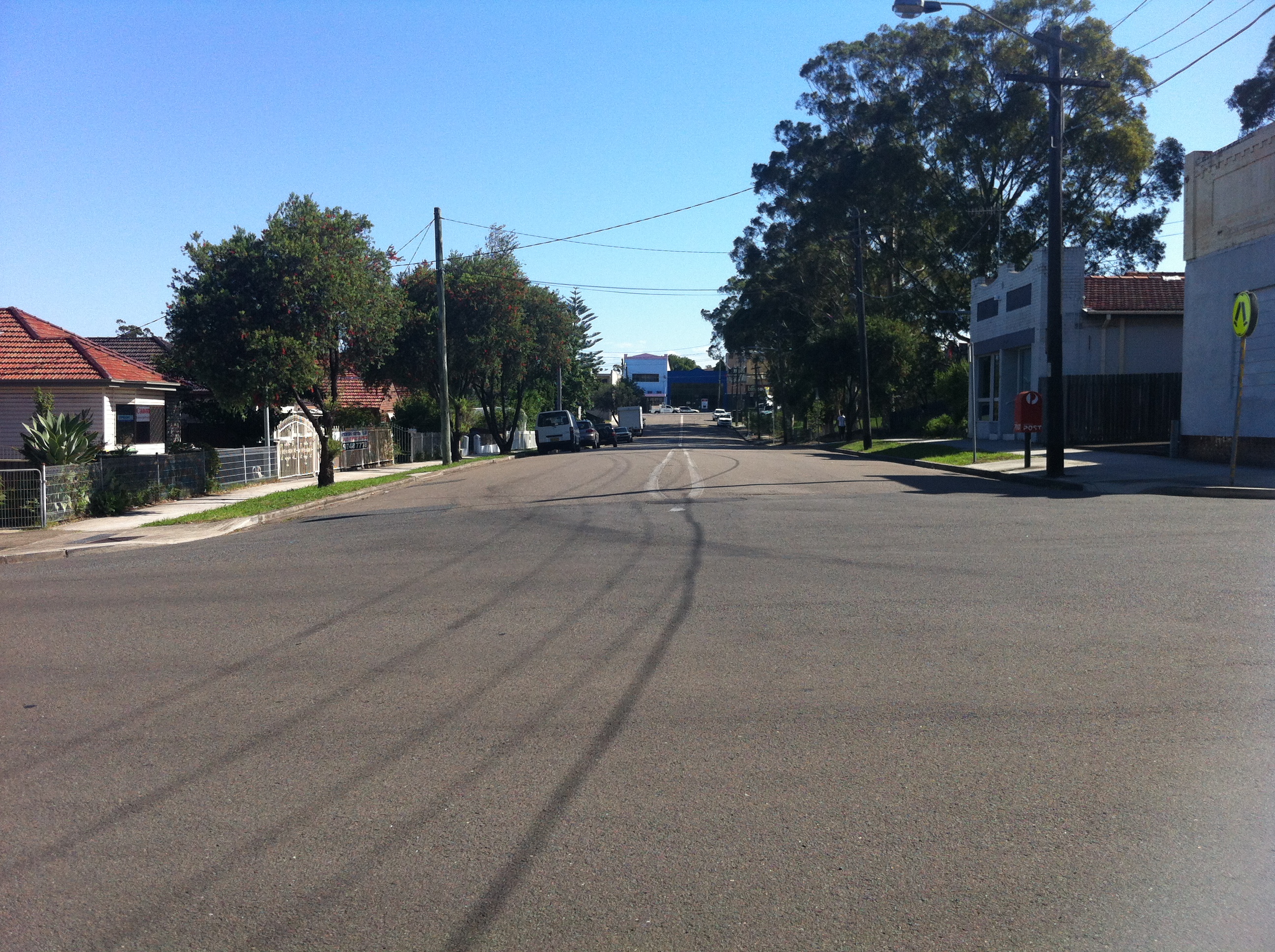
As promised, we’re now going to plunge into the half-assed history of the M4 freeway’s eastern terminus. I’m imagining you’re already as joyful and excited as those people on the bridge above, but don’t peak early – we’ll dig up some good stuff. If I do a half-assed job, consider it an homage.
After World War II it became clear that Parramatta Road wasn’t going to cut it anymore as a way of getting people to and from the western suburbs of Sydney, which had exploded in terms of population. Of course, in those days, Leichhardt was a western suburb, but you get the idea. In 1947, the newly created County of Cumberland Planning Scheme identified a possible route for an expressway which would connect Glebe to the Great Western Highway at Lapstone (of the treacherous Lapstone Incline fame). In reliably speedy NSW Government fashion, the corridor of land was reserved in 1951.
As an aside, I’d just like to shine the spotlight on my ignorance: I had no idea what Cumberland County was, and I was surprised to learn that not only was it created by Governor Arthur Phillip in 1789 and encompasses most of the Sydney metro area, but that there are 141 counties in New South Wales. A shadowy cabal of local government councillors would elect the Cumberland County Council, which then had a powerful influence over town planning in metro Sydney. Spooky stuff.
Anyway, the M4’s construction started backwards, with the first stage completed at Emu Plains in the late 60s. The late 60s. After the plan was formed in 1947. Yeah.
As the freeway crept closer and closer to Sydney, the pocket of land set aside to relieve the ever-building traffic pressure in the city waited patiently for its turn.
It’s still waiting.

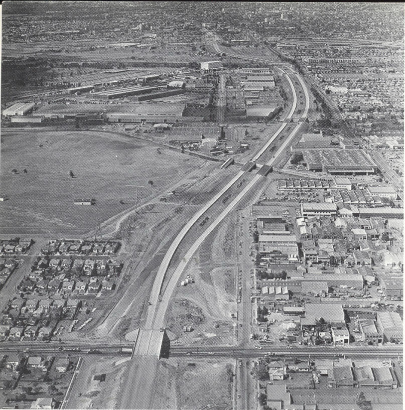
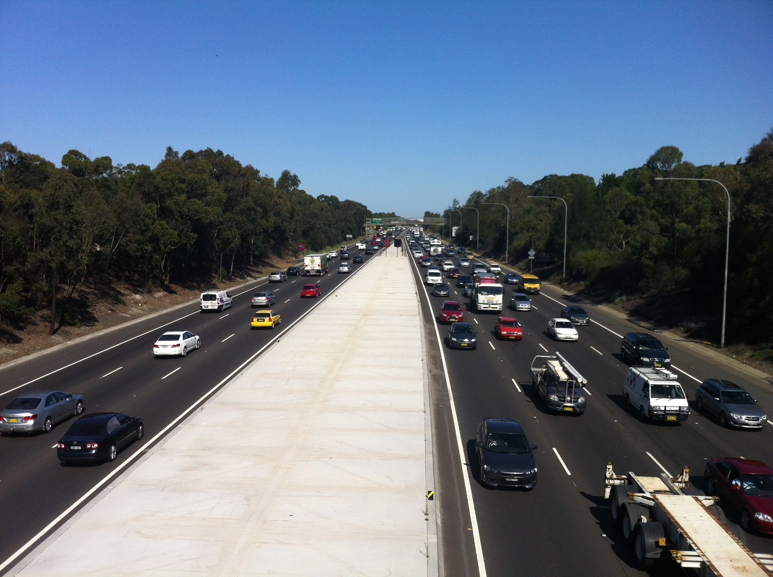
This is the start and end of the M4, and as close as the freeway gets to the city. Every day, traffic from the western suburbs and beyond is ripped from the (theoretically) 90km+ flow into the waiting 60km arms of Parramatta Road, Concord. Citybound motorists must then contend with the stop/start rhythm of Sydney’s oldest road and a new nightmare: traffic lights. If this sounds awkward, it’s because it is. And it looks even more awkward:

Image courtesy Google Maps
In 1976, the F4 freeway (as it was then known) was all set to drill right through the inner west and end up at its intended starting point in the city, Glebe. But Glebians (?) had had over 20 years to prepare their outrage and protests, so the Department of Main Roads found itself staring down a pissed off neighbourhood that feared the freeway would shatter its layout and atmosphere. In what would be the first of many such moves for the NSW Government, it backed down. The Concord to Glebe section of the freeway was abandoned, and a backup plan was hastily slapped together.
The F4 prepares to cross Silverwater Road, 1979. Courtesy Main Roads Journal/OzRoads
Also hastily slapped together were the physical components of the eventual fix, which was to spill the M4 onto Parramatta Road and hope that it all worked fine. In 1982, more than 30 years after planning had commenced, the section of the M4 between Concord and Auburn was opened to traffic, despite the next section between Auburn and Granville not being complete.

Concord reforged: the F4 ends, 1985. Courtesy Main Roads Journal/OzRoads
What a shemozzle! Although the rest of the freeway west of Concord was eventually completed (pretty much), it’s the section between Concord and Auburn that remains the most interesting and telling of the struggles that went into constructing it. With the O’Farrell Government now gearing up to deliver on its promise to complete the M4 (via a tunnel system, natch), it’s as good a time as any to see what kind of stopgap measures we can look forward to.

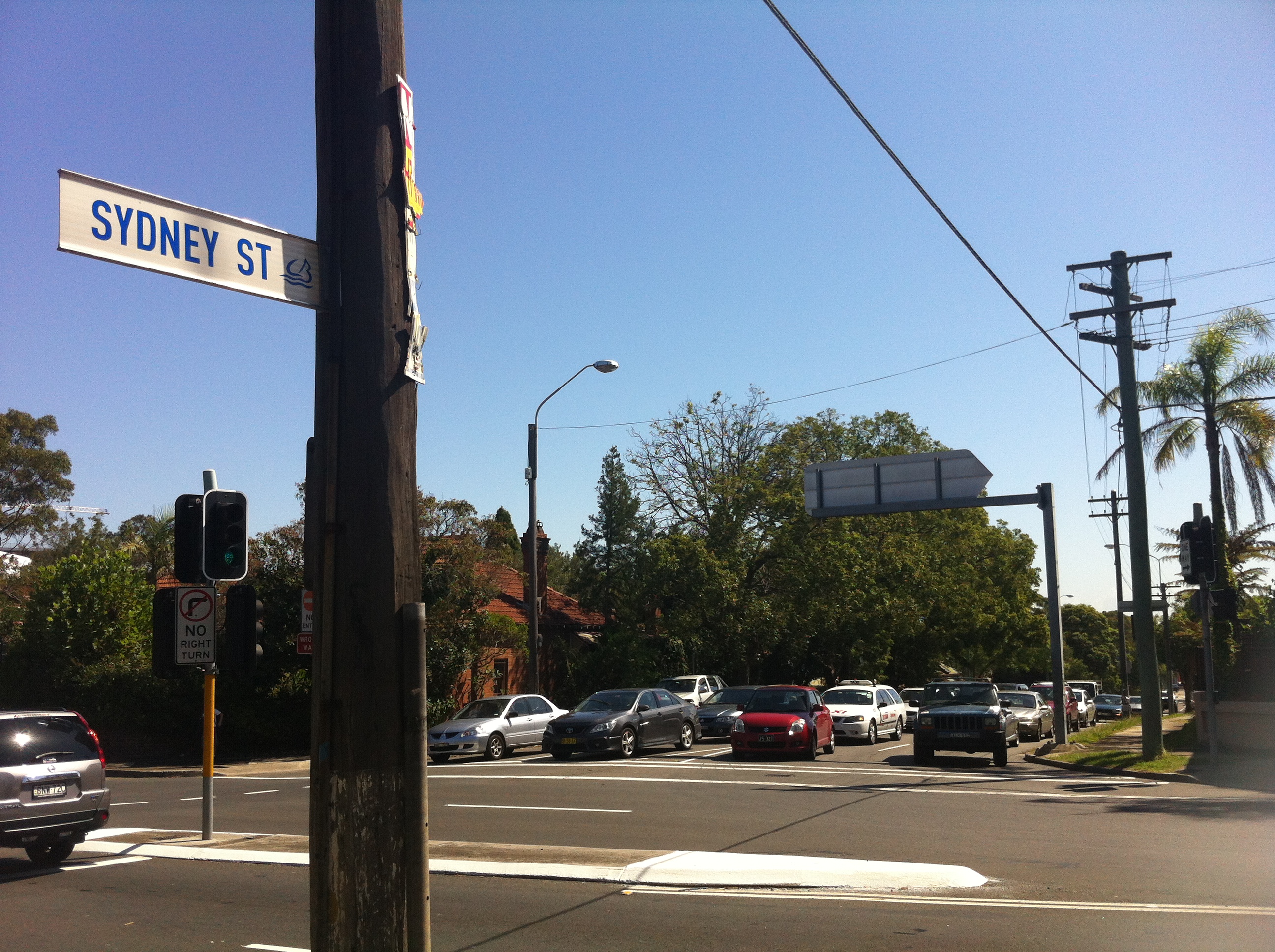
Where the M4 itself joins Parramatta Road, it LITERALLY joins Parramatta Road in a series of glued on slabs of cement. It’s easy to see the difference in road material here..

…here…

…and here. This is because the entrance to the M4 as it is today was originally part of Concord Road, which was relocated a block to the west. Why? Bear with me…
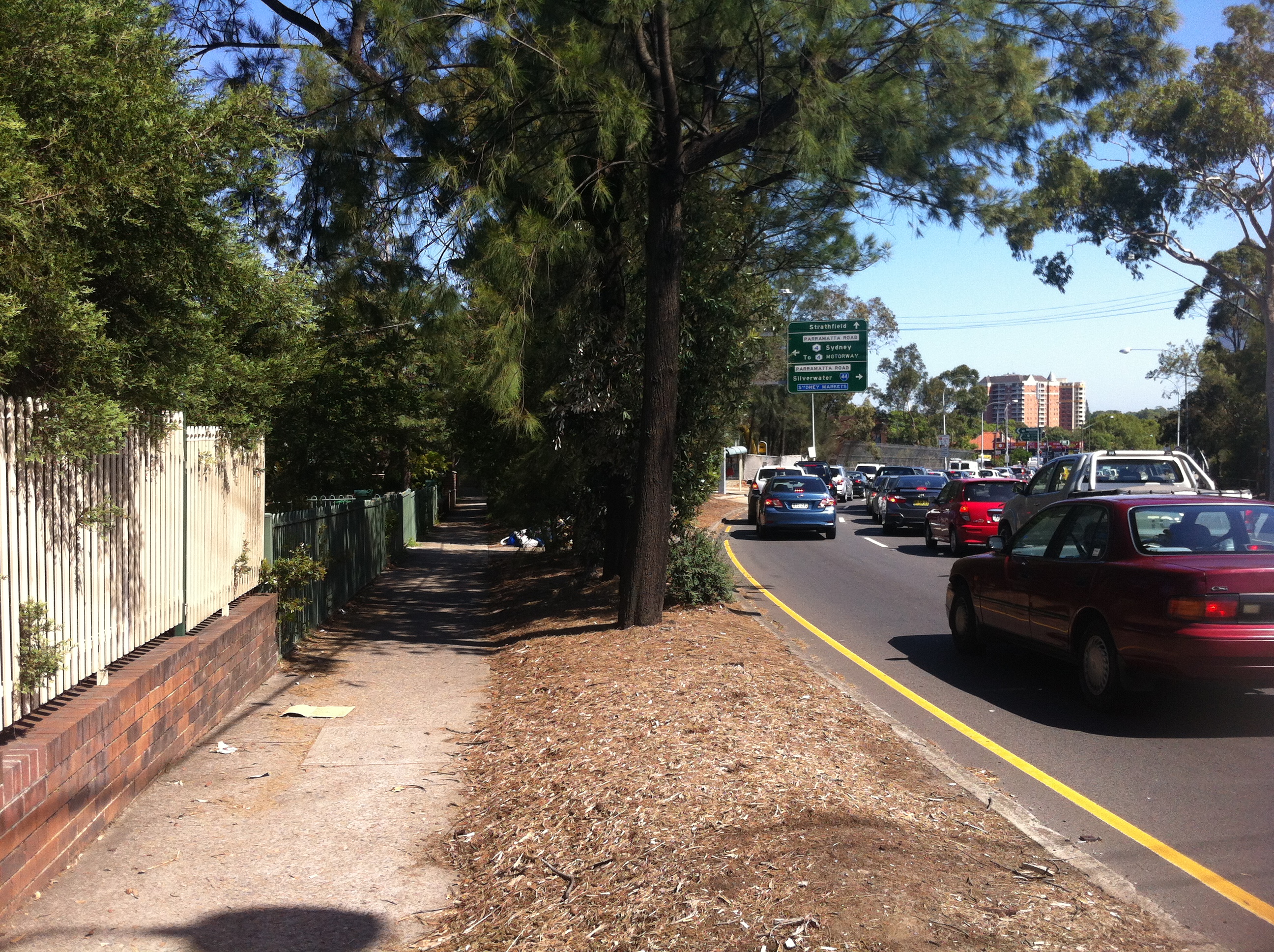
When this section was completed in 1982, the one-way Sydney Street was the only way off the M4. Traffic would then spill into Concord Road, which at the time followed a different alignment…

…being this, the current end of the M4. To accommodate more traffic, Concord Road was realigned to cross Parramatta Road instead of joining it.
Concord Road was extended towards Leicester Street on the other side of Parramatta Road, and the former curve was filled in by parkland and a bus stop:
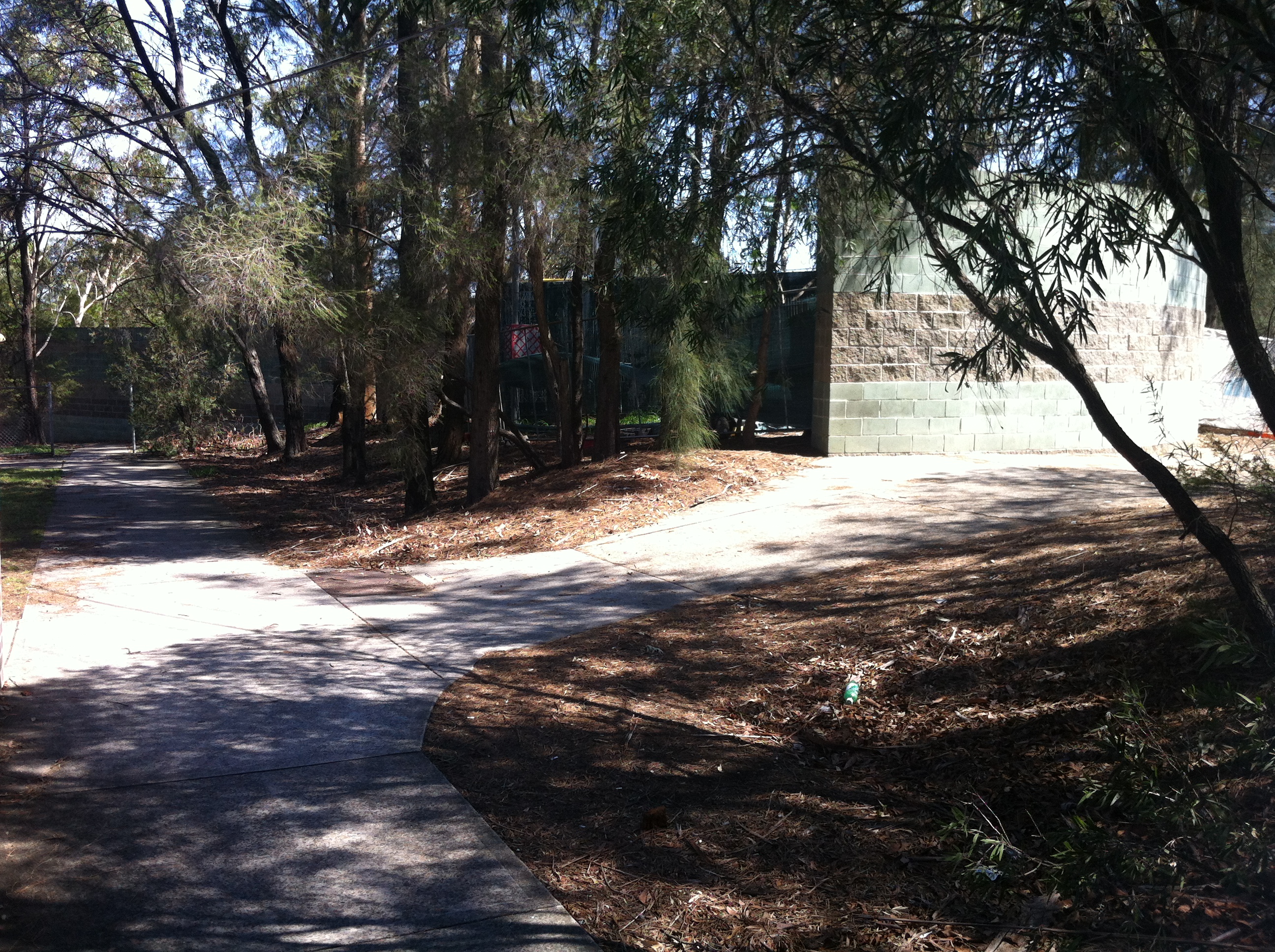
So if you’ve ever wondered what this big bit of nothing was all about, that’s the story, although it could be argued that providing more access for buses adds to Parramatta Road’s problems, but that’s another story.

A tunnel was dug here between the M4 and Concord Road to form the overpass that exists there today, and to direct the traffic flow onto Parramatta Road. What was the fruit of all of this effort? One set of traffic lights is bypassed by eastbound traffic.

This restructure meant that Young Street, which in 1982 acted as the eastmost on-ramp for the M4, was cut in half by the new end of Concord Road. What was once one of the most important streets in Sydney now ends with a whimper:

…where once it would have joined the M4 it now provides access to a unit block’s carpark.
As mentioned, the other problem the M4 faced in 1982 was that it stopped at Silverwater. You could get on at Young Street, belt down the freeway at 90km/h in your Holden Monaro for about five minutes before being dumped back onto Parramatta Road, the defacto western expressway, at our old friend Melton Street.
Yes, this is the sight you would have faced exiting the M4 between 1982 and 1984, when the next segment was completed. You would have zoomed up past the school and the Melton Hotel, and then back onto Parramatta Road for the next million years if you were trying to get to Springwood. If we look a bit closer, we can see where the exit ramp used to be:

In the bushes between Adderley Street and the M4 you can see a clear path the motorists would have taken to rejoin Sydney traffic. I’m assuming the RTA has set this land aside for future widening of the freeway, as if that will ever happen, but in the meantime it gives us that vital link to the past. Once again, a seemingly insignificant little road like Melton Street actually did have a grander place in the scheme of things. Parramatta Road: where anything can happen.
Further up from Melton Street is the Silverwater mainstay Stubbs Street, as seen in the very first picture in this article. The M4 proceeds under the Stubbs Street overpass…
…which was completed in 1981 to mark the end of this section of the freeway.

Once the next section between here and Granville was completed in 1984, Melton Street was once again exclusive to pub patrons and parents dropping off their kids, while motorists were free to drive on to the west.
Or were they?

By 1989 only a small section of the M4 as we know it today was missing, and a private consortium, StateWideRoads, was contracted by an exhausted NSW Government to finish the job. As we all know, a grand don’t come for free, so by the time this missing link (and some hastily approved widening) was completed in 1992, someone had to pay.
That someone was you.

SWR tollbooths, 2007. Image courtesy someone who isn’t me.
It was determined that the section between James Ruse Drive at Granville and Stubbs Street, Silverwater was the section through which the majority of cars would pass, thus ensuring the shortest possible time for a toll to be in place. In May 1992, $1.50 was required to continue out to the western suburbs. By the time the toll was removed in February 2010, over $970 million had been paid to pass these booths.

Today, there’s little apart from the alignment of the lanes to suggest that the toll booths were ever there, but other remnants of the M4 project have left a more lasting mark all over Sydney. The freeway is back in the hands of the NSW Government, which is akin to returning an abused child to their abusive parent. As the battle to complete the M4’s route into the city rages on in state parliament, Federal Opposition Leader Tony Abbott has even expressed support for the completion should he win government at the next election. Thousands of motorists a day are still inconvenienced by the half-finished freeway. One accident on the M4 causes traffic chaos all over the city. The Eastern Suburbs are still effectively isolated from the rest of Sydney due to a lack of motorways….so I guess there are always upsides. There’s been talk of reinstating the toll to pay for what would by now be a very expensive couple of kilometres. In 1977, the projected cost of completing the M4 from Concord to Glebe as intended would have been $287m.
The M4 is only 46km long.
Maybe if it ever gets finished, it’ll be linked up to the Western Distributor so that it can actually start distributing people to the west instead of, you know, nowhere.
TRAFFIC STOPPING UPDATE: Thanks to Burwood Library’s archive of interesting old stuff, you can now enjoy this old pamphlet detailing the opening of TWO new segments of the F4 back in 1982. Even better is that this article’s diagrams illustrate the progress of the F4 almost as well as the above article. You all thought I was mad when I wrote this one, but who’s mad now?


Newsagent/Dalat Hot Bread – Concord West, NSW

Here’s a fun instance of ‘street musical chairs’. Exhibit A: Dalat Hot Bread in Concord West. An ordinary shop with an ordinary awning…

But on closer inspection we can see that it says Financial Review. Clearly, this was once a newsagent. But Concord Westians still need newspapers, so where did it go?

A few doors up along Concord Road is what is now the newsagent, but looking at that sign it was clearly once something else. It’s a tough sign to read, so I’ll leave open to interpretation, but I wonder why the newsagent moved? Was the rent too high two doors along? Were there not as many customers at that specific latitude?
