Hurstfield – Act II: Hubris (1975-1988)
…and my heart was beating fast.

Lowy and Saunders, the Butch and Sundance of retail. Image courtesy Westfield

Ground Zero, 1953. Image courtesy Westfield

Failure on rails, 1986. Image courtesy Hurstville Council

Frisco Furniture’s days are numbered, although it doesn’t know it yet. 1976. Image courtesy Hurstville Council

Wishful thinking.
More wishful thinking.

“The Scheme” sounds very Bond Villain, doesn’t it?

Don’t wear sunglasses inside, you look like a tool.
Rose Street is an unfortunate victim of progress.

What happened to the offices?

Yeah, right.

SMH, June 24 1977

Cross St Car Park in happier times, 1976. Image courtesy Hurstville Council

We hardly knew ye. Crofts Ave car park, 1976. Image courtesy Hurstville Council

Rose St razed, 1977. Image courtesy Hurstville Council

Humphreys Lane enjoys the last sunlight it will ever see, 1977. Image courtesy Hurstville Council

Crossing Cross St, 1978. Image courtesy Hurstville Council

Carving it up, 1977. Image courtesy Hurstville Council

Keeping the sign around was a sick touch, 1978. Image courtesy Hurstville Council

Obsolescence in motion, 1977. Image courtesy Hurstville Council
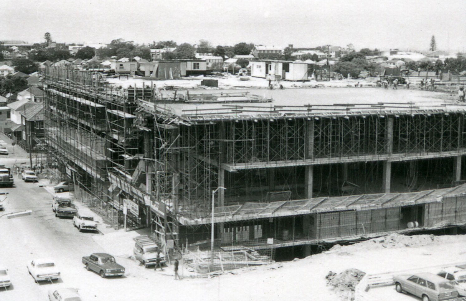
Westfield takes shape, 1977. Image courtesy Hurstville Library
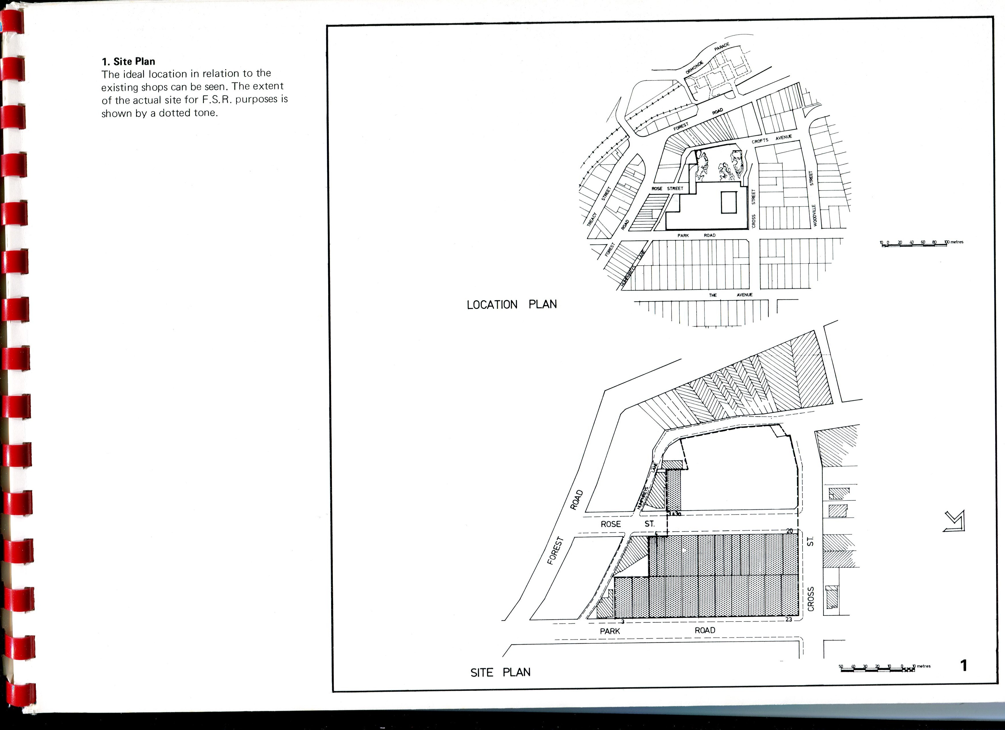
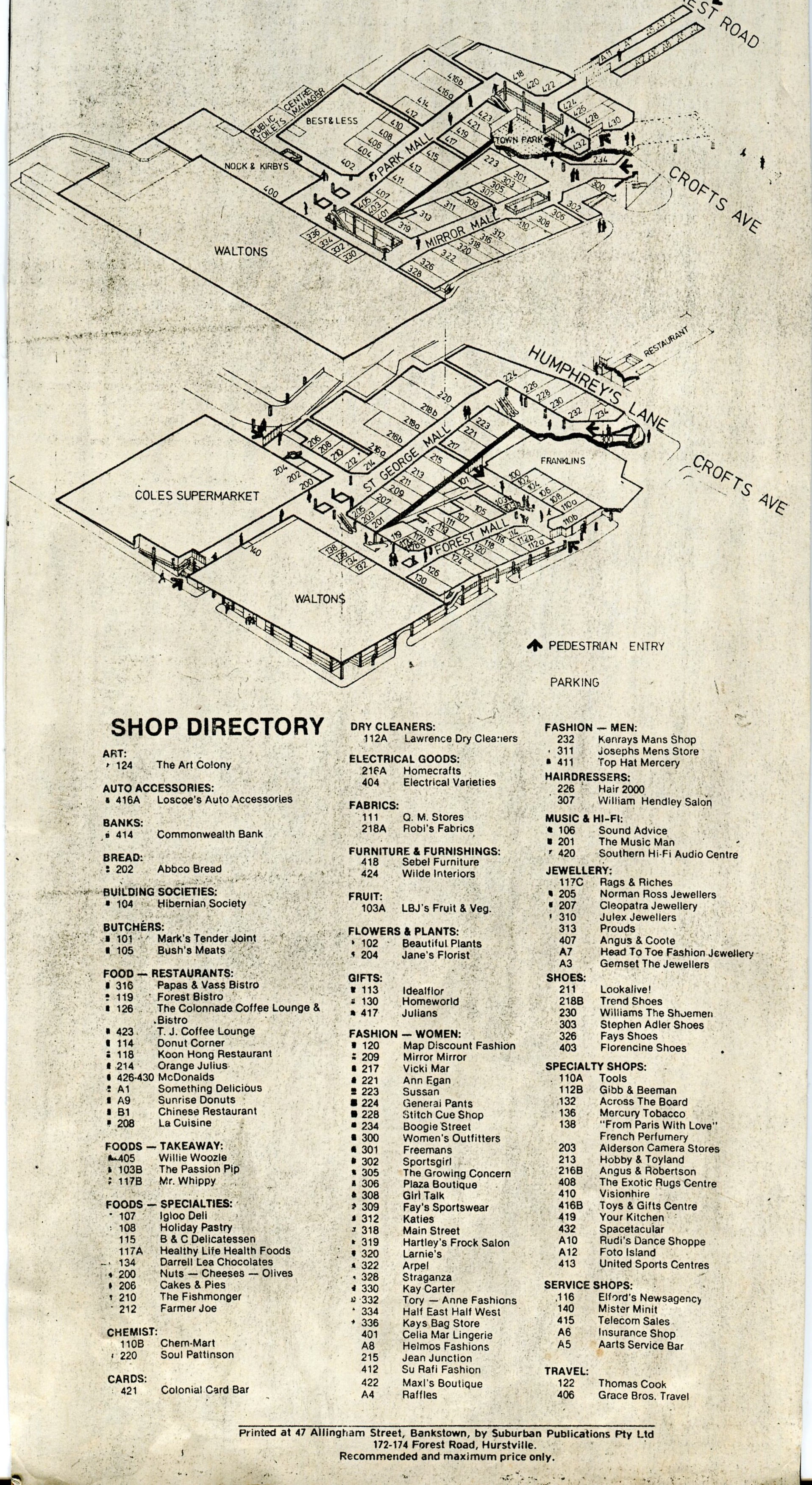
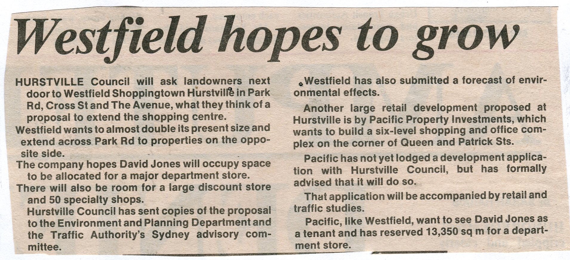
 As you can probably tell by the plans above, the centre was much smaller when it opened than it is now. 1978 was a simpler time when people didn’t need as much junk. But what junk did they need, exactly? What did this behemoth of retail extravagance boast that Forest Road’s usual suspects couldn’t? Let’s take a look at 1978’s centre directory to get a better understanding of just what Westfield had brought to Hurstville’s threadbare table.
“Sound Advice”? Ugh.

Snowy Hill Park, 1978. Image courtesy Hurstville Council
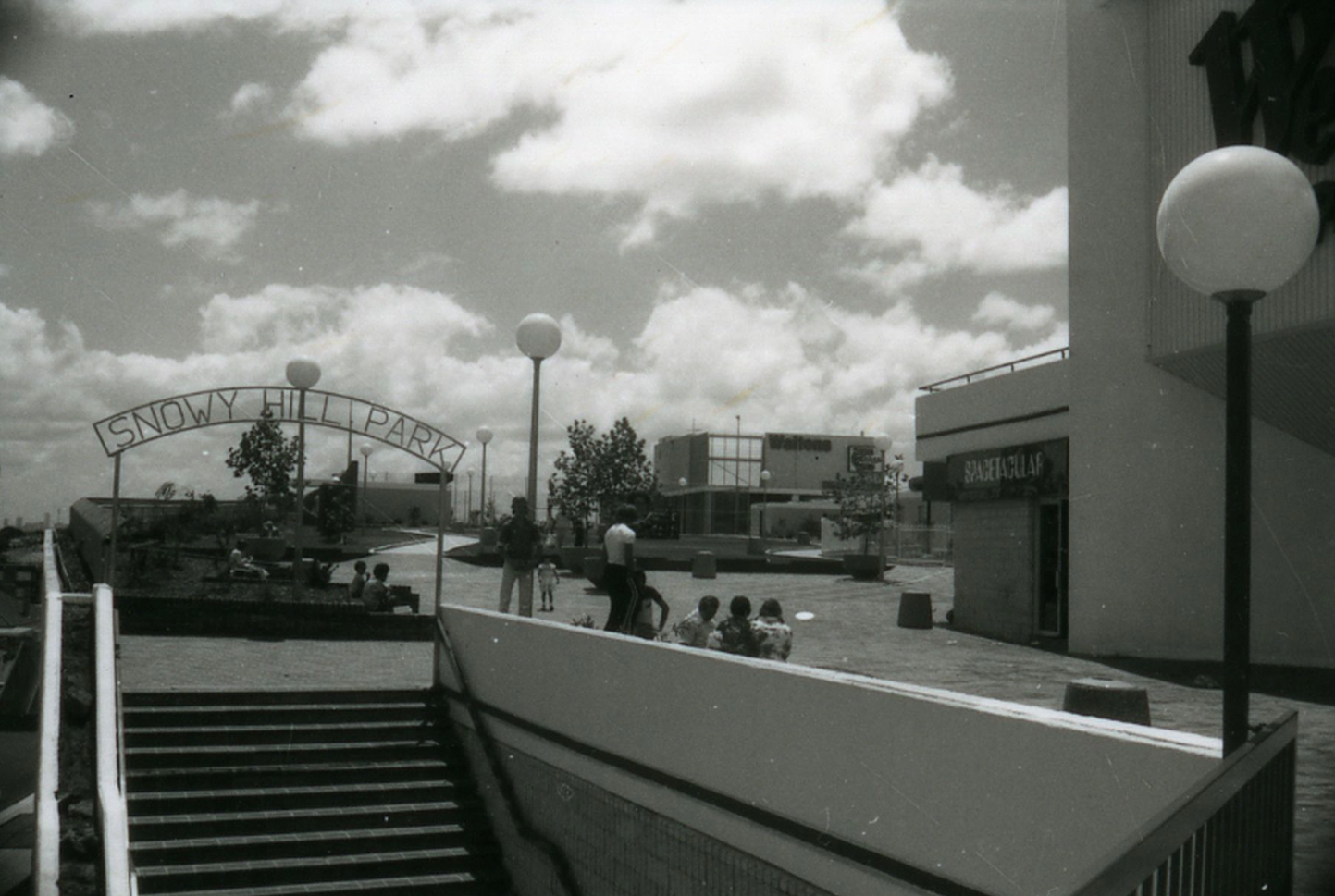
I wonder where this sign is today? Note the Spacetacular entrance on the right, 1978. Image courtesy Hurstville Library

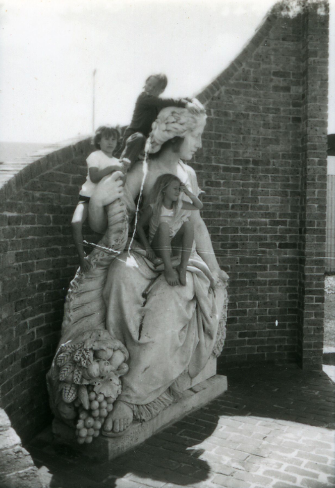
A cornucopia of ‘plenty’, 1979. Image courtesy Hurstville Library

Exciting stuff.
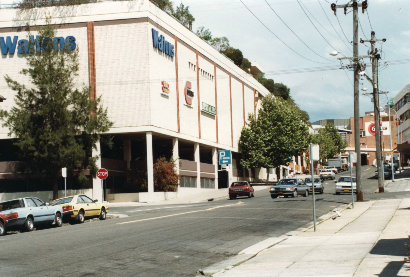
Westfield from Cross St, 1983. Image Courtesy Hurstville Library

Of giving…money to Westfield?

Of course, it’s always about you.

Jaffles. How…exotic.

That’s $13.90 per tape.
Even these clowns charge less than Hurstville Council for one old photo.

You forget sometimes that Esky is a brand name.

They’re all the same shirt.

HELP OVERLOAD

Selling fruit and veggies is no way for an ex-president to make ends meet.
St George Express, May 7 1986
 To be concluded…
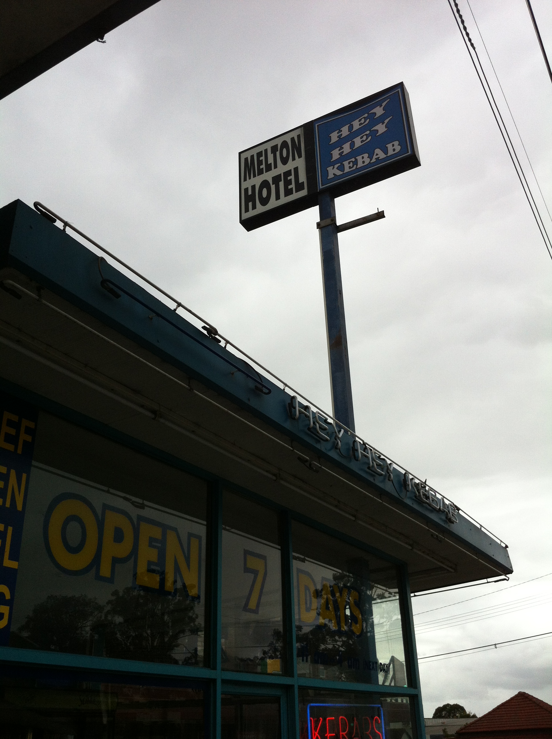
The Melton Hotel – Auburn, NSW
Get comfy, this’ll be a long one.
 Sometimes, it’s not so much about what a place has become as it is about how it got that way. This is certainly true in the case of Auburn’s Melton Hotel. Ordinarily I, like any passer-by, would take one look at the Melton and think ‘I value my life too much to go in there,’ subsequent to the instinctual thought of ‘Just another pub.’ Situated along Parramatta Road at the corner of Station Street, there’s just nothing that sticks out about the hotel in any way; not even the jovially named ‘Hey Hey Kebab’ adjoining gives cause for anything more than a mild double-take.
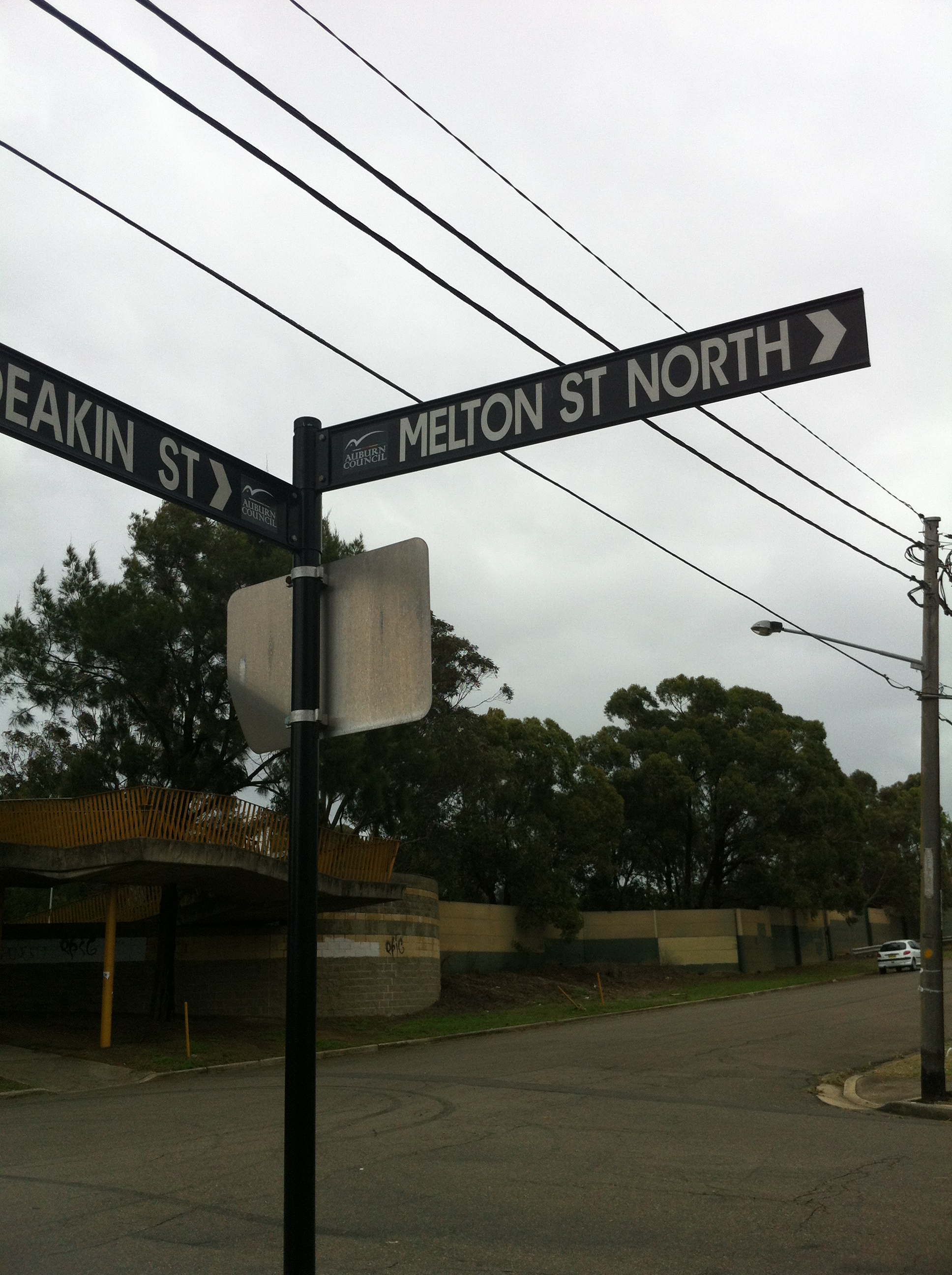
 So why, dear reader, am I subjecting you to this dry account of a seemingly humdrum pub? Well, what piqued my interest (as I’m sure it will yours) was the simple fact that the street running parallel to the hotel’s side of the block is called Melton Street South.

Not pictured: Melton Street North
This got me thinking: why was the pub named the Melton Hotel if it wasn’t actually on Melton Street? Clearly it was time for some field detective work, because I knew if I didn’t solve the mystery it would bother me all day. I couldn’t find anything about anyone named Melton in the area’s history (it’s not even clear to historians why the area itself is named Silverwater), but I had a feeling if they were honouring some local hero, they wouldn’t just name a pub and a street after them. First port of call: the Atlas of the Suburbs of Sydney, ca 1885-1890.

Courtesy the Atlas of the Suburbs of Sydney, ca. 1885-1890
This map of Auburn shows that neither Station Street nor Melton Street South existed at the time. Today, they’re located between the map’s Stubbs Street and Sutherland Street (now Silverwater Road).
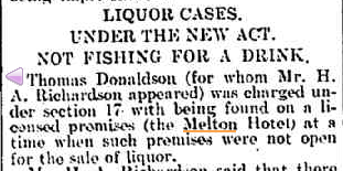
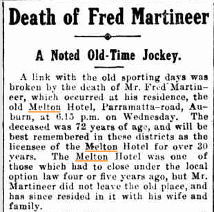
Next: time to research the pub itself. Thankfully, the pub in question has an illustrious history; according to the hoteliers, its license dates back to 1811 (when it was owned by Samuel Haslem, of Haslem’s Creek fame), attached to an inn located not too far from the current site. In 1877 a former jockey, Fred Martineer, became the licensee of the Melton Hotel and held that position for over 30 years, firmly establishing the pub as a favourite of the area’s myriad meat workers.
Tragedy struck in 1914 when, after too many cases like this…
The Cumberland Argus and Fruitgrowers Advocate, 21 February 1906
…the public was swept up by a need to reinstill a sense of public decency via a series of local option acts. The acts enforced a six o’clock closing time for pubs and resulted in 293 hoteliers losing their licenses, including Martineer. Despite the pub’s closure and with flagrant disregard to the after hours prohibition, he continued to live in what became known as the ‘old Melton Hotel’ until his death in 1918:
The Cumberland Argus and Fruitgrowers Advocate, 16 March 1918
The Old Melton had been named sometime prior to 1895, when it appeared on that year’s list of Hotel Licensees. It’s this hotel that sat on the corner of Melton Street South (then Melton Road), so from this we can assume the street was named after the pub. But, like me, the Martineers couldn’t let it go. In 1929, the Martineers built the NEW Melton Hotel at its current location, which at the time seemed to take up the entire section of Parramatta Road between Melton Street and Station Street.
That’s all well and good, but today it’s a very different story. Nothing remains of the Old Melton, the New Melton is nowhere near the corner of Melton Street, and there’s a string of dingy shops between it and its namesake street. What happened?
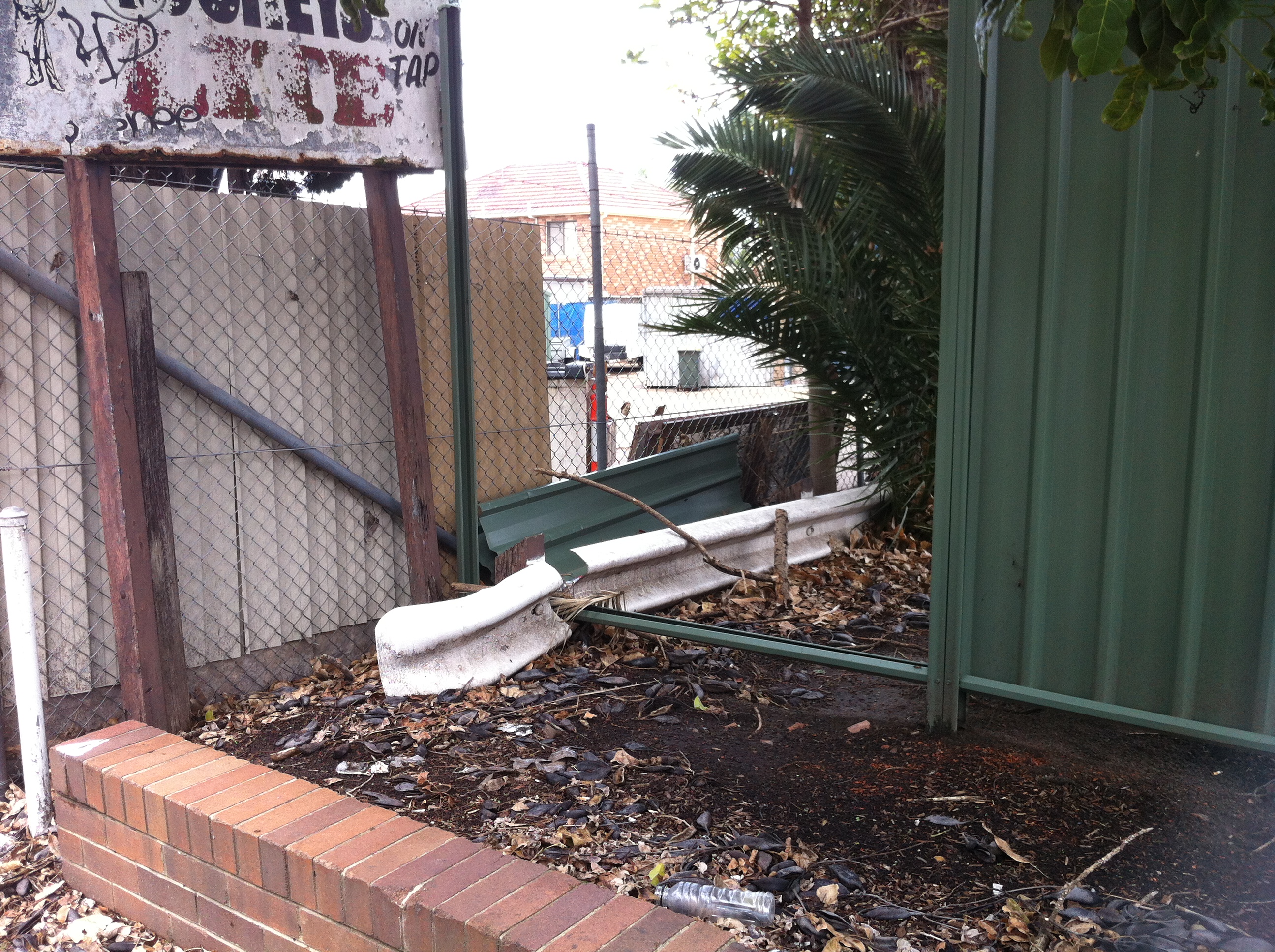
 Discounting the obvious greed associated with subletting the Melton Street side of the block to said dingy shops, the true answer seems to lie in the Melton Hotel’s parking lot. The hyperbolic claim of “stacks & stacks of parking” is betrayed by the truncated nature of the car park itself. Here it is, seen from Station Street:
 Further encroachment into the lot reveals a flimsily constructed wall on the Melton Street side. Hmm…
 And a gap in the northern end of that wall. HMM…
 The gap leads out to Melton Street, whereupon you’re immediately facing a school. This sign:
 …is all that remains of this side’s former life as an entrance/exit to the Melton’s car park, and indeed of the Melton’s connection to the street it inspired. A closer look at the other side of the fence backs this deep bit of insight up.
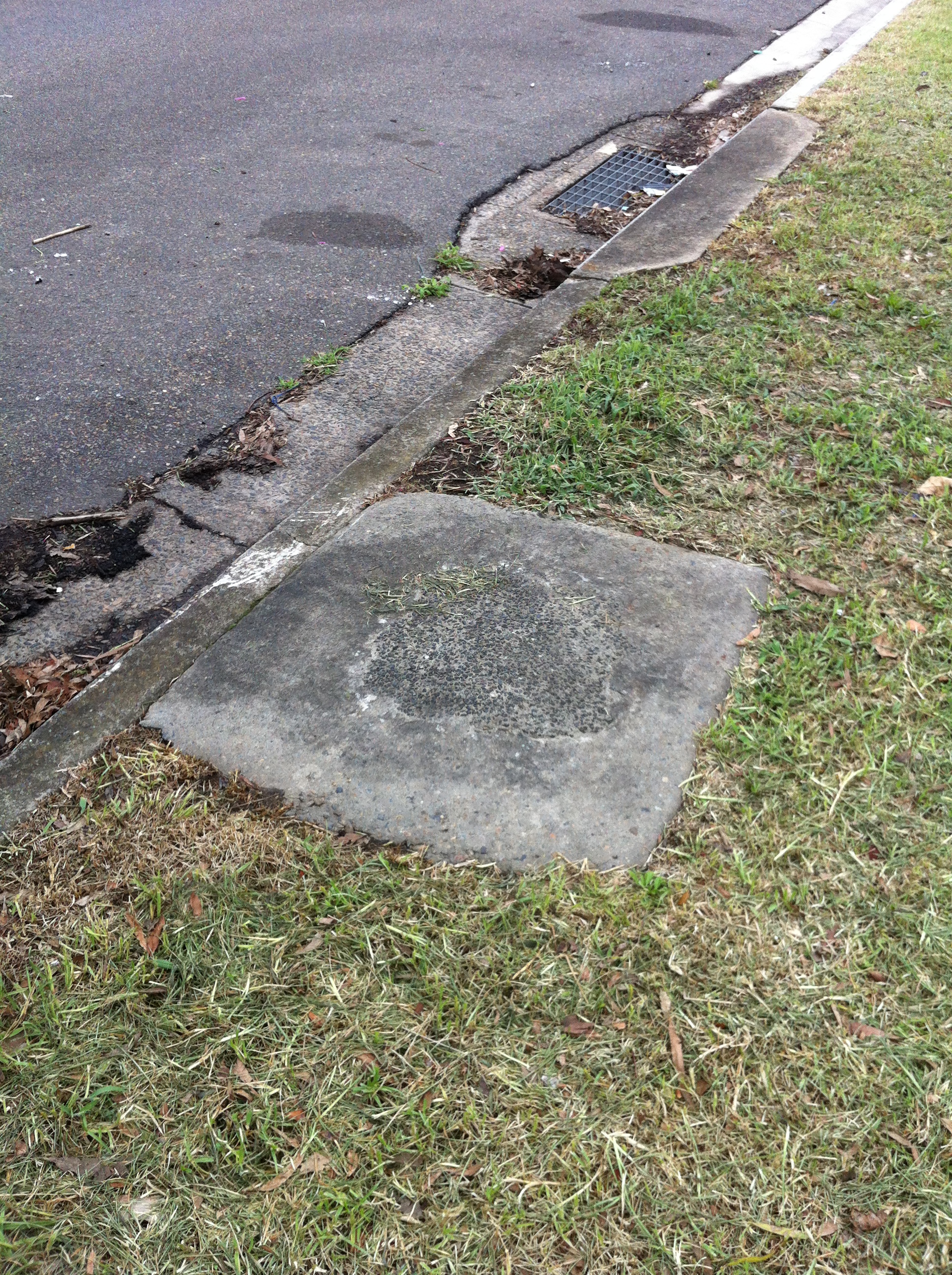
 The kerb is clearly a lighter shade of cement, indicating the spot where the driveway used to be. The two bushes are doing a laughable job of hiding the wooden fencing that blocks off those driveways.
 Even stranger is the choice to keep these former barriers, and simply cut them where the new fence intersects.
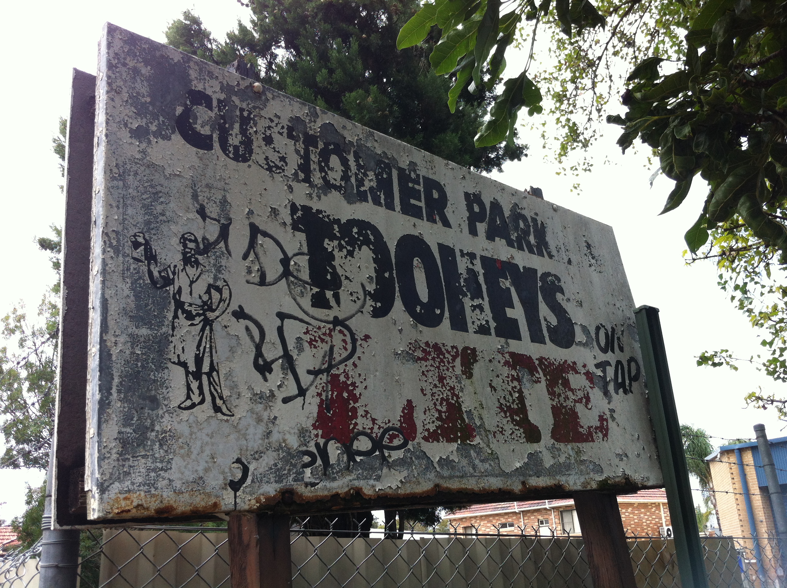 One of the more interesting aspects of all of this is the sign that once guided thirsty drivers into the parking lot. Hidden by overgrown branches and worn away by years of neglect, there’s no real reason for the hoteliers to have left it there – least of all what it’s advertising. After all, if it hadn’t been for the sign, I never would have stumbled upon this madness in the first place. No, for me, the real gold is the sign’s reverse side:
 Remarkably well-preserved, the sign advertises Tooheys 2.2, which was an attempt by Tooheys to introduce a light beer to their otherwise heavy range in the late 1980s.
While it would be nice to think that this was Tooheys doing its part to avoid another 1914 Local Option fiasco, the way the ad puts a jokey spin on drunken violence and employs a disturbing tagline clearly aimed at the breathalyser crowd suggests a more cynical set of motives. For better or worse, this didn’t take, and by 1995, 40 years after the Local Option acts were repealed, 2.2 was 6.0 feet under. It’s worth pointing out that 2.2 was supplanted in 1998 by Hahn Premium Light, which is now Australia’s top selling light beer…and owned by Tooheys. A fascinating trail of the significant episodes of 2.2’s short life can be found here (WORTH READING). I think the lesson here is don’t give your beer a name that invites terrible Richie Benaud impressions.
But back to the Melton. Also of note are the apparent remains of either a garbage can or a phone box (remember those?) located between the two driveways.
 Let’s stop for just a second to process this. Regardless of whether this was in fact a garbage can which spent countless nights being chundered into by melting Meltonians, or a phone booth which spent its Friday and Saturday nights listening to endless pleas by hopelessly pissed pub patrons for their wives, girlfriends, parents or less drunk mates to come and pick them up, and then being chundered into, the fact remains that it was located BETWEEN the two driveways. How is this a spot for either of those objects which both appear as bright flames to drunken moths? The line for the phone alone would have been both long and drunkenly ignorant enough to queue across the nearest driveway. You can’t tell me this didn’t cause at least one clipped wing.
Even worse is the pub’s proximity to Auburn North Public School. Anyone foolish and drunk enough to ‘breathe easy’ and attempt to drive home via the Melton Street exit (or entrance, depending on the level of drunkenness) on a weekday afternoon ran the risk of knocking over a kid on their way home. If it didn’t happen or nearly happen, I’d be surprised.
With these reasons in mind, it’s easy to imagine just how and why the Melton would have had these driveways sealed up, thereby severing its ties to its own history. It’s also easy (and funny) to imagine particularly OCD and DUI pub patrons attempting to drive out of their usual exit and smashing the fence, otherwise why the need for the bushes and the potplants? Sure, the Melton could have chosen to seal up the Station Road driveways, which face the old Joyce Mayne complex, but it turns out that a child’s life is worth more than that of a shopper looking for bargain whitegoods. Who knew?
And all because some public spirited men didn’t know their limits and couldn’t hold their beer.
Of course, I could be wrong about everything, and I might owe both the Melton and overdrinkers everywhere an apology, but have a look at this:

The Cumberland Argus and Fruitgrowers Advocate, 10 July 1915
EPILOGUE
Not pictured: Melton Street South
You may have just read all that and be wondering ‘what was the point?’ or ‘where’s the remove bookmark button?’, but more inquisitive (or less demanding) readers may be wondering ‘What was so drastic that happened to Melton Road to cause it to be split into Melton Road South and Melton Road North?’
Next time, baby.

Oatley Village Video/Car park – Oatley, NSW

Here’s another victim of the video shop exodus. This one didn’t even have a franchise attached while it was alive, making it even harder for it to stay afloat once the VHS ocean started to get rough. I bought an ex-rental copy of Surf Ninjas on VHS from here years ago, so I know I did my part. I can sleep at night. Can you?

It’s since been turned into a car park of all things. You couldn’t even use the building for anything else? The cafe next door is that popular that it needs the three or four extra car spaces afforded it by this tiny space? Oatley is full of wide, long, empty streets to park in, especially since Coles won’t be setting up there. Oh, wait.

Inside it looks like a supervillain meeting room, where the Oatley Star Chamber plots world domination…or at least the downfall of Coles, their mortal enemy. It’s so barebones that you can see the rollerdoor that would have been used for new shipments of pure VHS goodness back in that time.

Here’s the after hours return chute the tardy denizens of Oatley would have used to return videos after the shop had closed for the day. Or, in some cases, never used at all:

That was three years ago. If you do that for long enough, of course you’re going to go out of business. This must have occurred to the kindly owner at some point, because a year before closing down he changed his tactics:

Take note, Darrell Lea.
